


JCParavy

 Visorando Member
 Premium user
 - Location: Saint-Genix-sur-Guiers (73240)
- Gender: man
Sign up:
Published route(s)
 Route around Armix in the Bugey
 7.40 mi
 +1,201 ft
 -1,188 ft
 4h 25
4h 25
 Average
 Departure from Armix (Ain)
Here is a short route in the Bugey with a ridge route, which can be done out of season (autumn-winter, for example), if necessary in half a day.
Pointe de la Terrasse
 6.78 mi
+3,189 ft
-3,189 ft
5h 55
6.78 mi
+3,189 ft
-3,189 ft
5h 55
 Difficult
Departure from Beaufort (Savoie) (Savoie)
Difficult
Departure from Beaufort (Savoie) (Savoie)
Discover the third highest peak in the Beaufortain, offering sweeping views of the Mont Blanc Massif, the Savoie Alps, and even as far as the Écrins.
The Trou de la Mouche loop
 5.42 mi
+3,340 ft
-3,327 ft
5h 25
Difficult
Departure from La Clusaz (Haute-Savoie)
5.42 mi
+3,340 ft
-3,327 ft
5h 25
Difficult
Departure from La Clusaz (Haute-Savoie)
This is a classic destination in the Combes des Aravis, allowing you to visit two pretty combes linked by a remarkable natural curiosity.
Le Bellachat or Pointe du Mont du Fût
 8.95 mi
+4,741 ft
-4,718 ft
8h 15
Difficult
Departure from Montaimont (Savoie)
8.95 mi
+4,741 ft
-4,718 ft
8h 15
Difficult
Departure from Montaimont (Savoie)
A summit at 2,822 metres on a ridge running parallel to the Lauzière, offering a magnificent 360° view of the French and even Swiss Alps.
The Moucherotte circular
 6.46 mi
+2,648 ft
-2,648 ft
5h 15
Average
Departure from Saint-Nizier-du-Moucherotte (Isère)
6.46 mi
+2,648 ft
-2,648 ft
5h 15
Average
Departure from Saint-Nizier-du-Moucherotte (Isère)
Climb up to the magnificent Moucherotte viewpoint by taking a circular route up the wild Pas de la Bergère and back down the 'normal' route to Saint-Nizier-du-Moucherotte.
Circular route: Sentier du Solitaire – Cheminée de Corde – Arpison Viewpoint
 6.35 mi
+3,297 ft
-3,274 ft
5h 45
Difficult
Departure from Saint-Laurent-du-Pont (Isère)
6.35 mi
+3,297 ft
-3,274 ft
5h 45
Difficult
Departure from Saint-Laurent-du-Pont (Isère)
A lovely circular route through little-known and little-visited parts of the Chartreuse, following old paths… which, sadly, are sometimes on the verge of disappearing.
Circular Fétrus-Pertuis from Saint-Laurent-du-Pont
 6.37 mi
+2,917 ft
-2,900 ft
5h 30
Average
Departure from Saint-Laurent-du-Pont (Isère)
6.37 mi
+2,917 ft
-2,900 ft
5h 30
Average
Departure from Saint-Laurent-du-Pont (Isère)
This circular can be done in almost any season (except after storms or heavy rain) and allows you to discover some lesser-known parts of Chartreuse.
Dent de Cons circular
 4.35 mi
+2,904 ft
-2,894 ft
4h 30
Difficult
Departure from Marthod (Savoie)
4.35 mi
+2,904 ft
-2,894 ft
4h 30
Difficult
Departure from Marthod (Savoie)
Ascent of the Dent de Cons, the easternmost peak of the Bauges, offering beautiful views of the Bauges, the Bornes, the Beaufortain, Mont Blanc... The route describes a circular loop starting from Marthod, which runs partly on very steep grassy slopes and on a sometimes exposed ridge.
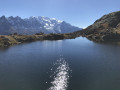
Chéserys, Blanc and Persévérance lakes circuit
 7.28 mi
+3,766 ft
-3,766 ft
6h 40
Difficult
Departure from Chamonix-Mont-Blanc (Haute-Savoie)
7.28 mi
+3,766 ft
-3,766 ft
6h 40
Difficult
Departure from Chamonix-Mont-Blanc (Haute-Savoie)
A long loop taking in the various lakes in the eastern part of the Aiguilles Rouges Massif, with magnificent views of the Mont Blanc Massif just opposite, reflected in the waters of the lakes.
⚠️ The itinerary includes two tricky sections equipped with ladders and metal ramps.
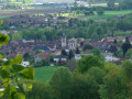
Circular of the Hauts de Saint-Genix-sur-Guiers
 8.79 mi
+1,119 ft
-1,089 ft
5h 00
Average
Departure from Saint-Genix-sur-Guiers (Savoie)
8.79 mi
+1,119 ft
-1,089 ft
5h 00
Average
Departure from Saint-Genix-sur-Guiers (Savoie)
This walk allows you to discover the village of Saint-Genix and climb to its heights to cross a rural area offering beautiful views of the Chartreuse, then follow a section of the Way of St James leading back to the village after crossing a forest.
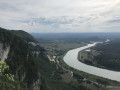
Bois de Glaize: Saint-Martin Chapel, Recorba and Mont Tournier
 5.12 mi
+988 ft
-984 ft
3h 15
Average
Departure from Loisieux (Savoie)
5.12 mi
+988 ft
-984 ft
3h 15
Average
Departure from Loisieux (Savoie)
This circular route takes place mainly in the forest and can be completed in any season in half a day, allowing you to visit the characteristic sites and viewpoints of this area crossed by pilgrims on the Way of St James.
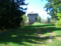
Belt of redoubts and batteries around Fort de Montgilbert
 6.32 mi
+1,342 ft
-1,322 ft
4h 05
Average
Departure from Montendry (Savoie)
6.32 mi
+1,342 ft
-1,322 ft
4h 05
Average
Departure from Montendry (Savoie)
Circular forest path starting from Fort de Montgilbert, following the belt of redoubts and batteries built along a ridge to defend the entrance to the Maurienne valley and passing through a sensitive peat bog site.
Crossing Mont Joigny, from Gorgeat to Bornée
 5.09 mi
+1,601 ft
-1,601 ft
3h 45
Average
Departure from Apremont (Savoie) (Savoie)
5.09 mi
+1,601 ft
-1,601 ft
3h 45
Average
Departure from Apremont (Savoie) (Savoie)
This circular loop can be completed in almost any season, even in half a day, allowing you to enjoy beautiful views, discover fossils and, when in season, a renowned site for lady's slipper orchids.
Circular Mont Saint-Michel from Curienne
 5.09 mi
+1,253 ft
-1,250 ft
3h 25
Average
Departure from Curienne (Savoie)
5.09 mi
+1,253 ft
-1,250 ft
3h 25
Average
Departure from Curienne (Savoie)
This circular offers beautiful views and allows you to visit Mont St-Michel, which dominates the Cluse de Chambéry, the Motte castrale de la Bognette and, if you wish, the Grotte des Fées.
Cime de la Jasse loop
 8.05 mi
+3,839 ft
-3,819 ft
7h 05
Difficult
Departure from Laval (Isère)
8.05 mi
+3,839 ft
-3,819 ft
7h 05
Difficult
Departure from Laval (Isère)
Loop ascending through the pretty Vénétier valley and its lakes to the Cime de la Jasse, a beautiful viewpoint due to its advanced position between Belledonne and Sept-Laux. Return via the Crête de Bedina, on the Prapoutel resort side.
Mont de Grange crossing
 6.71 mi
+3,602 ft
-3,602 ft
6h 15
Difficult
Departure from Abondance (Haute-Savoie)
6.71 mi
+3,602 ft
-3,602 ft
6h 15
Difficult
Departure from Abondance (Haute-Savoie)
A loop trail that takes you to the highest point of the Vallée d'Abondance Chablais, offering exceptional views of the Alps. A fairly wild climb up the Montagne de Pertuis, followed by a more conventional descent via the Crête de Coicon.
Caution: near (4), there is a ridge that is a little exposed.
You are in a protected area! See the regulations in the practical information section.
The Salève circular: Orjobet, Corraterie, viewpoints and Grande Gorge
 7.80 mi
+2,625 ft
-2,612 ft
5h 50
Difficult
Departure from Collonges-sous-Salève (Haute-Savoie)
7.80 mi
+2,625 ft
-2,612 ft
5h 50
Difficult
Departure from Collonges-sous-Salève (Haute-Savoie)
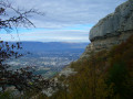
A circular trail that showcases the many facets of Salève: climb up via the Orjobet Cave, pass through the Trou de la Tine, Vire de la Corraterie, viewpoint towards Mont Blanc and Rochers de Faverges, viewpoints from the Observatory over Geneva and Lake Geneva, descent via the Grande Gorge and return to the start by passing under the large rock climbing routes.
Above Miribel-les-Échelles
 5.85 mi
+856 ft
-856 ft
3h 25
5.85 mi
+856 ft
-856 ft
3h 25
 Easy
Departure from Miribel-les-Échelles (Isère)
Easy
Departure from Miribel-les-Échelles (Isère)
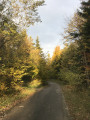
This circular forest loop is accessible in all seasons, even in snow, and takes you through several areas of the Miribel, Saint-Aupre and Rocharey forests, crossing two medium-altitude passes, the Mille Martyrs and the Pilori.
You can also enjoy some unobstructed views along the route.
Circular at Grand Crêt d'Eau
 4.62 mi
+1,345 ft
-1,375 ft
3h 20
Average
Departure from Lancrans (Ain)
4.62 mi
+1,345 ft
-1,375 ft
3h 20
Average
Departure from Lancrans (Ain)
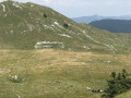
A circular with limited elevation gain, winding through mountain pastures, allowing you to visit three of the ridges that form the Grand Crêt d'Eau (including the highest point) and enjoy breathtaking views of the Genevois and the Alps.
The Dent du Loup and the Sornin-Molière Plateau from Le Fournel
 7.41 mi
+2,336 ft
-2,323 ft
5h 25
Average
Departure from Engins (Isère)
7.41 mi
+2,336 ft
-2,323 ft
5h 25
Average
Departure from Engins (Isère)
Among the many possible combinations on the Plateau de Sornin, this circular route allows you to go around it and soak up this area of the Vercors, while also taking in sites offering unobstructed views. The route is accessible in almost all seasons, with snowshoes if there is heavy snowfall.
The Grande Sure circular loop starting from Curière
 10.55 mi
+3,937 ft
-3,937 ft
8h 15
Difficult
Departure from Saint-Laurent-du-Pont (Isère)
10.55 mi
+3,937 ft
-3,937 ft
8h 15
Difficult
Departure from Saint-Laurent-du-Pont (Isère)
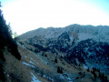
A varied but relatively long route up to the Grande Sure, favouring sections that are slightly steeper but above all wilder and less frequented than the usual routes: Pas de la Biche and Crête des Charmilles.
Water Trail in Brégnier-Cordon
 4.72 mi
+728 ft
-751 ft
2h 50
Average
Departure from Brégnier-Cordon (Ain)
4.72 mi
+728 ft
-751 ft
2h 50
Average
Departure from Brégnier-Cordon (Ain)
A signposted route taking you through several water-related areas (hillside, stream, marsh) around Glandieu and its waterfall.
 Notre-Dame Forest and the Réveillon Valley, starting from Boissy-Saint-Léger
18.65 mi
+387 ft
-364 ft
4 hrs
Average
Departure from Boissy-Saint-Léger (Val-de-Marne)
A relatively long but technically straightforward walk in a peri-urban area, taking you through the Gros Bois and Notre-Dame forests, then down the Réveillon Valley, before returning via the Camaldules and Grange forests.
Circular route around the confluence of the Guiers and the Rhône
 10.16 mi
+66 ft
-39 ft
1.5 hrs
Easy
Departure from Saint-Genix-sur-Guiers (Savoie)
10.16 mi
+66 ft
-39 ft
1.5 hrs
Easy
Departure from Saint-Genix-sur-Guiers (Savoie)
An easy walk with no significant inclines or difficulty, suitable for everyone. The walk takes in three departments, offering families the chance to explore the sometimes unspoilt banks of the Guiers and the Rhône.
Circuit of Mont Outheran, via the Col du Mollard, Col du Planet and Col du Grapillon
7.70 mi
+1,719 ft
-1,690 ft
3 hrs
Average
Departure from Entremont-le-Vieux (Savoie)
A mountain bike tour of Mont Outheran via the Col du Mollard, Col du Planet and Col du Grapillon, allowing you to explore its different sides with relatively limited elevation changes as the route never descends very far down.
The Charmant Som circular loop from Valombré
 10.48 mi
+3,999 ft
-4,003 ft
8h 20
Difficult
Departure from Saint-Pierre-de-Chartreuse (Isère)
10.48 mi
+3,999 ft
-4,003 ft
8h 20
Difficult
Departure from Saint-Pierre-de-Chartreuse (Isère)
Le Charmant Som is very busy due to the access road to its sheepfold coming from the Col de Porte. Its other sides, however, offer a wilder approach, particularly when coming from Valombré and Malamille. This route offers a relatively long but varied circular route, featuring ridge walks and crossings over slabs and sharp limestone pavements, whose wild character contrasts with the crowds at the summit arriving via the mountain pastures.
L'Étale
 4.82 mi
+4,455 ft
-4,455 ft
7 hrs
4.82 mi
+4,455 ft
-4,455 ft
7 hrs
 Very difficult
Departure from Manigod (Haute-Savoie)
Very difficult
Departure from Manigod (Haute-Savoie)
L'Étale (altitude 2,483 m) is a complex mountain in the Bornes-Aravis massif, renowned for its aerial ridge route. The normal route (with a few variations) allows you to climb up a relatively austere combe on the western slope, but the final stretch is well worth the effort for the purity of the ridge and the expansive view.
Circular route from La Lattaz to Mont Tournier from Saint-Maurice-de-Rotherens
 8.00 mi
+1,368 ft
-1,355 ft
4h 50
Average
Departure from Saint-Maurice-de-Rotherens (Savoie)
8.00 mi
+1,368 ft
-1,355 ft
4h 50
Average
Departure from Saint-Maurice-de-Rotherens (Savoie)
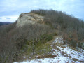
This circular route, suitable for all seasons, takes you along the ridge of the Montagne du Tournier, which runs from the Col de la Lattaz to Mont Tournier (877m), passing through various characteristic spots in the area, with unobstructed views of the surrounding mountain ranges.
 Grand Colombier ridge from Culoz
 12.21 mi
+3,150 ft
-3,136 ft
8 hrs
Average
Departure from Culoz (Ain)
12.21 mi
+3,150 ft
-3,136 ft
8 hrs
Average
Departure from Culoz (Ain)
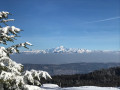
The ascent to the plateau and the Grand Colombier ridge through the snow follows an easy route, though it is relatively long due to the low starting altitude. The Grand Colombier offers a magnificent view over the Alps.
La Croix du Signal and the Échelles de Château Richard on the Verthemex side
 4.55 mi
+1,211 ft
-1,204 ft
3h 10
Average
Departure from Marcieux (Savoie)
4.55 mi
+1,211 ft
-1,204 ft
3h 10
Average
Departure from Marcieux (Savoie)
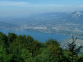
A circular forest loop, which can be completed in half a day and is accessible for most of the year, passing by the Croix du Signal viewpoint overlooking the Cluse de Chambéry and the Échelles de Chateau-Richard with its views of Lake Aiguebelette.
Mont du Chat ridge: from the TV relay station to the Croix du Signal
 6.73 mi
+751 ft
-745 ft
2.5 hrs
Average
Departure from Meyrieux-Trouet (Savoie)
6.73 mi
+751 ft
-745 ft
2.5 hrs
Average
Departure from Meyrieux-Trouet (Savoie)
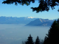
The Crête de la Montagne du Chat route follows paths and tracks with little change in elevation, offering exceptional views at both ends.
The ‘Cinq Haberts’ route in the Chartreuse
 8.86 mi
+3,179 ft
-3,179 ft
8 hrs
Difficult
Departure from Saint-Pierre-de-Chartreuse (Isère)
8.86 mi
+3,179 ft
-3,179 ft
8 hrs
Difficult
Departure from Saint-Pierre-de-Chartreuse (Isère)
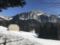
A beautiful classic summer circular route in the Chartreuse, passing through several historic passes and mountain pastures and their huts.
Most of the route follows good paths through forest or open mountain pastures.
Warning: a tricky section to be attempted only when the snow is stable.
Charming Som circular via Mont Fromage
 8.61 mi
+2,067 ft
-2,087 ft
6 hrs
Average
Departure from Sarcenas (Isère)
8.61 mi
+2,067 ft
-2,087 ft
6 hrs
Average
Departure from Sarcenas (Isère)
A beautiful circular loop with no technical difficulties, allowing you to traverse a varied ridge and climb Charmant Som in the process, with views of the main peaks of Chartreuse and Belledonne.
Circular route at the foot of the Sierra d’Irta starting from Peñíscola
 15.02 mi
+1,198 ft
-1,191 ft
4 hrs
Average
Departure from Peníscola / Peñíscola (Castelló / Castellón)
15.02 mi
+1,198 ft
-1,191 ft
4 hrs
Average
Departure from Peníscola / Peñíscola (Castelló / Castellón)
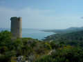
A route exploring the slopes of the Sierra d’Irta (National Park), passing through characteristic spots such as the Badúm Tower, the beaches of El Russo and El Pebret, the Pou del Moro, the Mas del Senyor and the Col d’Imberri with its views of Peñíscola.
Mont de la Charvaz, loop from Billième
 5.21 mi
+2,103 ft
-2,103 ft
4h 15
Average
Departure from Billième (Savoie)
5.21 mi
+2,103 ft
-2,103 ft
4h 15
Average
Departure from Billième (Savoie)
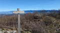
Among the many access routes to Mont de la Charvaz, this loop takes the most direct route to the summit, via its steep western face, and descends via gentler forest paths. The view from the summit over the Avant Pays Savoyard and the surrounding mountains is extensive.
A walk in the Dreux Forest
 11.58 mi
+351 ft
-374 ft
3 hrs
Average
Departure from Abondant (Eure-et-Loir)
11.58 mi
+351 ft
-374 ft
3 hrs
Average
Departure from Abondant (Eure-et-Loir)
This circular route, suitable for all, circles part of the Dreux Forest, sometimes along well-marked forest tracks, sometimes along the edge of the hillside above the Eure Valley, whilst avoiding any significant changes in elevation, and passes through some of the forest’s most characteristic spots.
Roche Veyrand, circular from Saint-Pierre-d'Entremont
 4.92 mi
+2,612 ft
-2,592 ft
4h 30
Difficult
Departure from Saint-Pierre-d'Entremont (Savoie) (Savoie)
4.92 mi
+2,612 ft
-2,592 ft
4h 30
Difficult
Departure from Saint-Pierre-d'Entremont (Savoie) (Savoie)
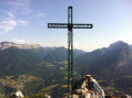
Roche Veyrand is a peak that proudly dominates the two Saint-Pierre-d'Entremont villages. Its steep slopes have made it possible to equip a Via Ferrata. This route is a classic in the Entremonts: it climbs directly up a steep path close to the equipped cliff, then descends via a wide forest detour that takes you through several hamlets of Saint-Pierre-d'Entremont (Savoie).
The circular Banchet: daffodils and Château de Montbel
 3.67 mi
+778 ft
-761 ft
2h 20
Average
Departure from Ayn (Savoie)
3.67 mi
+778 ft
-761 ft
2h 20
Average
Departure from Ayn (Savoie)
Montagne du Banchet is very popular when the daffodils are in bloom: the proposed route runs along the flower-covered ridge and stretches to the ruins of the proud Château de Montbel.
Circular via Roche Percée and the Romagnieux viewpoint from Béon
 5.52 mi
+2,060 ft
-2,073 ft
4h 20
Average
Departure from Béon (Ain)
5.52 mi
+2,060 ft
-2,073 ft
4h 20
Average
Departure from Béon (Ain)
A circular forest loop that is accessible in almost all seasons, running along the slopes of Grand Colombier and passing through an arch that you only discover at the last moment and a viewpoint over Culoz, Lac du Bourget and the surrounding mountains.
In (6), be sure to stay away from the paths leading to the Romagnieux farm.
See review dated 08/08/2022.
The Grand Thur circular loop from Izieu
 3.41 mi
+1,030 ft
-1,030 ft
2h 30
Average
Departure from Izieu (Ain)
3.41 mi
+1,030 ft
-1,030 ft
2h 30
Average
Departure from Izieu (Ain)
Circular route above Izieu, suitable for all seasons. The route is mainly through forest but offers some views of the Rhône valley and the surrounding mountains.
The Balcons du Lac d'Aiguebelette from Nances
 7.32 mi
+1,614 ft
-1,631 ft
4h 45
Difficult
Departure from Nances (Savoie)
7.32 mi
+1,614 ft
-1,631 ft
4h 45
Difficult
Departure from Nances (Savoie)
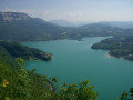
This long circular loop takes you across the slopes of L'Épine overlooking Lake Aiguebelette, between a rather tough and steep climb and a return to lake level. It can get hot here on summer afternoons, but it remains passable until late in the season, as long as the snow does not fall below 800m.
Circular walk from Nances
 3.17 mi
+961 ft
-935 ft
2h 20
Average
Departure from Nances (Savoie)
3.17 mi
+961 ft
-935 ft
2h 20
Average
Departure from Nances (Savoie)
This circular walk can be enjoyed in any season, taking you up above Novalaise to the Sainte-Rose Chapel, then up to the former Villas Doria before crossing over to the site of the old Épine fortified castle and descending back into the valley.
Ridge walk above Grand Carroz
 5.71 mi
+2,093 ft
-2,093 ft
4h 25
Average
Departure from Entremont-le-Vieux (Savoie)
5.71 mi
+2,093 ft
-2,093 ft
4h 25
Average
Departure from Entremont-le-Vieux (Savoie)
Le Grand Carroz is at the centre of an area surrounded by a line of ridges, offering unobstructed and varied views. The proposed route climbs to the Col de la Drière, crosses Mont Pellaz or Lentille and the Col des Fontanettes, then climbs the Montfred ridge off-trail before returning via a forest path to the starting point. Caution: the ridge route is not technically difficult but runs alongside steep cliffs on the right-hand side.
Vachères - Montagne de Musan - Pré de Cinq Sous circular from Beauregard
 10.39 mi
+3,501 ft
-3,514 ft
7h 50
Difficult
Departure from Beauregard-Baret (Drôme)
10.39 mi
+3,501 ft
-3,514 ft
7h 50
Difficult
Departure from Beauregard-Baret (Drôme)
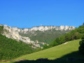
Large circular route covering the main ridges delimiting the upper basin of the Portail de Beauregard: ascent via the wild Vachères (off-trail), passage through the Cols de Sonnaize, Pas du Loup and Tourniers, steep climb to Pas de la Pierre to cross the long and beautiful ridge of Montagne de Musan to Pas Pourceau, descent via the "Pré de Cinq-Sous", the Cols des Cordeliers and Marchands, finally the Ravin de Combins to the Passage du Tour and return to the village via the Portail.
Le Revard via Pas de Rebollion and Col du Pertuiset
 8.35 mi
+3,241 ft
-3,232 ft
6h 40
Very difficult
Departure from Mouxy (Savoie)
8.35 mi
+3,241 ft
-3,232 ft
6h 40
Very difficult
Departure from Mouxy (Savoie)
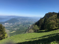
Le Revard is a plateau offering magnificent views of both the Northern Alps around Mont Blanc and Lake Bourget at its feet. This circular route climbs from the edge of the old cable car station, ascending the very steep Pas du Rebollion off-trail, then, after a route passing through several bumps on the plateau, descends via the classic Pertuiset trail.Route modified on 3/07/2023 between (6) and (9) to avoid private land, then on 20/10/2025 between (4) and (5) to take into account changes in the equipment.
Cirque de Saint-Même: Waterfalls and Cave via the Pas Ruat
 2.62 mi
+1,056 ft
-1,030 ft
3 hrs
Very difficult
Departure from Saint-Pierre-d'Entremont (Savoie) (Savoie)
2.62 mi
+1,056 ft
-1,030 ft
3 hrs
Very difficult
Departure from Saint-Pierre-d'Entremont (Savoie) (Savoie)
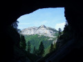
The Cirque de Saint-Même is very busy in summer, with most visitors content to have a picnic on the meadows or follow the signposted route through the waterfalls. The short circular loop suggested here extends this route by taking in an additional waterfall and the Source du Guiers Vif, via the steep Pas Ruat pass with its astonishing passage beneath the rock face emerging in front of the Grotte du Guiers Vif.
⚠️ This route is partly unmarked, unmaintained and presents significant risks. Hikers undertake this route at their own risk. Please refer to the official marked trails.
⚠️ The footbridge leading to the Grotte du Guiers Vif (4) was damaged by a rockslide in July 2023: a mayoral order currently prohibits access.
Circular Mont Beauvoir from Saint-Christophe-la-Grotte
 10.59 mi
+3,379 ft
-3,386 ft
7h 50
Difficult
Departure from Saint-Christophe (Savoie) (Savoie)
10.59 mi
+3,379 ft
-3,386 ft
7h 50
Difficult
Departure from Saint-Christophe (Savoie) (Savoie)
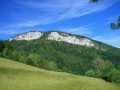
This circular loop combines a crossing of a little-visited summit offering views of the Chartreuse and the Avant Pays Savoyard with historic or documented passages: ascent via the Route Sarde and the Sentier du Beauvoir, return via the route Béatrice de Savoie and the Voie Royale.
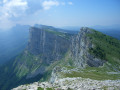
Crossing the Rochers de la Balme
 9.70 mi
+3,330 ft
-3,304 ft
7h 20
Difficult
Departure from Corrençon-en-Vercors (Isère)
9.70 mi
+3,330 ft
-3,304 ft
7h 20
Difficult
Departure from Corrençon-en-Vercors (Isère)
Les Rochers de la Balme offers the possibility of an off-trail ridge crossing, which is quite long but not very technical. Several combinations are possible depending on the access routes chosen. This circular route offers a complete traverse from Tête des Chaudières to Pas Ernadant, with a steep climb (partly off-trail) via Combe de Fer and a more conventional descent via Cabanne de Carrette and theGR® 91.
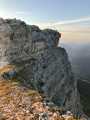
Chamechaude circular via the Arche, the Rampe de l'Écureuil and the Canyon
 4.36 mi
+2,533 ft
-2,523 ft
4h 15
Difficult
Departure from Sarcenas (Isère)
4.36 mi
+2,533 ft
-2,523 ft
4h 15
Difficult
Departure from Sarcenas (Isère)
This circular aims to offer alternatives to the very busy normal route, allowing you to discover lesser-known aspects of Chamechaude, the highest point in the Chartreuse. Without being as technical as the Arnaud breach or as exposed as the Sangle du Jardin, this route is off the beaten track: it therefore sometimes requires a sense of direction and certain (short) steep passages require effort and attention.
Please read the Practical Information section carefully.
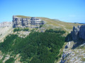
Tour of the Font d'Urle Plateau, from Puy de la Gagère to Serre de Montué
 10.21 mi
+2,467 ft
-2,441 ft
6h 50
Difficult
Departure from Bouvante (Drôme)
10.21 mi
+2,467 ft
-2,441 ft
6h 50
Difficult
Departure from Bouvante (Drôme)
This long circular route covers the different areas of the Font d'Urle Plateau and its pastures, mainly following the ridges that connect its two extreme peaks, the Puy de la Gagère and the Serre de Montué. It allows you to visit the main sites characteristic of this karstic landscape: the karstic cave des Cloches, the Double Arche, the Grotte du Berger and the Glacière de Font d'Urle.