Country:
 City:
City:


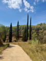
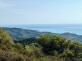
From Alcalá de Xivert or Alcossebre, take the Estopet cycle route to a junction where signposts indicate the Barrenq de la Carrera. Park there without causing any obstruction.
(S/E) Head east along the path that climbs up the Barranq de la Carrera. Avoid the farm tracks branching off to the right or left and continue straight on along the path which enters the forest and climbs steadily up the left bank of the Barranq to reach the ridge at a junction.
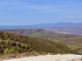
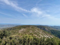
(1) Turn left (let the path to Ebri branch off to the right). The path crosses Lo Pla de Lagur then begins to climb towards the ridge, through a pine forest. At the summit, it veers to the right, follows this ridge, then descends slightly before climbing a second hill, descends a little further before climbing the third hill, the Campanilles, whose summit is preceded by a secondary peak clearly visible from below.
(2) Continue north-east and descend towards the next summit, Fabuquello, which is steeper. There are several ways to climb it: the easiest is to head towards the rocks and veer right to traverse a slope on the eastern face. At a junction, let the path leading down to the Font de la Parra branch off to the right and climb back up to the left onto the ridge (cairn).
(3) Resume the ridge walk, with its ups and downs, to the Col de la Palma.
(4) Follow the path opposite uphill to reach the road from Pulpis, which is tarmac-surfaced on this steep section.
(5) Follow this road to the left and downhill. It becomes a dirt track again as the gradient eases and reaches the junction with the track leading to the corrals.
(6) Turn left and continue slightly downhill to the next junction.
(7) Let the path leading to Xivert Castle go down opposite you and turn left onto the main road, which climbs slightly. Then head back down the valley via the Cami de l’Ametler, which is quite a long stretch. Leave the forest.
(8) Turn left onto a path through the fields that climbs slightly and leads back to the starting point at Estopet. (S/E)
 Visorando Member
 Difficult
 Easy
Easy