Country:

 City:
City:


The car park at the southern exit of the Col du Rousset tunnel can be reached from Die by heading up to the pass, or from the north via the Grands Goulets, or from Villard-de-Lans by going through the tunnel.
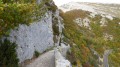
(S/E) Follow the first few metres of the road leading out of the tunnel and, immediately, take the path on the right heading north-west (markedGR® 93). Let the return path branch off to the right, followed by the access path to the Via Ferrata. At La Pause, the path is carved into the cliff face in a corbelled section, climbing up to a promontory offering a fine view. It flattens out slightly before rising in wide curves through the forest and eventually emerges into the Chironne mountain pastures.
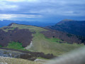
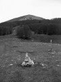
(1) Turn immediately left to follow a path, barely visible in the mountain pasture, which heads south and re-enters the forest where it becomes more distinct. After a short descent, it begins to climb again, leaving the forest to ascend a grassy slope which forms the reverse side of the Rochers de Chironne; you will reach the distinctive landmarks marked by cairns.
(2) Resume the track across the mountain pasture behind the rocks, heading west, and, after a grassy pass, climb towards the ridge leading from the Col de Chironne and follow it to the left, towards the Rochers de l’Aiglette.
The signposted path crosses a wooded area before returning to the grassy slope. It runs quite low down the slope, but it is best to follow the path closest to the ridge in order to reach the But de l’Aiglette.
(3) After the ridge walk, head down the path below which continues south-west, before turning sharply north-west to descend the grassy ridge near the cliff, facing the But Saint-Genix.
The signposted path enters the forest and emerges from it shortly before the Col de Vassieux.
(4) Take the signpostedGRP® path opposite, which climbs up a wooded ridge before descending slightly at the next junction, Entrecols.
(5) Take the path opposite which climbs up the ridge bordering a mountain pasture, then descends slightly to the Col de la Chau.
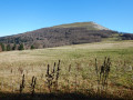
(6) Head up the ridge opposite once more, which climbs through the forest before emerging at Champ Rolland onto a grassy section that you follow up to the summit of But Saint-Genix.
(7) From the summit, descend either down the slope of the mountain pasture to Champ Rolland, if the pasture is not in use, or via the path you took on the way up, to Champ Rolland and then on to the Col de La Chau.
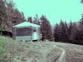
(6) Climb a little towards the Col de Vassieux and, on the grassy ridge, turn left into the mountain pasture to follow a faint farm track, which descends into the valley and becomes a forest track leading to the Col de Vassieux mountain hut.
If the mountain pasture is occupied and fenced off, continue down the ascent path to Entrecols and turn left to reach the refuge in 5 minutes.
(8) From the refuge, head down its access track heading north until you reach the forest road at Le Plainet.
(9) Turn right and follow this tarmacked forest road to the three-way junction.
(10) Ignore the roads branching off to the right and left and head up the forest road opposite, which heads north before levelling off and turning south-east, until you reach the Charbonniers junction.
(11) Leave the road heading north via the Combe des Muletiers, climb to the right (south) for 100 m, then turn left (north-east) towards Chironne. The gravel forest track climbs through the forest then continues on level ground to the junction with the Côte Maljosset forest track.
(12) Turn right onto this track, which leads to the ridge. When it bends to the right, continue straight on along the forest track towards the Combe de Nève for 100 m, then turn right onto the Chemin de Chironne, which descends to the mountain pasture; cross this on level ground before climbing up to the Col de Chironne, after joining theGR® marked path that ascends from the Combe de Nève.
(13) From the Col, head north-east and leave the path running level to the north to set off up the grassy slope towards the But de Nève, following faint, intermittent tracks where possible. After passing an initial ridge, continue climbing through the grass to the foot of the western ridge of the But de Nève.
From there, you can either climb straight up the steep slope towards the summit, or, more easily, follow some tracks to ascend northwards up the western flank and join the ridge towards the secondary summit at 1641, before heading south along the easy grassy ridge leading to the summit.
(14) Descend south-south-east along the ridge, or its eastern flank, which is quite steep but presents no technical difficulty. The faint tracks gradually become a well-defined path that descends to a level stretch of meadow.
Leave the ridge and head left towards a clearly visible cairn marking the correct descent route through the forest: a path follows this before veering left to lead to the geographical Col du Rousset (labelled ‘Col Naturel’ on the signs).
(15) Turn right to follow theGR®-marked path, first through grassy sections, then a slightly rockier corridor, and finally across a scree slope to the right before descending back onto the ascent path. On this path, turn left to quickly reach the pass road and the car park (S/E).


 Visorando Member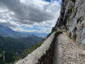
 Moderate
 Easy
Easy 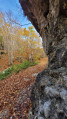
 Difficult