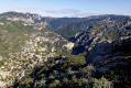
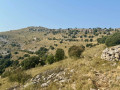
Country:
 City:


From Ulldecona or the motorway junction, head towards La Sénia and continue along the road leading to the Benifassa Convent, passing the Ulldecona reservoir (Embalse).
After a climb, turn right towards Fredes; do not turn off to the right towards the convent, but continue along the road which winds its way up, passes over a pass and reaches a lush green valley before arriving at Fredes.
Car park at the entrance to the village.
(S/E) Take the unpaved but passable track heading north-west. After a hairpin bend to the right, you’ll reach a junction.
(1) Continue straight on along the track, which climbs via a few hairpin bends and flat sections up to the wide Coll de Tombadors.
(2) Turn left (towards Tossal dels Tres Reis) and, immediately, leave the track to turn 90° left onto a forest track. This climbs in stages to the foot of the highest points of the Serra Pelada and begins a descent through woodland. It emerges at the summit of the grassy ridge of the Serra Pelada.
(3) Descend via the Cami del Mas Blanc, enjoying unobstructed views. The track climbs slightly, still through open country, before veering right to descend into the forest and emerge into the old mountain pastures of Mas Blanc, at a junction on an unnamed pass.
(4) Turn right to cross the level fields. The track then turns left, cutting across a continuous stone wall.
(5) The start of the path to the summit is 30 m after the bend, on the left. The path splits in places but remains clear enough to follow easily. The aim is to climb straight up the slope, keeping the stone wall a few metres to your left. Shortly before reaching the top of the ridge, the path veers to the right to traverse the slope – sometimes on a sloping surface – and continues to climb gently, passing two small rocky outcrops (cairns) to reach the gentle slopes leading to the summit (Petite Tour).
(6) Return via the same route, traversing then heading straight up the slope to (5) and then (4). On the way down, it is possible to cut straight across towards Mas Blanc, but the path is not maintained and becomes somewhat lost amongst the retaining walls; it is preferable to return to the track.
(4) Once back at the unnamed pass, turn sharply right towards Mas Blanc, passing a barrier that prevents vehicle access.
(7) Amidst the imposing buildings on this site, head for the corner of the outbuildings to take an old path marked by cairns, which begins to descend between the terraces bounded by the low retaining walls. This path is overgrown and sometimes obstructed, but whenever you risk losing it, there are cairns which you should follow, even if they cut across some of the old bends, as they enable you to stay on course and descend without getting lost, first down gentle grassy slopes, then down steeper wooded slopes. This section therefore requires care and, after a 200-metre descent, leads to the bed of the (usually dry) Arroyo de Trencaladre stream, which you cross before climbing up the opposite side to reach a forest track a few metres further on.
(8) Turn sharply left to head up this track, first along the bottom of the valley, then, after a hairpin bend to the right, climb up the slope on the right bank of the Barranc de Prades. This section through the forest is quite long, as it involves a few ascents and descents and a few detours around tributary ravines. Emerge from the top of the forest to reach the old mountain pastures at Mas de Trencaladres.
(9) Continue along the track, which climbs only slightly from here and joins the Coll de Tombadors road near a damp, level stretch.
(1) Turn right onto the final hairpin bend leading back to Fredes (S/E).

 Visorando Member