Country:

 City:


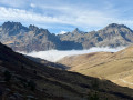
The route starts at the junction between the Glandon and Croix de Fer mountain passes (large car park). The ascent from the Maurienne region can be made either via St-Colomban-des-Villards from La Chambre (CD 927), or via St-Sorlin-d’Arves from St-Jean-de-Maurienne (CD 926), and from the Oisans region via the Eau d’Olle Valley from Rochetaillée (CD 526).
(S/E) Drive up the road towards the Col du Glandon (another parking option).
(1) Take the path on the right, towards the Col de Bellard. It climbs steeply straight up the slope (there is a hairpin bend to the left) to ascend a series of grassy humps, including that of Le Camp (Lasdiguières Fortifications), descends slightly to cross a clearing at Les Fraiches, and winds its way up in hairpin bends to the edge of the Cherennes plateau.
(2) Cross the vast alpine plateau heading east to reach the clearly visible Col du Bellard (where the ski lifts terminate).
(3) Turn right to climb towards the Crête de Bellard, either straight up the slope of the ski run (GPS track) or by taking a switchback to the right. The slope levels out as you reach the top stations of the chairlifts to the south-east.
(4) Climb straight south towards the summit ridge (cross in sight); the summit is on the left.
(5) Return along the ridge to the right, heading west; the route is easy at first, then becomes steeper near the Gazex avalanche-triggering devices, until you reach the clearly visible pass at the edge of the Plateau des Chansures.
(6) Turn left to descend into the thalweg along a well-marked path (a few muddy sections can be avoided) to the ruins of Le Truchet.
(7) Head off to the right to cross more or less level ground towards the Col de la Croix de Fer. You’ll arrive above the chalet and refreshment hut.
(8) Head towards the Croix-de-Fer-Est orientation table and, just behind it, take the ‘Zones humides’ path which plunges down into the valley. The descent is a little rough but short, leading to a crossing over a peat bog and a footbridge over the stream.
(9) Cut across a path (which you should not follow) to take the track opposite, which climbs through mixed terrain to the edge of Lac Potron.
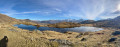
(10) Head to the right to reach Lake Guichard.
(11) Walk round the southern side of the lake and return to the opposite bank to take a path descending slightly to the left, crossing a peat bog before climbing up to the notch in the Col de la Croix de Fer Ouest opposite. (A possible alternative is to take a shorter route round the lake and climb up a path to join the gravel road leading level to the right towards the Col de la Croix de Fer).
(12) Cross the roads to take the path opposite, which descends towards the Olle mountain pastures, heading for the Col du Glandon. After a steep descent, the path crosses the plateau-level mountain pasture, with a view towards the Chalets d’Olle.
(13) Join the gravel road and follow it down towards the chairlift stations at the Chalets du Vallon, crossing the culverted stream at the end.
(14) Turn right to follow one of the tracks on the left bank of the stream, wade across the Ruisseau du Vallon at the most convenient point, and descend its grassy left bank to a clearly visible footbridge, which you cross.
(15) Take the path on the left, which follows level sections, descends steadily for a short while, passes the Ribauds ruins and crosses the hillside before climbing at the very last moment towards the road (Sous le Camp), emerging directly at the starting car park. (S/E)
 Visorando Member

 Extremely difficult
 Difficult