Country:

 City:


Either from Ambérieu-en-Bugey in the west or from Belley in the east, take the Route de la Cluse des Hôpitaux (CD1504) towards Saint-Rambert-en-Bugey.
From the roundabout to the south-west (towards Torcieu), head south on the CD73 towards Serrières. Park in the cul-de-sac, alongside the Câline stream.
(S/E) Walk back down 50 m along the CD73 (Route de Conand) to cross the Câline and immediately turn left onto Rue du Moulin heading south, which crosses the Foulon and begins to climb towards the forest.
After a few bends, you’ll reach the flat ground of the Combe de Nave.
Veer to the right to resume the climb up to a ledge just before an open area, then turn left onto a less obvious path leading into the forest. It climbs gradually at first, then more steeply up the slope, following the bed of an intermittent stream for a while. At the head of this stream, the path veers left and winds its way up the slope in switchbacks to the foot of the cliff, level with an arched cave. (Follow the red markings carefully in this difficult section)
(1) Turn right to take the steep ascent, which is equipped with a handrail cable allowing you to haul yourself up through a weak spot in the cliff to its summit (an exposed section, but well-equipped). At the summit, head towards the edge of the forest, visible in the distance, at the edge of a farmland plateau.
(2) To cross over to the Balcon de la Falconnière, it is best to go round the hay meadows: turn left onto a path running alongside the woodland, then turn right to follow a fence and take the path that emerges.
At the next copse, turn right onto the paths at the edge of the woodland to reach, at the other end, a track which you follow northwards to the Balcon de la Falconnière viewpoint.
(3) Retrace your steps and stay on the more or less level path until it joins the end of a tarmac road. Then turn left for about thirty metres (towards the Creux de Lent).
(4) Turn right to head up a path lined with timber stacks and reach another junction, where a small road ends. Here, you can take the path opposite leading directly to Crêt Saint-Martin, or turn left (GPS track) onto a level path running alongside the Creux de Lent, passing by the Golet de Pètremont.
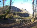
(5) Carry on straight ahead and, at the end, head down slightly through the woodland to the Croix de la Montagne.
(6) Turn right onto a lovely forest track, which is flat at first but then begins to climb through the woods to the Creux du Soir meadow; follow this along to the ridge, where it meets the path coming from the right from Crêt St-Martin.
(7) Continue southwards to cross the Plat du Mont until you reach the junction with the path ascending from the right from Cleysieu.
(8) Carry on straight ahead and begin the climb towards Le Cordonnet.
(9) The route leaves the grassy ridge (enclosure) and veers slightly to the left, descending gently along a lovely path (with retaining walls) through the forest, which joins the Ruisseau de la Gorge valley.
At two junctions with paths leading uphill to the left, turn right and, after a few bends, climb up to the Col du Golet d’Ars.
(10) Turn left towards the south onto a rough track (with ruts) which starts off flat before climbing more steeply to a rock viewpoint at the edge of the cliff.
(11) Turn left to continue the climb, which gradually levels off before descending via the Plat d’Ars towards the Taporal forest junction.
(12) Leave the forest tracks behind and head due east up theGR® 59 marked path. Halfway up the slope, it veers left to climb the side of the hill, then curves back to the right, passing the highest point of the Crêt de Pont.
(13) Continue straight on along the ridge path; it turns left to begin the descent, then veers right to join the forest road coming from Taporal.
(14) Turn left onto this track and descend in a series of bends until you reach a left-hand bend where the track crosses off-level to the north-west, before resuming its descent via a wide right-hand bend leading back to the bottom of a thalweg.
(15) Turn left to follow the track at the bottom of the thalweg and, as the slope becomes steeper, the path branches off to the left for a long, descending traverse through the forest – quite steep in places – beneath La Cula, eventually leading out of the forest and into the hamlet of Lé or Bief Carré de Conand (fountain).
(16) Cross the hamlet to descend to the Conand d’En-Bas junction.
(17) Turn left to follow the CD73 to the Pré-Blanc crossroads.
(18) “From there, there are three options for reaching Serrières:
- follow the CD 73 all the way; this is the most direct route but not very pleasant as there is some traffic;
- turn right onto the signposted path to head up towards Arandas, join the CD 104, then descend via La Grange du Devant towards the Câline valley: this avoids a bit of road, but at the cost of a significant climb;
- a compromise between the two: first follow the CD 73, then cross to the right bank and head up via Blanaz: this is the route shown on the GPS track.''
So, continue along the CD 73, which passes through the two hamlets of Le Vachat.
(19) At the junction with the path leading down from the Golet de Pètrement, carry on for a further 400 m along the CD 73.
(20) At the junction with a stony track, turn right and head back down to cross the Câline via an old bridge, then climb back up on the opposite side. After a bend to the left, the track levels out and follows a long traverse along the hillside towards the north, through an area that may be damp.
At the end of this stretch, the forest track turns right and descends towards the Ruisseau de Grinand, which it fords to join the CD 104.
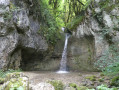
(21) Take the small road opposite towards Blanaz. It passes above a tuff waterfall and climbs up to the village of Blanaz, where you should turn left.
(22) Walk up past the church and, at the top of the village, turn left onto the tarmac-surfaced Chemin de la Madone, which climbs past the cemetery and turns right at the foot of the statue of the Madonna.
(23) Follow this small road northwards; it crosses a threshold and descends through the forest to the houses at Crêt Froid. Continue down through a few bends, gradually heading north again, until you reach the start of a path on the left.
(24) Take this stony path, which descends quite steeply to join more passable tracks. Turn right, then left, to descend into Serrières to the starting point (S/E).

 Visorando Member
 Moderate

 Difficult
 Association / Club / Walk leader
 Easy