


 Country:
 City:
City:


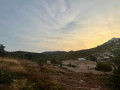
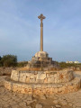

To get to Peñiscola, take the Carretera de l’Estació (CV 1410) and, at the small roundabout before the large one at Plaça de la Constitució, turn right up Carrer de la Cova until you reach the clearly signposted car park.
(S/E) From the car park entrance, head back along Carrer de la Cova, continuing uphill until you reach the junction with Carrer de Costa-Rica.
(1) Turn right to go down this street and, at the bottom, continue on to Carrer de los Oliveres, which you take on the left. Cross the dry stream bed, then turn right and then left until you reach the junction halfway up the slope.
(2) Turn right onto the country lane, which runs alongside a plot of land not yet developed and then leads to a housing estate as it descends onto the Carretera de l’Estació.
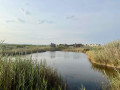
(3) Turn right to reach the pedestrian crossing and cross the avenue, then head down Carrer de Xaloc to the edge of the marsh. Follow the path to the right for about fifty metres.
(4) Take the footbridge over the watercourse and continue along the walkway on stilts, stopping to admire the viewing points on the left. You’ll leave the stilts at the corner of the sports facilities built on a raised platform.
(5) Turn left and continue along the path between the marsh and the facilities (car park, campsite) until you reach the junction with the Assegador de la Creu.
(6) Turn left, visit a viewpoint overlooking a stretch of water on the right, then rejoin the path which leads into the middle of the marsh. It veers left, heading due west, and joins the Cami d’Envig at a cross.
(7) Turn left onto the shared footpath and cycle path which runs alongside the Avinguda for 300 m.
(8) Turn left onto the Cami Vell, which winds its way between the farmland and the marsh, until it emerges at the Poligono car park and Carrer del Puntarró.
(9) Turn right and head up Carrer del Puntarró to the roundabout; cross it and turn left onto Carretera de l’Estació for about 50 metres to rejoin the outbound route.
(3) Walk up through the housing estate, turn left and continue along the country lane.
(2) Turn right and walk 50 metres uphill, then turn left onto a level path which crosses Carrer dels Tarongers and continues (over a rough section) to Carrer del Barranc Ample, which you follow down to the left. Head back up the road opposite and turn right to follow Carrer de Costa-Rica uphill to a junction with Avinguda d’Italia opposite the Serra d’Irta.
(10) Turn left and head down Carrer de la Cova to the Bellavista car park. (S/E)
 Visorando Member
 Moderate
 Difficult
