Country:

 City:
City:


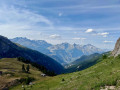
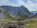
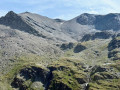
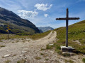
From Modane, head up towards the Valfréjus ski resort (Le Charmaix), cross the entire resort and continue along a gravel road to the hamlet of Le Lavoir, where there is a car park.
(S/E) Walk to the end of the car park and take the slope (ski run) to the left of the road towards Le Thabor. At the top, head straight up through the grassy slopes along a path that joins the Route du Fréjus.
Take this road to the right as far as the Fontaine Froide junction (without heading down towards the hamlet of Fontaine Froide on the right).
(1) Let the Route du Fréjus (return route) branch off to the left and carry on straight ahead along the track, which becomes a footpath. At one point, it crosses the bed of a torrent and continues on the opposite side, climbs a ridge and arrives at the Vallon de la Roue junction.
(2) Ignore the path on the left leading up to the Petit Argentier, then the path on the right towards the Vallée Étroite, and continue along the left bank of the stream. The path climbs towards the clearly visible pass, passes close to the Baraque Poste de la Roue and reaches the Col de la Roue.
(3) The easiest route from the pass is to descend on the Italian side towards Bardonecchia, covering a drop of around sixty metres, and, at a right-hand bend, turn sharply left onto a path heading eastwards. This path climbs gradually as it skirts the ridges descending from the crest on the left, then, after a long, ascending traverse, joins a ridge coming from the south.
Alternative route 1: it is normally more natural from the pass to follow the ridge eastwards, climbing the steep path that starts opposite: you reach the rocky area of the Roc de Jany fairly easily, which you must cross to descend to the Petit Col de la Roue and then join the aforementioned traverse path. However, this section is schist-covered and exposed, and the paths bypassing it to the south are rather treacherous. Experienced walkers may wish to attempt this ridge path, but most will opt for the lower detour suggested in the guidebook.
Alternative 2: between these two routes, it is possible to cross without losing as much altitude by taking the faint tracks to the south-east between the ridge path and the descent path: you reach the bypass path whilst remaining at an altitude of around 2,530 m, but this involves off-trail walking.
(4) Climb straight north up the slope, first along the ridge then through a parallel undulating area to the right. Follow the most clearly marked tracks, sometimes accompanied by cairns. These climb beneath two rocky outcrops.
(5) Here, two routes appear to branch off in opposite directions: it is indeed possible to bypass the main rocky outcrop to the right or to the left; the left-hand route seems better marked and runs easily along the ridge (GPS track). Above this outcrop, the path climbs towards the ridge, which is now close by and clearly visible.
(6) Once you reach a pass on the summit ridge (alt. 3,008 m), you are free to visit the three identifiable peaks: the GPS track shows the route to the South-East Peak (3,041 m), which is very easy.
(7) Return to the pass.
(6) It is possible to head off in the other direction towards the North-West Peak (3,047 m) and even continue on to the French summit of the Grand Argentier (3,042 m) after passing through a lower point on the ridge. In any case, return to the pass.
(6) Descend straight north-east, following the line of cairns, off the beaten track, but on the steepest slope a clear path reappears. Follow it down to a flat section of the stream where you veer to the right. The cairn-marked path descends a small ledge then continues through a rocky, uneven area where it disappears and cairns multiply in various directions.
(8) When the terrain becomes a little grassier, turn right towards the clearly visible Col du Fréjus. You’ll gradually need to stop descending and traverse level towards the pass, crossing a few temporary streams.
(9) At the pass, take the stony track that heads off level to the left towards the site of the old Fréjus barracks, at the junction with the road leading up to Punta Bagna.
(10) The track finally descends towards the Ruisseau du Fréjus.
(11) Pass a road on the right leading to the Col d’Arrondaz, and descend to the site of the Pas du Roc, a major defensive structure in the area.
(12) Continue down the road, which turns at the junction with the path to Le Genevret, and reaches the hamlet of Le Jeu.
(13) Continue down the road to the Fontaine Froide junction, which you passed on the way there.
(1) Turn right and follow the road down to Le Lavoir and its car park (S/E).
 Visorando Member
 Moderate
 Difficult