


 Country:

 City:


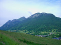
From Aillon-le-Jeune, which can be reached via the Col des Prés from Chambéry or via Le Châtelard from within the massif, head towards the resort and stop at the second bend at the Crédibert car park (start of a botanical trail).
(S/E) Take the path heading north-west to the hamlet of Crédibert. At the entrance to the hamlet, head up the botanical trail on the right, which rises above the car park. When the botanical trail branches off to the right at the top, continue along the path that winds its way up through the forest to the Chalet des Fontaines
(1) After a flat section, resume the climb, ignoring a path branching off to the left towards Aillon-le-Vieux, and continue uphill to reach the ridge of the Montagne de Motzon. Climb up its eastern slope. At the various junctions, take the path on the left which stays closest to the ridge until you reach the start of the Rochers de la Bade trail.
(2) Ignore the path leading to the Col de la Cochette and head left up towards the ridge, where steeper sections alternate with gentler ones. The path can sometimes become indistinct: follow the blue markings closely along the ridge, as the slopes can be steep.
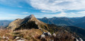
You’ll gradually emerge from the forest, alternating between grassy slopes and rocky sections. You’ll sometimes need to use your hands, but it’s nothing too difficult. The most exposed section of the ridge is climbed on its western flank. This brings you to the summit, which is rather rugged, facing the Colombier.
(3) The start of the descent towards the Col de la Cochette is mainly grassy, but the path—clearly marked in blue and yellow—soon alternates between following the line of the exposed ridge and hurtling down steep slopes alongside a rocky outcrop. You’ll often need to use your hands and hold on to rocks or trees.
Places to rest are quite rare as the descent is physically demanding, with even a few short climbs. It is only as you approach the Col de la Cochette that the terrain becomes noticeably easier, leading to the foot of the Colombier.
(4) At the pass, take the path directly opposite, which climbs steeply but without difficulty to the summit.
(5) For a change, descend via the west-facing path, which leads to mountain pastures near the Col du Colombier, where it veers left to descend to the Chalet de Rossane.
(6) Walk level across towards the Col de la Cochette.
(4) Descend the eastern-facing pastoral road towards Aillon, cut across the first wide bend and head down the track through the forest. Follow the red and yellowGRP® markings, which take you along forest tracks cutting across the hairpin bends of the main track, until you reach the junction at the Bois de Saint-Bruno.
(7) Continue down the forest tracks, which wind in wide bends, until you reach the tarmac forest road at Le Muret.
(8) Turn right onto it. It continues as a forest track that climbs slightly for a short while.
After reaching a high point, the track descends slightly: after 200 m, turn left onto the signposted path which plunges into the forest, crosses to the right with a few muddy sections, then descends to cross the Ruisseau du Couvent.
Leave the signposted path, which stays on the left bank, and head back up the opposite side via a track leading to the hamlet of Les Folliet.
(9) From there, you can head uphill to stay in the forest and pass above La Mense before descending towards the starting point.
It is also possible to avoid this climb by following a short stretch of tarmac road (GPS track): head down the road leading to Les Folliet. It curves back towards Le Couvent. Turn right towards La Chartreuse.
(10) Walk down the road to La Correrie and its chapel.
(11) At the junction, take the marked grassy path on the right, running parallel to the road, which leads pleasantly to the foot of the Mense housing estate.
(12) Follow Rue de la Chapelle, which is on level ground, to the start of the Via Ferrata.
(13) Continue straight on and head downhill to join the D 32A, Route de la Combe, then take the secured path alongside the road which leads directly to the car park (S/E).

 Visorando Member
 Moderate

 Easy
 Difficult

