


 Country:

 City:
City:



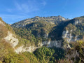
Starting point at Le Bourbon, at the junction before Les Trois Fontaines, accessible from the Col de la Placette (CD 520A) via a small road that winds its way up towards the forest.
It is best to park on the branch leading towards Les Reynauds, where there is space at the side of the road.
(S/E) Take the Chemin des Reynauds southwards, pass through this hamlet and continue to the Chalets du Soulet
(1) Don’t be tempted by the well-maintained forest track that climbs to the left; instead, carry on straight ahead along the path that descends slightly into the forest. Let the paths towards Pommiers branch off to the right and continue uphill to the Cota Bois junction.
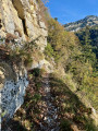
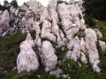
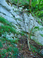
(2) Head left up a track, then a path that climbs due south, straight up the slope towards the cliffs. Reach the rocks and follow the marked path closely as it winds its way between the rocky outcrops; the path then becomes exposed and crosses to the left towards the earthen passage of the Pas de l’Aronde.
(3) Cross this ascending section carefully and continue climbing, towards the end via wide switchbacks, to the edge of the plateau, where a narrow track branches off to the left, descending a few metres to the viewpoint at the edge of the cliff.
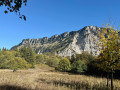
(4) Return to the path and follow it south-east; it crosses a few old forest tracks before climbing up to the ridge. Turn left and follow this gently ascending ridge until you emerge into the Prairie de Charminelle, which you cross to reach the junction of paths.
(5) If access via the Pas de Miséricorde is prohibited, do not turn left. See the section: practical information on the alternative route.
Take the path on the left, heading due north towards Jusson and the Combe des Veaux. Begin the descent and, after 150 m, leave the marked path that branches off to the right at this level to turn left onto the Charminelle path through the forest (trail markings); it crosses a few forest tracks and descends gradually to the Ruisseau de l’Hérétang.
(6) Head back up opposite to the left until you reach the path coming from La Velouse.
(7) Please note = > As of 18 October 2026 => The return route via the Pas de Miséricorde is also exposed and is currently closed due to rockfalls; you must take the diversion via the Combe des Veaux and Jusson until the official reopening.
Take the path on the left leading towards the Pas de Miséricorde, which is no longer signposted or maintained.
(8) Pass this exposed pass with care – a cable is still in place at the exit – and begin the descent towards the clearly visible viewpoint.
(9) Continue the descent – steep but steady – to the junction with the path coming from Jusson (there is no sign at this point).
(10) Follow the now signposted path down to the left, which winds through the forest; avoid cutting across the scree to prevent erosion. You’ll arrive at the Trois-Fontaines car park.
(11) Take the access road on the left, cross the Pont de Grépy and continue to the Bourbon junction. (S/E)
 Visorando Member
 Difficult
 Association / Club / Walk leader
 Moderate
 Easy
Easy 
