The Cime du Caro circular loop

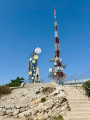
El Caro is a high point (1,442 m) in the Ports Natural Park, at the far end of Catalonia, overlooking the Ebro Valley. A road leads up to it from the valley, as it serves the mobile phone masts installed on this exposed summit. This road is best known to cyclists, who climb nearly 1,200 m over 13.8 km. However, this summit lies on a ridge that can be explored on foot, starting from the wooded plateau at its base. The elevation gain on this circular route is modest, but some of the climbs are physically demanding. The view from the summit is therefore well worth the effort on this route.

Details

105729692
Creation:
Last update:
Last review:
  • Walking
    Activity: Walking
  • ↔
    Distance: 4.72 mi
  • ◔
    Average duration: 3h 30 
  • ▲
    Difficulty: Moderate

  • ⚐
    Back to start: Yes
  • ↗
    Ascent: + 1,509 ft
  • ↘
    Descent: - 1,493 ft

  • ▲
    Highest point: 4,715 ft
  • ▼
    Lowest point: 3,514 ft

Photos

Description of the walk

From Tortosa, in the Erbre Valley, head towards Roquetes, where the ascent begins heading westwards along a winding road that reaches the El Mascar plateau. At a pass, ignore the road leading left towards the summit and continue across the wooded plateau to the Caro Refuge and the L’Esquirol car park.

(S/E) Continue along the road towards Fredes; it descends slightly. Ignore the road on the right leading to the Ermita de Santa Maria dels Ports and turn left to climb up to the Col de la Carrasqueta.

(1) Leave the road and take the signposted path (GR®) on the left, which climbs in stages through the forest and ends with a slightly steeper ascent to reach the Col dels Pallers, on the ridge.

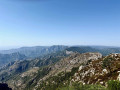
(2) Turn left and continue climbing along the ridge, skirting round the first rocky outcrop on the left. The path then becomes steeper as it climbs to the first ledge, at an altitude of around 1,300 m. You’ll need to use your hands a little, but it’s never really exposed. The path becomes easier from there until you reach the next summit on the ridge: Moleta Redona.

(3) The summit of Caro is in sight, but you need to descend a little to an unnamed pass. The ridge then becomes very rocky; the path veers off to the west on the left, descending a small slope to reach a more passable, albeit steep, ramp. This ascent takes you to the base of the summit. By traversing to the left, you reach the road where the cyclists arrive.

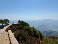
(4) Explore the accessible parts of the summit: a monument and, above all, a panoramic esplanade overlooking the Ebro Valley.

(5) Return to the road (4) and begin the descent along a well-marked path, which cuts across the road’s hairpin bends, down to the Col del Vicari.

(6) The path veers to the left, cuts across a hairpin bend, then descends due north down fairly steep wooded slopes until it reaches the El Mascar road.

(7) Turn left and follow the more or less level road towards the Caro UEC refuge.

(8) At a Fork in the road, keep left (ignore the turn-off on the right to the Refugio Monte Caro). Continue to the L’Esquirol car park (S/E).


Waypoints

  1. S/E : mi 0 - alt. 3,606 ft - L’Esquirol car park - Refugi de Caro
  2. 1 : mi 0.83 - alt. 3,566 ft - Coll de la Carrasqueta (1801 m)
  3. 2 : mi 1.58 - alt. 3,970 ft - Coll dels Pallers (1218 m)
  4. 3 : mi 2.11 - alt. 4,423 ft - Moleta Redona (1359 m)
  5. 4 : mi 2.85 - alt. 4,672 ft - Road junction - Caro (1442 m)
  6. 5 : mi 2.92 - alt. 4,659 ft - Mirador del Monte Caro
  7. 6 : mi 3.55 - alt. 4,196 ft - Coll del Vicari (1294 m)
  8. 7 : mi 4 - alt. 3,553 ft - El Mascar Road
  9. 8 : mi 4.44 - alt. 3,612 ft - Fork in the road
  10. S/E : mi 4.72 - alt. 3,606 ft - L’Esquirol car park - Refugi de Caro

Notes

This route is signposted as a GR® from (8) to (2), with boundary markers elsewhere, as well as directional signs at junctions.

The path is generally well marked; take care not to lose it in the rocky sections.

Set off fairly early in the morning to make the most of the cool shade during the climb up to Col dels Pallers and even the ascent of the next rocky outcrop.

You can start from any point along the road between (7) and (1). The suggested starting point balances the distance travelled on the road between the start and the finish and, above all, has good parking facilities.

Worth a visit

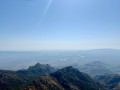
There is a sweeping view (though unfortunately often misty) from the summit over the surrounding mountain ranges (the Els Ports and Benifassa Natural Parks) as well as over the valley and the Ebro Delta.

Always be cautious and plan ahead when you're outdoors. Visorando and the author of this route cannot be held responsible for any accidents occurring on this route.

The GR® and PR® markings are the intellectual property of the Fédération Française de Randonnée Pédestre.

For more walks, use our search engine .

The GPS track and description are the property of this route's author. Please do not copy them without permission.