Country:

 City:
City:


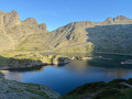
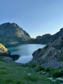
From Domène or Uriage in the valley, head up to Chamrousse via Les Seiglières to reach Le Recoin, where the resort has plenty of car parks
(S/E) Look out for the sign marking the start of the trails and head up first beneath the Aiguille ski lift, then veer to the right; when the GR® climbs straight up to the Col de l’Aiguille, head more directly to the right to reach the Col de la Balme at the same level.
(1) Head up to the right, south-east, for 100 m, then turn left to follow the signposted path up towards the Lacs Robert. The path climbs up the slope to reach a flat area where a small lake is gradually being filled in: the Lac de Levetel.
(2) Continue easily north-east along the track back to the resort, passing beneath the Croix de Chamrousse.
(3) The path cuts across the Couloir de Casse Rousse then becomes steeper as it climbs to the Brèche Robert Sud via a very rugged section.
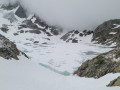
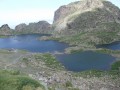
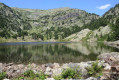
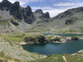
(4) Cross the breach and descend to the first Lac Robert, which you skirt to the right.
(5) From the headland in the centre of the lakes, head north to the junction with the northern pass.
(6) Continue on level ground northwards past the last lake, then the path cuts across the steep slope towards the junction marked ‘Grand Sorbier’.
(7) Ignore the path branching off to the left towards L’Oursière and cross the valley to the next junction, which no longer has a sign (Clôt des Vernes).
(8) Ignore the GR® continuing straight ahead and veer right onto a less well-marked path, though signposted with yellow paint marks, which begins to wind its way up and then climbs a steep gully where you’ll need to use your hands. At the top, the path becomes less steep and follows a long traverse with the occasional descent in the Échaillon area.
It thus cuts across a few steeper rocky ridges and finally joins the torrent at the bottom of the Combe de Jasse-Bralard.
(9) Cross the torrent and follow it for a short while along the right bank before climbing the steep grassy slopes to the left up to a double ledge where the ridge crosses.
(10) Switch to the northern slope of this ledge to descend via less steep slopes and rounded boulders down to Lac David.
(11) Leave the lake via the PR® marked path, which runs along the hillside and joins the Grande Lauzière path. You will then be looking down on Lake Claret, towards which you must descend, either via the first very steep scree slopes, or further on (after crossing two torrents) via easier grassy slopes (GPS track).
This off-trail descent allows you to avoid the detour to the Refuge de la Pra. At the lake, head for its western shore and join the GR®738, skirting it on either side.
(12) From here, follow the GR® downstream; it moves away from Lac Claret and runs alongside Lac Longet, overlooking it.
(13) Towards the end of the lake, you can visit Lac Bernard below on the right; otherwise, stay on the GR®, which crosses a grassy pass and then descends steeply to Lac Léama, clearly visible further down.
(14) Continue past the lake to the lowest point of this circular route, crossing scree.
(15) Climb back up the opposite side, first along a very steep section and then a grassier one, until you reach a ledge from where the GR® descends slightly to cross over to the junction you passed earlier.
(8) Cross over to the Grand Sorbier junction.
(7) Climb the correct slope leading to the Lacs Robert plateau, up to the Brèche Nord junction.
(6) Turn right to pass to the north of the lakes and climb up the hillside to reach a widening pass at the Brèche Robert Nord.
(16) Head west, staying firmly on the GR®, for a fairly steep descent opposite a large scree slope. You’ll enter the forest and the slope levels off slightly before reaching Lac des Pourettes.
(17) Continue down to a grassy plateau and veer left to climb back up through the forest to the junction at the Grand Aiguille.
(18) Stay on level ground for a long traverse along the hillside through the forest, until the path emerges into the Combe de Casserousse, near Cargneules.
(19) Cross the valley floor and head back up, cutting across the ski runs, to the Col de l’Aiguille.
(20) Head over to the western slope, avoiding as far as possible the numerous tracks other than the GR® (mountain bike tracks, etc.) and head towards Le Recoin, which is visible ahead (S/E).

 A long, very rugged route, almost entirely exposed to the sun, with numerous scree slopes that are hard on the ankles: this is a demanding hike (IBP index 125 = very difficult) that you should set out on early in the morning. But the magnificent lakes are well worth the effort… Keep an eye out for vultures and spotted nutcrackers: keep your eyes peeled.
 Visorando Member
 Very difficult
 Moderate