Country:

 City:


From Grenoble, head up via Monestier-de-Clermont to Gresse-en-Vercors. Just before the village, turn right onto the CD 242 towards the hamlet of Les Petits Deux. Park in the hamlet’s car park; if there are no spaces left, drive past the Col des Deux and park 150 metres further on at the Via Cordata car park.
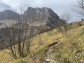
(S/E) At the northern end of the hamlet (towards Saint-Andéol), turn left onto the signposted path which runs alongside meadows, then climbs through the forest, skirting the Ravin de Farnaud before emerging from the forest via a series of hairpin bends leading to the Côte Joubert ridge.
(1) Follow the ridge path upwards, ignoring a path on the right that leads back down, and join the balcony path at the “Sous Séguret” junction.
(2) Continue to the right, heading west across the scree slope at the foot of the Rocher de Séguret; cross the scree to reach its left bank, where some vegetation clings to the rock, and climb the steep, winding corridor leading to the Pas de Berrièves pass (elevation 1902).
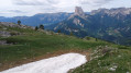
(3) You can climb directly up to the Rocher de Séguret or take a steady ascending track to the south, but this veers away from the ridge and, when crossing a ravine, you must leave it to climb up to the left, choosing the grassiest sections, until you reach the first summit of Séguret with a cairn (elevation 2051).
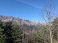
(4) Take the route heading south to cross the various summits of the ridge off the beaten track and, after descending to a gap, climb back up towards the first summit of Roche Rousse (elevation 2105).
(5) Continue southwards along the ascents and descents leading to the next summit (elevation 2121).
(6) Continue as close as possible to the ridge until you reach a descent to the Pas de la Posterle, marked by a small cairn (elevation 1976).
(7) Continue climbing southwards to the summit of Pierre Blanche (elevation 2106).
(8) Continue along the ridge to the final summit marked by a cairn (elevation 2087) and descend towards a meadow (elevation 1966) where you’ll find a well-trodden path which, after a brief climb, descends via a slightly steeper section to the clearly visible Pas de la Ville (elevation 1925).
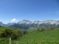
(9) Turn left to descend the wide, winding path to the junction with the ‘Sous le Pas de la Ville’ balcony path (elevation 1721).
(10) Turn left to take this level balcony path heading north. After crossing a few ravines, you’ll arrive above the ski lift arrival points at the resort. Descend along a path towards the Pierre Blanche ski lift.
(11) From there, you have a choice of descent routes:
- either via the service track (trace),
- or via the various grassy ski runs.
At the foot of the ski lift (first-aid post), turn left to reach the start of the Pré Levé ski lift.
(12) Do not let the path carry you downhill, but cross a grassy section at the same level to rejoin a country lane that winds round a copse and heads north-east. It runs through a gently sloping side valley until it approaches the woodland.
(13) Then veer left, heading north, to descend towards a stream (the ‘Sentier des Arbres’) and turn left to cross it, then head back up the opposite slope to the north-west until you reach the footbridge over the Ruisseau de la Daraze.
(14) Cross the bridge and turn right to follow the left bank of the stream until you return to Les Petites Deux (S/E).

 Visorando Member


 Moderate