Country:

 City:
City:


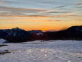
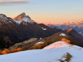
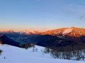
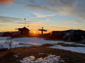
From Chambéry, head to Aillon-le-Jeune via the Col des Prés. In the main town, turn right towards the resort and follow the road uphill to the car park at the Couvent de la Chartreuse d’Aillon. In winter, snow clearance stops just beyond this point.
(S/E) Continue straight on along the Route de la Chartreuse, which climbs gently and reaches the Cabane de la Fullie car park.
(1) Carry on along the road until you reach the junction with the Route forestière du Muret
(2) Carry on straight along the road to the Praz-Gelaz summer car park; the road then bends to the right just before a path heads off.
(3) Turn left to follow the path up towards La Fullie, first through the meadow, then through the forest. Halfway up the slope, let the path continue straight ahead and turn right to take a flight of steps leading onto a forest path that leads to the Col de la Fullie.
(4) From the mountain pasture, retrace your steps and veer left onto the gently ascending path running along the foot of Mont Chardonnet, then joining the wooded ridge which, after a few descents and ascents, leads to the Chalet de la Cha.
(5) Do not take the first signposted path leading down to the left, but continue along the ridge path, descending only a few metres towards the last chalet.
(6) Head up the Pré de la Cha, through open terrain and then back into woodland, to reach Mont de la Vierge.
(7) Continue along the ridge, on level ground, to a pass at Pré Condut.
(8) Continue along the more or less level ridge path, which eventually climbs more steeply in the Adrets area.
(9) From there, head straight for Mont Pelat, which is visible ahead, down the final slopes.
(10) Begin the descent on the opposite side, staying on the ridge, via old blue runs alternating between slopes and flat sections. A snowmobile track allows for a more consistent gradient all the way to the Col de la Sciaz.
(11) Follow the track as it turns sharply to the right and heads north along a wide, gently sloping forest road, which emerges into the meadows at the foot of the Mont Pelat chairlift. Turn left to reach the junction with the Morbier path (another possible descent route from the Col de la Sciaz).
(12) Turn right to stay on the stony track, which crosses the old Rochettes chairlift and then the old Combe aux Biches ski lift. As you approach the Route des Ginets, just after crossing a stream, turn left onto a path running parallel to the stream, which leads to the top of the Parking des Gilets car park.
(13) Head straight down towards the valley along the Route des Gilets, then turn right onto the Route de la Correrie until you reach a left-hand bend.
(14) From there, to head back up to the Convent, there are three options:
- GPS route: if there is enough snow to put on snowshoes (signs for snowshoes at Combe de Lourdens), take a path heading north-east at the bend, which enters a field (you’ll need to go over the fence) and crosses it on level ground. At the end of the field, head up to the right until you reach another path which descends, crosses the Ruisseau de la Fullie via an old bridge, and then climbs up the opposite side before heading straight up the slope towards a retaining wall belonging to the Convent. Finally, turn left to reach the car park (S/E).
- Alternatively, as this route is accessible all year round, continue down the road and, after crossing the Ruisseau de la Fullie, turn right onto a path that runs between the buildings before climbing towards the Convent, leading to the car park (S/E).
- Finally, head down the road to La Correrie, then turn right onto the Route de la Chartreuse, which leads back up to the Convent (S/E).

 Visorando Member
 Moderate
 Easy
Easy