


 Country:

 City:
City:


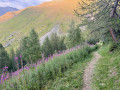
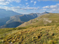
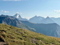
Head up the Romanche Valley (CD 1091) towards La Grave. At the Chambon Dam, take the CD 25 on the left, pass through Mizoën, continue to Besse and drive through the village. After the Gay car park, continue along the Route du Rif Tort until the tarmac ends, at the first major hairpin bend, at a place called St-Denis. Park, taking care not to obstruct the road.
(S/E) Take the gravel track and follow its hairpin bends up to the Col Nazié.
(1) Take the GR® 54 on the right and follow its hairpin bends up to the ridge, at the junction with Chalet Josserand.
(2) Take the path that descends to the right alongside the Marais du Rif Tort, towards the Plateau d’Emparis and the Lacs Noir and Lérié. At the end, head straight down towards the ford and the crossroads
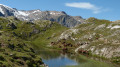
(3) Leave the GR® and head south towards Lac Noir. The path first winds its way up the slope, then heads straight towards the rockier terrain, up to Lac Cristallin.
(4) Continue climbing southwards to reach the ridge of the Plateau des Lacs.
(5) Carry on straight ahead; the terrain levels out, passing close to small lakes (which may be dry) before emerging at Lac Noir, facing La Meije.
(6) Follow the path southwards; it joins the ridge overlooking the Romanche valley and veers eastwards before descending to Lac Lérié.
(7) Leave the lake by heading gently uphill towards the north-east; turn left at the Plateau junction, then at the Souchet junction, and reach the Col du Souchet.
(8) Descend straight ahead towards the north and gradually veer left towards the west to reach the junction you passed earlier in the centre of the Plateau d’Emparis.
(3) Head down to the left along the edge of the Rif Tort, cross the ford and follow its right bank for 200 m. There, turn right onto an unmarked path that is barely visible at first but becomes clearly visible on the slope: it cuts across the hillside to join the gravel road to Mizoën above the Chalets du Fay.
If you wish to stay on a marked path, head down alongside the Rif Tord, staying on the GR® 54C, which climbs up from further down towards the Chalets du Fay. When you reach the road, simply turn right and follow it for 200 metres to retrace your route.
(9) Turn left to walk down the road for 50 metres to the sign where you turn right towards Sur Berche and Les Chatons, onto a path that crosses a mountain pasture plateau for some time, climbing gently, passing Chalet Girardet and reaching a threshold at Sur Berche.
(10) Head down the slope opposite, veering to the right; the path winds in hairpin bends, joins a path coming from the right of the Col St-Georges and descends to a grassy pass at a place called Loutre de Quoa.
(11) Continue to the right towards Besse on the path which descends through grassy terrain before entering the forest, where it winds down steep slopes via well-marked switchbacks to the Quoa junction.
Alternative route: there is an alternative route by turning left towards Les Chatons, to reach the next pass at La Citrière, where you cross over to the Besse side via a descent out of the forest that leads to the same Quoa crossroads.
(12) Continue down the signposted path and, at the ‘Coin Fauchez’ sign, turn right to head back up, crossing three streams in succession, to the road at St Denis. (S/E)
 Visorando Member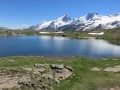

 Moderate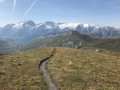
 Easy
Easy 
 Very difficult
