


Perche Sarthois

 Tourism professional
PRO  Premium user
Premium user Sign up:
Published route(s)
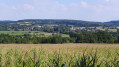
 Panoramic views over the Prairies d'Avezé
 6.80 mi
 +377 ft
 -384 ft
 3h 25
3h 25
 Moderate
 Departure from Avezé (Sarthe) (Sarthe)
This route, which alternates between sunken lanes, forest paths and flat sections, will take you to the hill overlooking the Huisne Valley to the west. Along the way, several panoramic views allow you to admire the meadows of Avezé, a veritable hay barn that has provided for generations of farmers.
La Tuilerie des Saules via the hills of Souvigné-sur-Même
 8.10 mi
+659 ft
-653 ft
4h 20
Moderate
Departure from Souvigné-sur-Même (Sarthe)
8.10 mi
+659 ft
-653 ft
4h 20
Moderate
Departure from Souvigné-sur-Même (Sarthe)
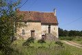
This walk starts in the village of Souvigné-sur-Même and follows sunken paths lined with pollarded trees, allowing you to explore the bocage, the grazing meadows, the woods and the surrounding countryside. The rolling hills offer views from their summits of the villages of Préval and Avezé and the Huisne and Même valleys.
Montmirail Castle and its countryside
 6.17 mi
+295 ft
-312 ft
3h 05
6.17 mi
+295 ft
-312 ft
3h 05
 Easy
Departure from Montmirail (Sarthe) (Sarthe)
Easy
Departure from Montmirail (Sarthe) (Sarthe)
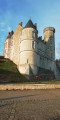
This hike allows you to discover Montmirail, a "small town of character", and its green countryside through woods and sunken paths.
The Trognes Route in Boëssé-le-Sec
 7.82 mi
+495 ft
-492 ft
4h 00
Moderate
Departure from Boëssé-le-Sec (Sarthe)
7.82 mi
+495 ft
-492 ft
4h 00
Moderate
Departure from Boëssé-le-Sec (Sarthe)
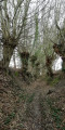
This route through valleys and bocage will allow you to explore the countryside around Boëssé le Sec. You’ll discover a beautiful avenue of pollarded trees.
The Beillé meadow
5.58 mi
+135 ft
-135 ft
2h 40
Easy
Departure from Beillé (Sarthe)
This walk follows the Huisne Valley and crosses the meadow where an American airfield was set up following the liberation of France in August 1944. A sign on site recounts the history of this temporary airfield.
The Chéronne stream
8.57 mi
+531 ft
-528 ft
4h 25
Moderate
Departure from Tuffé (Sarthe)
The route through the countryside around Tuffé takes us to the Château de Chéronne and the church of Saint-Denis-des-Coudrais. The Chéronne, which feeds the Tuffé lake, crosses and recrosses the sunken paths several times.
This route is best enjoyed in good weather as the dirt tracks can be quite wet.
The village of Dehault and its hillsides
 5.33 mi
+210 ft
-223 ft
2h 40
Easy
Departure from Dehault (Sarthe)
5.33 mi
+210 ft
-223 ft
2h 40
Easy
Departure from Dehault (Sarthe)
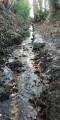
A lovely walk around the village of Dehault, through which the Montreteau flows. A hilly route with some beautiful sunken lanes.
The heights of Dehault
 3.06 mi
+157 ft
-148 ft
1h 35
Easy
Departure from Dehault (Sarthe)
3.06 mi
+157 ft
-148 ft
1h 35
Easy
Departure from Dehault (Sarthe)
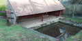
Over hill and dale, following the sunken paths and the Montretaux stream, discover the charming village of Dehault and its landscapes.
Around Cherreau
 3.81 mi
+272 ft
-272 ft
2h 00
Easy
Departure from Cherreau (Sarthe)
3.81 mi
+272 ft
-272 ft
2h 00
Easy
Departure from Cherreau (Sarthe)
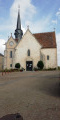
This walk offers beautiful views of La Ferté-Bernard and Cherreau.
Saint-Aubin-des-Coudrais and its hills
 7.66 mi
+456 ft
-427 ft
3h 55
Easy
Departure from Saint-Aubin-des-Coudrais (Sarthe)
7.66 mi
+456 ft
-427 ft
3h 55
Easy
Departure from Saint-Aubin-des-Coudrais (Sarthe)
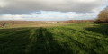
Set off to explore the hills and valleys of the Saint-Aubin countryside and its varied landscapes: woods, meadows and cultivated fields.
In the footsteps of Gohan in Bouloire
 10.05 mi
+486 ft
-509 ft
5h 05
Moderate
Departure from Bouloire (Sarthe)
10.05 mi
+486 ft
-509 ft
5h 05
Moderate
Departure from Bouloire (Sarthe)
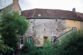
Bouloire is nestled in the heart of a vast, hilly agricultural region crossed by the Dué and Tortue rivers. Human presence along the ancient road between Le Mans and Orléans is attested to by a coin dating back to the Merovingian period. Its name comes either from a Celtic place name meaning "fortification" or from an etymology meaning "between two coasts ". The town centre is rich in ancient architectural heritage. The Church of Saint-Georges, destroyed by a fire that ravaged the village in 1680, bears the coat of arms of Marshal Guillaume Testu de Balincourt, who enabled its reconstruction. The town's coat of arms is also linked to this figure.
The bellowing of the stag in Villaines-la-Gosnais
 2.53 mi
+190 ft
-164 ft
1h 20
Easy
Departure from Villaines-la-Gonais (Sarthe)
2.53 mi
+190 ft
-164 ft
1h 20
Easy
Departure from Villaines-la-Gonais (Sarthe)
The village of Villaines, situated near the ancient Le Mans–Chartres road, developed in the Middle Ages around the church, on the hillside. You will appreciate its rural charm and the well-preserved architecture of the village houses and the old farmhouses scattered across the countryside. Their materials – terracotta for the tiles and bricks, limestone rubble and lime plaster coloured with local sand – blend beautifully with this scenic setting, offering fine views over the Huisne valley.
The Jewel of Courtanvaux
 4.41 mi
+305 ft
-322 ft
2h 20
Easy
Departure from Bessé-sur-Braye (Sarthe)
4.41 mi
+305 ft
-322 ft
2h 20
Easy
Departure from Bessé-sur-Braye (Sarthe)
Bessé dates back to the Middle Ages. At that time, the parish comprised numerous fiefdoms, including Courtanvaux, a parish seigneury elevated to a marquisate in 1609. The village developed particularly from the18th century onwards thanks to the establishment of pre-industrial sites, as evidenced by the cotton mill set up by Elie Savatier in 1735 (on the site of a former linen weaving mill) or the paper mill established at La Roche in 1824. The latter has since become the town’s main industrial site.
La Tussonne from Vancé
 4.15 mi
+318 ft
-295 ft
2h 10
Easy
Departure from Vancé (Sarthe)
4.15 mi
+318 ft
-295 ft
2h 10
Easy
Departure from Vancé (Sarthe)
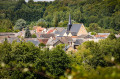
Situated in the south-west of the Calais plateau, which is cut by steep-sided valleys, the village is divided by watercourses belonging to the Braye basin; the two main ones are the Charmançon and the Tusson. Its origins may date back to the Gallo-Roman period, but its history becomes clearer in the Middle Ages thanks to the discovery of coins. In the early19th century, following significant population growth, Vancé became home to a large number of craftsmen. In 1810, the village was home to thirteen weavers and twelve building tradespeople: four stonemasons, one bricklayer, one carpenter, three joiners, three shingle cutters and numerous other craftsmen catering to everyday needs.
On the Via Turniacensis in Maisoncelles
 5.48 mi
+82 ft
-82 ft
2h 35
Easy
Departure from Maisoncelles (Sarthe) (Sarthe)
5.48 mi
+82 ft
-82 ft
2h 35
Easy
Departure from Maisoncelles (Sarthe) (Sarthe)
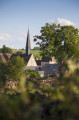
The village of Maisoncelles, described as a ‘street village’, has developed linearly along the road linking Bouloire to Tresson and Écorpain, running perpendicular to the Ruisseau de l’Étangsort. Although difficult to date precisely, the imposing Church of Notre-Dame, possibly dating back to the Romanesque period, is undoubtedly the oldest building in the village. You can, however, see typical rural features from theThird Republic, such as the public pump at the foot of the church. Heading towards the cemetery, you will see on the right the old communal washhouse, recently converted to welcome walkers, and further up, a former school recognisable by its two-storey structure and brick window frames.
Bird trail from Nuillé-le-Jalais
 4.43 mi
+151 ft
-174 ft
2h 10
Easy
Departure from Nuillé-le-Jalais (Sarthe)
4.43 mi
+151 ft
-174 ft
2h 10
Easy
Departure from Nuillé-le-Jalais (Sarthe)
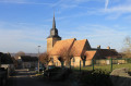
Nuillé-le-Jalais, first mentioned in the9th century , still has a small Romanesque church. Surprisingly, many of the local place-names refer to birds: La Pie qui Couette, La Grande Oiselerie and Le Chardonneret. The route’s signposting is a nod to this unique feature.
The starting point of the 24 Hours of Le Mans from Montfort-le-Gesnois
 5.15 mi
+230 ft
-230 ft
2h 35
Easy
Departure from Montfort-le-Gesnois (Sarthe)
5.15 mi
+230 ft
-230 ft
2h 35
Easy
Departure from Montfort-le-Gesnois (Sarthe)
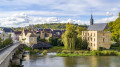
The present-day commune, formed by the merger of two former major market towns, stretches out parallel to the Huisne valley across uneven terrain. The old Pont de Gennes is at the lowest point (60 m), whilst the highest point (100 m) is at Montfort-le-Rotrou. The former is a crossroads village situated at the mouth of an old crossing point over the Huisne. The latter, situated on a strategic defensive site, is a linear settlement built under the protection of the castle. The two were joined by a gradual urban expansion in the 19th century. The walk takes you past the starting point of the first major motor race organised by the Automobile Club de France (ACF) in 1906, the forerunner of the 24 Hours of Le Mans.
The Maquis des Bois de la Croix in Connerré
 3.50 mi
+233 ft
-220 ft
1h 50
Easy
Departure from Connerré (Sarthe)
3.50 mi
+233 ft
-220 ft
1h 50
Easy
Departure from Connerré (Sarthe)
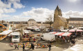
Situated in the Huisne valley, inhabited since prehistoric times, Connerré developed in the Middle Ages around a religious centre comprising the Church of Saint-Symphorien and a priory. The town, enclosed by a wall at the end of the 16th century, opened up at the end of the Ancien Régime thanks to the construction of bridges replacing fords and the expansion of transport links: the construction of the Paris–Nantes royal road around 1780, followed by the opening of a station on the Le Mans–Paris line in 1854. These developments fuelled the economic boom of the 19th century through fairs and markets and the growth of industry. The market town modernised and expanded gradually, then more rapidly from the 1970s onwards. Today, Connerré is an attractive small town, situated halfway between Le Mans and La Ferté-Bernard.
The Two Oaks of Luart Route
 4.15 mi
+69 ft
-69 ft
2h 00
Easy
Departure from Le Luart (Sarthe)
4.15 mi
+69 ft
-69 ft
2h 00
Easy
Departure from Le Luart (Sarthe)
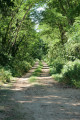
This rural village had a population of just over 1,000 in themid-19th century before seeing its population gradually decline due to rural depopulation until 1962, when it fell to 643 inhabitants. The closure of many small farms gradually freed up the least productive agricultural land for building. Thanks to a proactive policy by the local council and the presence of a construction company in the village, Le Luart experienced considerable suburban development, leading to a spectacular rise in its population, which reached 1,445 inhabitants in 2012. Since then, the population has tended to stabilise.
Palet de Gargantua Circuit
 5.19 mi
+79 ft
-72 ft
2h 25
Easy
Departure from Torcé-en-Vallée (Sarthe)
5.19 mi
+79 ft
-72 ft
2h 25
Easy
Departure from Torcé-en-Vallée (Sarthe)
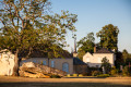
Known successively as Ecclesia de Torciaco, then Torcey and Notre Dame de Torcé, the former parish has been called Torcé-en-Vallée since 1926. The documents first mentioning it relate to the construction of the priory and the church. However, it is clear that Torcé’s history predates this, as evidenced by the megalith located at the western entrance to the village, known as the ‘Dolmen de Torcé’ or ‘Palet de Gargantua’. Human occupation may date back to the Middle Neolithic period.
The Chéronne Valley in Saint-Denis-des-Coudrais
 3.22 mi
+115 ft
-115 ft
1h 35
Easy
Departure from Saint-Denis-des-Coudrais (Sarthe)
3.22 mi
+115 ft
-115 ft
1h 35
Easy
Departure from Saint-Denis-des-Coudrais (Sarthe)
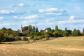
The former parish of Saint-Denis-des-Coudrais developed under the influence of the lords of Chéronne, who held the parish seigneury, until the Revolution. Under the Ancien Régime, the village fell under the jurisdiction of the Perche (right bank of the Chéronne) and the Maine (left bank of the Chéronne). Whilst the local economy was primarily agricultural, deposits of very high-quality white clay were exploited from an early stage to supply the nearby pottery workshops, notably those in Tuffé, Bonnétable and Prévelles. This activity ceased in themid-20th century with the closure of the last workshop in Prévelles in 1962. The place names bear witness to this history: Les Caves, la Fosse (now called Les Merisiers), and les Terres Blanches.
The Vow of Saint-Quentin
 5.43 mi
+266 ft
-269 ft
2h 45
Easy
Departure from Saint-Maixent (Sarthe)
5.43 mi
+266 ft
-269 ft
2h 45
Easy
Departure from Saint-Maixent (Sarthe)
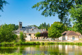
Bordering the Huisne valley to the west and the Vibraye forest to the east, Saint-Maixent is first mentioned in the13th century. Although the settlement is largely scattered (27 farms and 59 cottages in 1841), there are large hamlets such as Les Blousières, whose houses, clustered around a now-vanished pond, once housed up to 40 people, likely hemp workers. The village, crossed by the medieval road known as the “Chemin aux Bœufs” leading to Paris via Châteaudun, grew considerably in the 19th century thanks to the trade generated by this route.
A hidden architectural gem near Saint-Jean-des-Échelles
 3.46 mi
+118 ft
-118 ft
1h 40
Easy
Departure from Saint-Jean-des-Échelles (Sarthe)
3.46 mi
+118 ft
-118 ft
1h 40
Easy
Departure from Saint-Jean-des-Échelles (Sarthe)
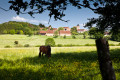
Situated on a small hill overlooking the surrounding area, the village, which takes its nickname from the Échelles farm, the former seat of the parish seigneury, offers a well-preserved architectural and landscape setting, dominated by the Church of Saint John the Baptist. Built inthe 12th century, this church underwent embellishment work in the16th century: what remains is the painted panelled vault, resting—an extremely rare feature—on posts placed against the walls, and above all the remains of an extraordinary altarpiece in carved and painted limestone, dated 1558. The décor was redesigned in the18th century with the installation of three new altarpieces.
Around Mont-Chauvel
 5.52 mi
+387 ft
-384 ft
2h 50
Easy
Departure from Courgenard (Sarthe)
5.52 mi
+387 ft
-384 ft
2h 50
Easy
Departure from Courgenard (Sarthe)
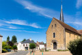
Situated on the eastern slopes of the Huisne, Courgenard, first mentioned at the end ofthe 9th century, was the seat in the Middle Ages of an important barony belonging to the chapter of canons of Le Mans Cathedral. The fine Romanesque architecture of Saint-Martin’s Church still bears witness today to the power of this barony, as does the remarkable16th-century decoration adorning the chancel. In the19th century, the village still lived off agriculture and the production of hemp cloth. Today, it forms part of the La Ferté-Bernard employment area.
Around Saint-Symphorien in Cherré-Au
 4.06 mi
+315 ft
-315 ft
2h 10
Easy
Departure from Cherreau (Sarthe)
4.06 mi
+315 ft
-315 ft
2h 10
Easy
Departure from Cherreau (Sarthe)
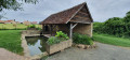
Cherré-Au is a new commune formed in 2019 by merging the communes of Cherré and Cherreau, located east of La Ferté-Bernard. The village of Cherreau has always been closely linked to the neighbouring town of La Ferté-Bernard. Indeed, in the Middle Ages, the lords of La Ferté took over the Abbey of La Pelice at the end ofthe 12th century. Then, in the14th century, the Domaine de la Plaisse was incorporated into that of La Ferté. More recently, as the town of La Ferté-Bernard expanded inthe 19th century, it encroached upon Cherreau, annexing the hamlets of Gué-Faux and La Fosse Fondue in 1889, which bordered the road to Paris.
In the heart of the Perche countryside from Avezé
 8.17 mi
+367 ft
-367 ft
4h 05
Moderate
Departure from Avezé (Sarthe) (Sarthe)
8.17 mi
+367 ft
-367 ft
4h 05
Moderate
Departure from Avezé (Sarthe) (Sarthe)
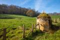
The village of Avezé developed in the Middle Ages to the north-east of the church, which was rebuilt inthe 16th century, at the same time as the priory that adjoined it, of which only extensive farm buildings remain. The main street is dominated by a large two-storey house known as the “Maison du prieur” (Prior’s House), dating from the 15th or 16th century, notable for its rear stair tower and its elegant façade that juts out over the current street.
Tuffé Abbey Circular Walk
 7.09 mi
+167 ft
-157 ft
3h 25
Moderate
Departure from Tuffé (Sarthe)
7.09 mi
+167 ft
-157 ft
3h 25
Moderate
Departure from Tuffé (Sarthe)
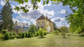
Tuffé-Val-de-la-Chéronne is a new commune formed in 2016 from the merger of the communes of Tuffé and Saint-Hilaire-le-Lierru. Inhabited since the Neolithic period, as evidenced by the Grandes Brières dolmen, Tuffé began to develop in the Early Middle Ages with the founding of an abbey around 650. From the Middle Ages to the Revolution, the monastery of Tuffé was also a large seigneurial estate bearing the title of barony; its power sparked emulation and, at times, rivalry with the neighbouring lay lords of Chéronne. At the end of the 19th century, the railway gave the village a new lease of life; it encouraged the establishment of an industrial estate on which the town’s current economic vitality still partly rests.
La Fosse aux Saneux in Sillé-le-Philippe
 9.40 mi
+256 ft
-246 ft
4h 35
Moderate
Departure from Sillé-le-Philippe (Sarthe)
9.40 mi
+256 ft
-246 ft
4h 35
Moderate
Departure from Sillé-le-Philippe (Sarthe)
The first mention of the parish under the name “Siliaco Philippi” dates back to the years 1145–1187. From the Middle Ages onwards, the parish seigneury was annexed to the Château de Passais, which itself fell under the barony of Touvoie, owned by the bishops of Le Mans, situated on the border between Savigné-L’Evêque and Saint-Corneille. Sillé-le-Philippe gave rise to the creation of a linear village; long remaining modest in size, it is now expanding due to its proximity to the Le Mans conurbation. This development also benefits the hamlet of Chanteloup (situated on the old royal road from Le Mans to Paris via Mortagne, now the RD 301), which once boasted several cafés and inns.
Stud farms and châteaux from Savigné-l'Évêque
 9.24 mi
+62 ft
-62 ft
4h 20
Moderate
Departure from Savigné-l'Évêque (Sarthe)
9.24 mi
+62 ft
-62 ft
4h 20
Moderate
Departure from Savigné-l'Évêque (Sarthe)
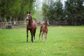
A region once densely populated along the ancient road from Le Mans to Évreux, and an important market town under the Ancien Régime, Savigné has long been favoured, due to its proximity to Le Mans, by the city’s notables, who have built or restored bourgeois houses and châteaux, sometimes on medieval seigneurial sites. Thus, as you follow the route, you will see Nuyet, dating from the late18th century, or, from the19th century, the châteaux of Le Rocher (now the town hall), Mortrie and Le Mesnil, where a major stud farm is located.
In the shade of the hedgerows towards Thorigny-sur-Dué
 7.30 mi
+203 ft
-213 ft
3h 30
Moderate
Departure from Thorigné-sur-Dué (Sarthe)
7.30 mi
+203 ft
-213 ft
3h 30
Moderate
Departure from Thorigné-sur-Dué (Sarthe)
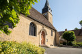
A few archaeological finds attest to human presence in Thorigné as far back as the Neolithic period. In Gallo-Roman times, a large agricultural estate (villa) is thought to have been the origin of a permanent settlement, which is better documented from the Middle Ages onwards. Despite the destruction of its medieval castle, which was replaced by a bourgeois house in the19th century, Thorigné stands out as a fairly large village offering a wide variety of civil architecture, spread out along the main axis linking the Dué valley to the church. Probably of Romanesque origin, the church was enlarged in the16th century and remodelled inthe 18th century . It houses interesting stained-glass windows and furnishings, such as the high altarpiece dating from 1669 and the18th-century side altarpieces.
The Pescheray Estate
 7.19 mi
+174 ft
-174 ft
3h 25
Moderate
Departure from Le Breil-sur-Mérize (Sarthe)
7.19 mi
+174 ft
-174 ft
3h 25
Moderate
Departure from Le Breil-sur-Mérize (Sarthe)
Le Breil and Nuillé are two villages of ancient origin. In the Middle Ages, Le Breil, or Breuil, was a seigneurial hunting ground. Nuillé, first mentioned in the9th century, still has a small Romanesque church.
The Sourice Valley
 6.31 mi
+203 ft
-190 ft
3h 05
Moderate
Departure from Surfonds (Sarthe)
6.31 mi
+203 ft
-190 ft
3h 05
Moderate
Departure from Surfonds (Sarthe)
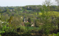
The parish underwent a re-demarcation in 1836: certain farms such as La Bardouillère and houses in the village were part of Volnay. Since then, the south-eastern boundary has been formed by the Ruisseau la Sourice. Under the Ancien Régime, the parish seigneury was annexed to the Château du Coudray, which you will see to the right of the hill as you head towards La Bardouillère. The village still has traditional houses near the church; it has gradually expanded towards the crossing point over the Sourice, where the roads from Surfonds to Bouloire and from Le Breil to Volnay used to meet, later transformed inthe 19th century into the main road from Tuffé to Le Grand-Lucé.
The angel musicians of Les Loges
 7.26 mi
+295 ft
-282 ft
3h 35
Moderate
Departure from Coudrecieux (Sarthe)
7.26 mi
+295 ft
-282 ft
3h 35
Moderate
Departure from Coudrecieux (Sarthe)
The present-day commune of Coudrecieux consists of the former parish of the same name, which was merged with that of Les Loges in 1808. Their place names reflect the wooded environment of these villages, which are still 50% forest today. Coudrecieux refers to the hazel wood known locally as ‘coudre’, and Les Loges to the light dwellings, made of branches and heather, temporarily occupied by charcoal burners and other forest workers. The Coudrecieux route will allow you to discover the rich architectural and landscape heritage of this commune. This is evidenced by the Manoir de la Cour, the Château des Loges, and the church of Les Loges (with its renowned stone bell tower dating from the year 1000)… These features are highlighted by information panels.
The Étangsort Valley towards Tresson
 8.68 mi
+348 ft
-351 ft
4h 20
Moderate
Departure from Tresson (Sarthe)
8.68 mi
+348 ft
-351 ft
4h 20
Moderate
Departure from Tresson (Sarthe)
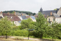
The origins of the settlement of Tresson are very ancient, as evidenced by a dolmen situated not far from Les Basses Poches. Furthermore, the territory of Tresson is crossed by the Via Turniacensis, near which a large agricultural estate is recorded in 572. This villa was donated by Bishop Domnole to Saint-Vincent Abbey, which established a priory in Tresson. This combination of factors led to the development of the present-day village in the Étangsort valley.
Between Tuffeau and Grès Roussard
 7.53 mi
+289 ft
-279 ft
3h 45
Moderate
Departure from Sainte-Osmane (Sarthe)
7.53 mi
+289 ft
-279 ft
3h 45
Moderate
Departure from Sainte-Osmane (Sarthe)
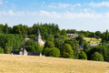
Val-d’Étangson is a new commune formed in 2019 from the merger of the communes of Évaillé and Sainte-Osmane. Dedicated to an Irish princess who became a hermit in Brittany in the7th century, the church, extensively remodelled around 1540, features a beautiful Renaissance porch with classical decorations. By undertaking the interior restoration of the building themselves, the residents have revived the tradition of the ‘fabrique’ – an assembly of parishioners responsible, under the Ancien Régime, for the building’s upkeep. In 1841, the local landscape was mainly characterised by small farmsteads, sometimes grouped into hamlets such as La Chauvière, and a few large estates, such as Rateau or a dairy farm.
Along the banks of the Tusson towards Val-d'Etangson
 7.85 mi
+308 ft
-315 ft
3h 55
Moderate
Departure from Évaillé (Sarthe)
7.85 mi
+308 ft
-315 ft
3h 55
Moderate
Departure from Évaillé (Sarthe)
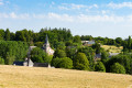
Val-d’Étangson is a new commune formed in 2019 from the merger of the communes of Évaillé and Sainte-Osmane. Possibly first mentioned as early as the9th century, the village on the banks of the Tusson consisted in 1829 of nothing more than the church, the18th-century presbytery with its courtyard and garden, and around fifteen houses. It expanded after 1840, no doubt linked to the opening of the road connecting the two sub-prefectures of La Flèche and Saint-Calais (now the D13).
La Redonne
 8.53 mi
+351 ft
-367 ft
4h 15
Moderate
Departure from La Chapelle-Huon (Sarthe)
8.53 mi
+351 ft
-367 ft
4h 15
Moderate
Departure from La Chapelle-Huon (Sarthe)
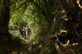
La Chapelle-Huon developed gradually from the Middle Ages onwards. Saint-André Church is a Romanesque building (11th–12th century) with a Renaissance seigneurial chapel added later. The current bell tower was built in 2000 as part of the building’s general restoration. On this occasion, contemporary stained-glass windows were added to enhance the interior. Saint-Gervais-de-Vic likely has very ancient origins. The place name ‘Vic’, from the Latin vicus, meaning village, may refer to the Gallo-Roman period. Iron slag and pottery shards, discovered during work on the railway line, are also evidence of an ancient presence. Admire the15th- and16th-century Manoir de la Béchuère, the Redonne stream and the beautiful wooded countryside.
A map and full description of the route are available in the Perche Sarthois Hiking Guide (50 routes). On sale at Perche Sarthois tourist offices for €10.
The Calaisienne Loop
 9.62 mi
+318 ft
-305 ft
4h 40
Moderate
Departure from Saint-Calais (Sarthe)
9.62 mi
+318 ft
-305 ft
4h 40
Moderate
Departure from Saint-Calais (Sarthe)
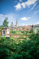
The evolution of Saint-Calais is evident in its town planning, which developed in the Middle Ages on either side of the Anille. On the right bank, the former abbey site founded inthe 6th century is still visible in the two tall gables of the current resource centre. During the Revolution, it gave way to another administrative centre with imposing buildings and the straight streets typical ofthe 19th century. On the left bank, on the hillside between the river and the castle founded inthe 11th century to rival the powerful abbey, you can easily make out the medieval quarter, which was built around the axis of the Grande Rue on an irregular and densely packed grid of plots.
In the eye of the Saint-Jean Fountain
 9.14 mi
+354 ft
-344 ft
4h 30
Moderate
Departure from Montaillé (Sarthe)
9.14 mi
+354 ft
-344 ft
4h 30
Moderate
Departure from Montaillé (Sarthe)
Montaillé has developed around two centres: the village centre, built up around the church, and La Brenaille, a cluster of hamlets and farms to the north of the village. The site of La Brenaille appears to have been inhabited since ancient times, whilst the village centre seems to have been settled during the Gallo-Roman period, as evidenced by the route of an ancient road between Le Mans and Orléans. ‘Montaillé’ likely derives from a contraction of the Latin ‘montem’, meaning mountain or high ground, and the name ‘Alhierus’, a Germanic name that may have referred to the landowner following the barbarian invasions ofthe 5th century. As the name suggests, the land is situated on high ground and is close to a stream, the Pibeau, and a spring, the Fontaine Saint Jean-Baptiste.
The Saint-Célerin circulars
 11.94 mi
+305 ft
-292 ft
5h 45
Moderate
Departure from Saint-Célerin (Sarthe)
11.94 mi
+305 ft
-292 ft
5h 45
Moderate
Departure from Saint-Célerin (Sarthe)
The earliest evidence of human settlement in Saint-Célerin is linked to the discovery of ancient coins, including a Gallic stater (1st or2nd century BC) and a Carolingian hoard dating from around 833, the year the locality of Caliniaco (known in French as Chahanay) was first mentioned.
The Woods of Roussigny
 11.28 mi
+758 ft
-751 ft
5h 50
Moderate
Departure from Saint-Ulphace (Sarthe)
11.28 mi
+758 ft
-751 ft
5h 50
Moderate
Departure from Saint-Ulphace (Sarthe)
Like the neighbouring village of Gréez, the medieval development of Saint-Ulphace is linked to the settlement, between the Braye and the Saint-Ulphace stream, of a hermit monk in the6th century. The Hermitage of Saint-Ulphace led to the clearing of the surrounding land and the settlement of Christianised populations, followed by the establishment of the parish, first mentioned in 802.
Route du père from Vibraye
 9.68 mi
+453 ft
-449 ft
4h 50
Moderate
Departure from Vibraye (Sarthe)
9.68 mi
+453 ft
-449 ft
4h 50
Moderate
Departure from Vibraye (Sarthe)
The village is characterised by the presence of the forest. This enabled its owner, the Marquis de Vibraye, to establish forges on the Braye river in Champrond in the early 17th century, where charcoal from the forest fuelled the furnaces producing pig iron and wrought iron until 1913. The trail partly follows the route taken by the convoys laden with heavy iron bars to the workshop in the hamlet of La Fenderie, on the pond of the same name. At La Bouverie, another vanished hamlet, eight houses provided accommodation for the forges’ carters, whilst charcoal burners and miners lived in makeshift huts. Now silent once more, the forest retains of this past activity only the network of paths. Part of it is now a Natura 2000 site.
Les Sapins des Pauvres
 11.37 mi
+302 ft
-289 ft
5h 30
Moderate
Departure from Saint-Mars-de-Locquenay (Sarthe)
11.37 mi
+302 ft
-289 ft
5h 30
Moderate
Departure from Saint-Mars-de-Locquenay (Sarthe)
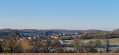
The name adopted at the time of the merger refers to the location of the two villages situated in the valley at the confluence of the Arche and Hune streams. The area has been inhabited since ancient times, as evidenced by the dolmen on the border with Tresson, dating from the Neolithic period, and the ancient road – the Via Turniacensis – linking Le Mans to Blois; passing through Volnay and Saint-Mars-de-Locquenay before heading towards the Loir Valley. This facilitated the development of large agricultural estates, explaining the presence of numerous fiefdoms in medieval times, of which few traces remain (Champion, Pois, Le Grand Yvay, Mèleve, Sargilet), with the exception of La Chesnaye, which incorporated most of them during the Modern Era (16th–18th centuries).
In the footsteps of the Crusaders, starting from Lombron
13.61 mi
+515 ft
-509 ft
6h 40
 Difficult
Departure from Lombron (Sarthe)
Difficult
Departure from Lombron (Sarthe)
Although local tradition places the first village at Bresteau, the Church of Saint-Martin, rebuilt by the monks of Saint-Vincent in the early 12th century, provides clear evidence of the antiquity of the village of Lombron. This beautiful church, open during the day, is well worth a visit both for the quality of its architecture (Romanesque choir and lantern tower, nave and chapels remodelled in the 14th and 15th centuries on their original foundations) and for its furnishings (16th-century statues including the Crucified Christ, the seigneurial bench of the Montmorency family, lords of Bresteau, terracotta bas-reliefs by Lebrun, circa 1760, 18th-century nave pews, etc.).
An unusual walk in Dollon
 14.36 mi
+715 ft
-689 ft
7h 15
Difficult
Departure from Dollon (Sarthe)
14.36 mi
+715 ft
-689 ft
7h 15
Difficult
Departure from Dollon (Sarthe)
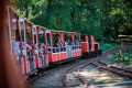
This route will allow you to discover the villages of Lavaré, Dollon and Semur-en-Vallon. These villages developed in the Middle Ages on land that was often sandy or stony, not particularly suitable for farming before modernisation. The villagers therefore found additional sources of income through textile crafts and the extraction of building materials. Situated away from major transport routes, these villages have retained their vitality despite the rural exodus that affected them following the decline of rural industries and traditional activities. Furthermore, these villages have managed to maintain a vibrant community life, fostering the development of unique events and venues such as the tourist train in Semur-en-Vallon and the Museum of Mechanical Music in Dollon.
Route of photography from Conflans-sur-Anille
 14.34 mi
+617 ft
-600 ft
7h 10
Difficult
Departure from Conflans-sur-Anille (Sarthe)
14.34 mi
+617 ft
-600 ft
7h 10
Difficult
Departure from Conflans-sur-Anille (Sarthe)
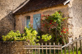
Situated on a small spur at the confluence of the Anille and Roulecrotte rivers, the village, first mentioned in the 13th century, retains several old houses, including the town hall, a former presbytery built in the 15th century. The church, rebuilt around 1780, features a beautiful collection of murals painted around 1860 using potassium silicate (a new technique for the time).
On the edge of the woods from Volnay
 13.34 mi
+502 ft
-492 ft
6h 35
Difficult
Departure from Volnay (Sarthe) (Sarthe)
13.34 mi
+502 ft
-492 ft
6h 35
Difficult
Departure from Volnay (Sarthe) (Sarthe)
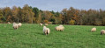
The name Val-de-la-Hune, adopted at the time of the merger, refers to the location of the two villages situated in the valley at the confluence of the Ruisseau de l’Arche and the Hune. The area has been inhabited since ancient times, as evidenced by the dolmen on the border with Tresson, dating from the Neolithic period, and the ancient road, the Via Turniacensis, linking Le Mans to Blois; passing through Volnay and Saint-Mars-de-Locquenay before heading towards the Loir Valley. This facilitated the development of large agricultural estates, explaining the presence of numerous fiefdoms in medieval times, of which few remains are left (Champion, Pois, Le Grand Yvay, Mélève, Sargilet), with the exception of La Chesnaye, which incorporated most of them during the Modern Era (16th–18th centuries).