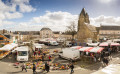
The Sourice Valley

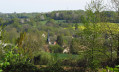
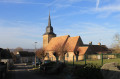
The parish underwent a re-demarcation in 1836: certain farms such as La Bardouillère and houses in the village were part of Volnay. Since then, the south-eastern boundary has been formed by the Ruisseau la Sourice. Under the Ancien Régime, the parish seigneury was annexed to the Château du Coudray, which you will see to the right of the hill as you head towards La Bardouillère. The village still has traditional houses near the church; it has gradually expanded towards the crossing point over the Sourice, where the roads from Surfonds to Bouloire and from Le Breil to Volnay used to meet, later transformed inthe 19th century into the main road from Tuffé to Le Grand-Lucé.

Details

97634879
Creation:
Last update:
Last review:
  • Walking
    Activity: Walking
  • ↔
    Distance: 6.31 mi
  • ◔
    Average duration: 3h 05 
  • ▲
    Difficulty: Moderate

  • ⚐
    Back to start: Yes
  • ↗
    Ascent: + 203 ft
  • ↘
    Descent: - 190 ft

  • ▲
    Highest point: 436 ft
  • ▼
    Lowest point: 285 ft
  • ⚐ Country: France
  • ⚐ City: Surfonds (72370)
  • ⚑
    Start/End: N 47.974758° / E 0.458366°
  • ❏
    IGN map(s): Ref. 1819SB
  • Hour-by-hour weather

Photos

Description of the walk

Car park at the community hall

(S/E) On leaving the multi-purpose hall car park, take the Route d’Ardenay on the left. Pass the cemetery and, 500 metres further on, take the path on the left. (You can continue straight on to take the longer route, an extra 4 kilometres.)

(1) At the crossroads, turn left, then continue straight on for 1.3 km.

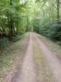
(2) Cross the D33, continue straight on along the Chemin de la Petite Chaussée until you reach a road.

(3) Follow it to the left (the Volnay route is to the right). Pass the Pré du Gué des Forges on your left and cross the Route de Bouloire. Follow the path uphill and pass the ruins of La Bardouillère (viewpoint).

(4) At the next junction, turn left towards the houses. Before the first house, in the bend, take the path along the hedge on the left and continue straight on until you reach the road (D33).

(5) Cross it and take the path opposite towards Le Buisson. At Le Buisson, turn right, leave the water tower on your left and continue.

(6) At Le Ruau, continue straight on, and at the three-way junction turn left, then at the next crossroads turn left again.

(7) After Maison Neuve, turn left and immediately turn left again before the tarmac road. Follow the path, pass Buisson again and, before the road, take another path on the right until you reach the D33.

(8) Follow it straight on to go down to the village. Take the path behind the church, on the right, then go straight on to the car park (S/E).

Waypoints

  1. S/E : mi 0 - alt. 312 ft - Multi-purpose hall
  2. 1 : mi 0.75 - alt. 285 ft - Crossroads
  3. 2 : mi 1.55 - alt. 315 ft - D33
  4. 3 : mi 2.1 - alt. 344 ft - Meadow at Gué des Forges
  5. 4 : mi 2.78 - alt. 423 ft - Crossroads
  6. 5 : mi 3.22 - alt. 407 ft - D33
  7. 6 : mi 3.86 - alt. 384 ft - Le Ruau
  8. 7 : mi 5.25 - alt. 420 ft - Fork in the road after Maison Neuve
  9. 8 : mi 6.04 - alt. 344 ft - Route
  10. S/E : mi 6.31 - alt. 312 ft - Multi-purpose hall

Notes

  • Yellow markings
  • 10% tarmac

Map and full route description available in the Perche Sarthois Hiking Guide (50 routes). On sale at Perche Sarthois tourist offices for €10.

Worth a visit

  • Church of Notre Dame de l’Assomption (12th–16th centuries).
  • Maison de maître de la Chaussée (late17th century).
  • The hamlet of Gué de Forge (traditional dwellings).

Other walks in the area

For more walks, use our search engine .

The GPS track and description are the property of this route's author. Please do not copy them without permission.