The Vow of Saint-Quentin

Bordering the Huisne valley to the west and the Vibraye forest to the east, Saint-Maixent is first mentioned in the13th century. Although the settlement is largely scattered (27 farms and 59 cottages in 1841), there are large hamlets such as Les Blousières, whose houses, clustered around a now-vanished pond, once housed up to 40 people, likely hemp workers. The village, crossed by the medieval road known as the “Chemin aux Bœufs” leading to Paris via Châteaudun, grew considerably in the 19th century thanks to the trade generated by this route.

Details

97214291
Creation:
Last update:
Last review:
  • Walking
    Activity: Walking
  • ↔
    Distance: 5.43 mi
  • ◔
    Average duration: 2h 45 
  • ▲
    Difficulty: Easy

  • ⚐
    Back to start: Yes
  • ↗
    Ascent: + 266 ft
  • ↘
    Descent: - 269 ft

  • ▲
    Highest point: 535 ft
  • ▼
    Lowest point: 328 ft

Photos

Description of the walk

Start from the car park at the Logis lake

(S/E) From the car park, turn left and cross the meadow. When you reach the road, turn right.

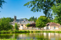
(1) Follow the first street on the left, Rue de la Duguerie (viewpoint over the church and the castle). You will arrive in the hamlet of Saint-Quentin (you can take the 5-kilometre alternative route by turning left).

(2) Otherwise, cross the hamlet of Saint-Quentin by keeping to the right. At the end of the straight stretch, leave the road and take the sandy path
sandy track that climbs straight up and leads to the water tower (you can go straight on to take a 1-kilometre detour).

(3) Alternatively, turn left. At La Boissière, go straight on. Cross the D29 with care to take the path towards Blanche Lande.

(4) Cross the road and turn right towards Le Grand Pavé (viewpoint over Lamnay). Turn left, then left again.

(5) Follow the road to the right. At the crossroads, turn left towards Carrefour Saint-Marc (you can turn right for a two-kilometre detour).

(6) To stay on the main route, continue straight ahead onto the Chemin des Blousières (viewpoint over Beauchamps Castle).

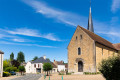
(7) At the end of the path, at a place called the Fork in the road, continue to the left. At the junction, keep right onto the street, then turn left towards the centre and, opposite the church, turn right again onto the D98bis for 50 m. Turn left to return to the starting point (S/E).

Waypoints

  1. S/E : mi 0 - alt. 348 ft - Car park at the Logis lake
  2. 1 : mi 0.35 - alt. 377 ft - Rue de la Duguerie
  3. 2 : mi 0.92 - alt. 443 ft - Saint-Quentin
  4. 3 : mi 1.31 - alt. 535 ft - Junction, water tower
  5. 4 : mi 2.18 - alt. 502 ft - Fork in the road towards La Blanche Lande
  6. 5 : mi 2.97 - alt. 469 ft - Route
  7. 6 : mi 4 - alt. 423 ft - Saint-Marc crossroads
  8. 7 : mi 4.8 - alt. 331 ft - End of the trail
  9. S/E : mi 5.43 - alt. 348 ft - Car park at the Logis lake

Notes

  • Yellow markings.
  • 27% tarmac.
  • Alternative routes: available on our website (Perche Sarthois).

Map and full route description available in the Perche Sarthois Hiking Guide (50 routes). On sale at Perche Sarthois tourist offices for €10.

Worth a visit

  • Church of Saint-Maixent.
  • Wash house.
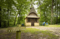
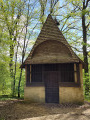
  • Saint-Quentin: tree of liberty, wash house and the chapel at the spring.

Other walks in the area

For more walks, use our search engine .

The GPS track and description are the property of this route's author. Please do not copy them without permission.