Country:
 City:
City:


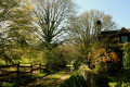
Start the walk at the information board located in the school car park.
(S/E) From the information board, take the road on the right towards Les Mésangeaux.
(1) There, take the dirt track opposite until you reach the next crossroads known as Le Chêne Lierru.
(2) Continue straight on towards Les Acacias. At the end of the path, turn right and then right again once you reach the road.
(3) At the end of the road, turn left. At the ‘Give Way’ sign, turn right. At the three-way junction, keep left.
(4) Take the dirt track on the left at Les Sablons. At the signpost, follow the sign for Sillé on the left. Cross the road carefully to take the dirt track opposite leading to La Fosse aux Saneux.
(5) At La Fosse aux Saneux (calvary), turn left until you reach Route de Touques.
(6) Turn right then left, cross the Ruisseau du Moulin aux Moines and, at a place called Préau, turn left towards Les Aulnays.
(7) After the Moulin aux Céramiques, take the dirt track on the left, cross two streams and arrive at a fork.
(8) Turn right, cross another stream, go through the courtyard of the Cohérie farm and continue to the D179.
(9) Follow it on the left until you reach Le Coq Hardi.
(10) Turn left and continue to the junction from the outward journey. Take the Chemin de la Philippoterie on the right.
(2) At the junction, take the tarmac road opposite.
(11) When you reach the cemetery, turn right, then take the first dirt track on the left. At the junction, turn left and, at the bottom of the track, take the path leading uphill to the right. At the top of this, turn right and head towards the D301.
(12) Before the road, take the dirt track on the left. Continue straight ahead before turning right and heading towards the D83.
(13) Turn right, then left. Pass the silo and continue straight on. At the junction, turn left and join the Route de la Chapelle.
(14) Follow it to the left, then turn right onto the D145c. After the bend, take the path on the left that runs alongside the stadium to return to the school car park (S/E).
 Tourism professional
 Easy
Easy 
 Visorando Member
 Association / Club / Walk leader
 Difficult