The Neolithic site at Gréez-sur-Roc

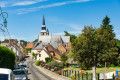
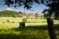
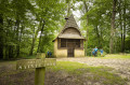
A route that allows you to explore this small village in the Perche region and its Neolithic site, situated on a rocky outcrop offering panoramic views of the hills.

Details

n°2926390
Creation:
Last update:
Last review:
  • Walking
    Activity: Walking
  • ↔
    Distance: 2.81 mi
  • ◔
    Average duration: 1h 25 
  • ▲
    Difficulty: Easy

  • ⚐
    Back to start: Yes
  • ↗
    Ascent: + 138 ft
  • ↘
    Descent: - 138 ft

  • ▲
    Highest point: 663 ft
  • ▼
    Lowest point: 489 ft

Photos

Description of the walk

(S/E) From the church car park, walk past the war memorial and turn left immediately; then, 100 metres on, at a junction, turn left onto the D14. Turn into the first street on the right, Rue du Nord, then left into Rue Laurent Boutroue. Continue along this street until you reach the picnic area.

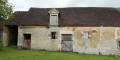
(1) Turn into the path and follow the hedge towards the Neolithic site. When you reach the remains of a dwelling and an information board, turn back and head to the right to return to the village. Turn left onto Grande Rue, then right onto Rue Neuve, which leads onto Rue du Grand Muret. Take this street on the left until you reach Rue du Bas Bourg.

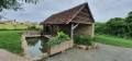
(2) Turn right onto this downhill street. Carry straight on past the wash house, and follow it to a four-way junction.

(3) Turn left onto a stony track which passes the petite Coudraie, then the Gué Bousseaux. The track crosses the stream and a picnic area before reaching a tarmac road, which you cross. Opposite, take a grassy path which climbs up to a fork in the road.

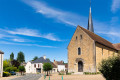
(4) Turn left and follow a lovely, sunken dirt track which leads back to the tarmac road you crossed earlier. Turn right and head back to the village. Once at the church, make your way back to the car park where you started (S/E).

Waypoints

  1. S/E : mi 0 - alt. 574 ft - Car park by the church
  2. 1 : mi 0.24 - alt. 564 ft - Picnic area
  3. 2 : mi 0.74 - alt. 551 ft - Rue du Bas Bourg
  4. 3 : mi 1.41 - alt. 564 ft - Chemin de la Petite Coudraie
  5. 4 : mi 2.06 - alt. 663 ft - Chemin de Saint-Ulphace
  6. S/E : mi 2.81 - alt. 574 ft - Car park by the church

Notes

Toilets on Place de la Mairie.
Picnic area at the entrance to the Neolithic site.

Worth a visit

Neolithic site.
Espace Jean Jousse: museum dedicated to the excavations at the Neolithic site.
Saint-Palmire Church (11th century).
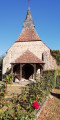
Washhouse and former Notre-Dame Chapel (private).

Reviews and comments

3.7 / 5
Based on 2 reviews

Reliability of the description
4.5 / 5
Ease of following the route
4 / 5
Route interest
2.5 / 5
marche en famille
marche en famille
• Edited:

Overall rating : 3 / 5

Date of your route : Feb 21, 2024
Reliability of the description : ★★★★☆ Good
Ease of following the route : ★★★★☆ Good
Route interest : ★☆☆☆☆ Very disappointing
Very busy route : No

The walk begins amongst the rather unidyllic 1960s-style houses and follows a small road for the most part: so it is by no means a family walk, as stated in the description, as it is dangerous for a family with children. I do not recommend it for families with children or pets.

Machine-translated

christopheprunauxcazer

Overall rating : 4.3 / 5

Date of your route : Jul 27, 2020
Reliability of the description : ★★★★★ Very good
Ease of following the route : ★★★★☆ Good
Route interest : ★★★★☆ Good
Very busy route : Yes

A short walk around this charming village in pleasant surroundings; good route description; very well-maintained path; a few viewpoints overlooking the village. Good.

Machine-translated

Other walks in the area

For more walks, use our search engine .

The GPS track and description are the property of this route's author. Please do not copy them without permission.