


 Country:

 City:
City:


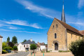
Start at the town hall car park.
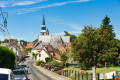
(S/E) From the town hall car park, take the small path next to the playground, then pass between the houses to reach the church. Take the road on the right towards Théligny (Rue de Saint-Fiacre). At the junction, continue straight on, passing the reservoir (viewpoint). You will come to a crossroads.
(1) Take the path on the left towards Pâtis des Croisettes. When you reach the house, head up into the woods on the right until you reach the junction. A 3.5 km alternative route is possible by continuing straight on.
(2) Otherwise, at the junction, take the path on the left. At the end of the path, follow the field on the left before turning right onto a path under the trees. Follow the path to the junction between the paths and take the path that climbs opposite before turning immediately right at the junction.
(3) Follow this path and pass the water tower.
(4) Once you reach the road, follow it to the right, keeping straight on, and after passing the pylon on your left, you’ll come back to the original junction.
(1) Take the path that climbs to the left towards Mont Chauvel (alternative route to the right). Continue to the right along the road.
(5) Take the first path on the right, which winds along the fields, then arrive at La Grande Mérie.
(6) Follow the tarmac track to the main road. At the stop sign, turn right onto the D7 to return to the starting point (S/E).
 Tourism professional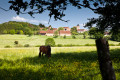

 Moderate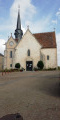
 Association / Club / Walk leader
 Difficult
