Around Cherreau

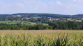
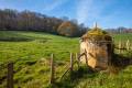
This walk offers beautiful views of La Ferté-Bernard and Cherreau.

Details

4073268
Creation:
Last update:
Last review:
  • Walking
    Activity: Walking
  • ↔
    Distance: 3.81 mi
  • ◔
    Average duration: 2h 00 
  • ▲
    Difficulty: Easy

  • ⚐
    Back to start: Yes
  • ↗
    Ascent: + 272 ft
  • ↘
    Descent: - 272 ft

  • ▲
    Highest point: 581 ft
  • ▼
    Lowest point: 299 ft

Photos

Description of the walk

Start: Cherreau town hall car park.

(S/E) Leave Cherreau via Rue de Cormes, on the right.

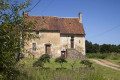
(1) On leaving Cherreau, turn right onto a dirt track which passes in front of Hardouin Farm and leads onto a small tarmac road.

(2) Follow the dirt track to the right (GR® 235), which joins a road; follow this to the right. It runs alongside the first houses of La Ferté-Bernard until it reaches the Route de Cherreau (D153).

(3) Cross the road and take the dirt track opposite; cross the Ruisseau de Saint-Symphorien and turn right. Continue until you reach a crossroads.
.
(4) Turn left and continue along the dirt track, which joins Rue de la Chevaudière, leading to Chemin du Cormier.

(5) Turn slightly right and, at the farm, carry on straight ahead along the sunken lane until you reach Route de la Pelice.

(6) Turn left and, 50 metres further on, immediately turn right onto a dirt track that climbs up to Route de la Sorie.

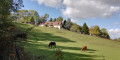
(7) Follow this road to the right, which offers a lovely view of Cherreau. Head down to Route de la Pelice, which you follow to the left until you reach Cherreau. Return to the town hall car park (S/E)

Waypoints

  1. S/E : mi 0 - alt. 394 ft - Town hall car park
  2. 1 : mi 0.2 - alt. 436 ft - Dirt track to the right
  3. 2 : mi 0.88 - alt. 423 ft - GR235 junction
  4. 3 : mi 1.56 - alt. 328 ft - Route de Cherreau (D153)
  5. 4 : mi 1.94 - alt. 325 ft - La Fosse Fondue
  6. 5 : mi 2.24 - alt. 400 ft - Chemin du Cormier
  7. 6 : mi 2.67 - alt. 466 ft - Route de la Pelice
  8. 7 : mi 3.11 - alt. 581 ft - Route de la Sorie
  9. S/E : mi 3.81 - alt. 387 ft - Town hall car park

Worth a visit

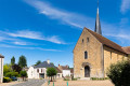
Saint-Symphorien Church.
Panorama of La Ferté-Bernard.
Panorama of Cherreau.

Always be cautious and plan ahead when you're outdoors. Visorando and the author of this route cannot be held responsible for any accidents occurring on this route.

The GR® and PR® markings are the intellectual property of the Fédération Française de Randonnée Pédestre.

Reviews and comments

4.3 / 5
Based on 2 reviews

Reliability of the description
5 / 5
Ease of following the route
4 / 5
Route interest
4 / 5
jo41
jo41

Overall rating : 4.5 / 5

Date of your route : Feb 12, 2023
Reliability of the description : Not used / Not applicable
Ease of following the route : ★★★★★ Very good
Route interest : ★★★★☆ Good
Very busy route : Yes

Hello, we didn’t follow the route description because we chose to do it ‘backwards’
We’re experienced walkers who are used to reading IGN maps, and we didn’t encounter any problems.
A lovely little walk with very little tarmac and pretty paths offering lovely views of La Ferté Bernard and Cherreau.
Kind regards, Jocleyne and Pierre

Machine-translated

Tessere
Tessere

Overall rating : 4 / 5

Date of your route : Oct 10, 2020
Reliability of the description : ★★★★★ Very good
Ease of following the route : ★★★☆☆ Average
Route interest : ★★★★☆ Good
Very busy route : Yes

Good evening, I’ve just completed the Cherreau walk
You’ve made a mistake – it doesn’t start on the outskirts of Cormes, as you wrote in point 1, but on the outskirts of Cherreau (please correct this). I’m going to do it again; I went as far as Cormes, but it was too late to retrace my steps
However, if I spot anything that needs changing, I’ll let you know
It’s true that we have a magnificent view of La Ferté-Bernard and Cherreau
Kind regards, Mrs Tessier

Machine-translated

Other walks in the area

For more walks, use our search engine .

The GPS track and description are the property of this route's author. Please do not copy them without permission.