Palet de Gargantua Circuit

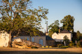
Known successively as Ecclesia de Torciaco, then Torcey and Notre Dame de Torcé, the former parish has been called Torcé-en-Vallée since 1926. The documents first mentioning it relate to the construction of the priory and the church. However, it is clear that Torcé’s history predates this, as evidenced by the megalith located at the western entrance to the village, known as the ‘Dolmen de Torcé’ or ‘Palet de Gargantua’. Human occupation may date back to the Middle Neolithic period.

Details

97211897
Creation:
Last update:
Last review:
  • Walking
    Activity: Walking
  • ↔
    Distance: 5.19 mi
  • ◔
    Average duration: 2h 25 
  • ▲
    Difficulty: Easy

  • ⚐
    Back to start: Yes
  • ↗
    Ascent: + 79 ft
  • ↘
    Descent: - 72 ft

  • ▲
    Highest point: 348 ft
  • ▼
    Lowest point: 243 ft

Photos

Description of the walk

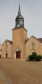
Start from the church square.

(S/E) Walk past the church and turn left onto Rue des Rosiers (D25), heading towards Lombron for 200 m before turning right to reach the park.

(1) Follow the footpath and, on leaving the park, take the path on the left.

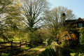
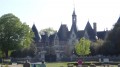
(2) After about 2 kilometres along the path (viewpoint over the Château des Aulnays and its mill), leave the path on your left and continue straight ahead. Then take the path on the right at the corner of the meadow.

(3) At the end of the path, you’ll reach the entrance to the hamlet of La Montabonnière. Turn right onto the D179 for 600 m to join the D301.

(4) Cross it carefully and take the path opposite, between the two fields. Cross another road and follow the path opposite before turning right at the end onto a road.

(5) Take the first path on the right at the corner of La Volerie and continue to the main road. Carefully cross the D301 again to reach the path opposite.

(6) In the woods, leave the path on your left and continue to the right to reach the main D180 road leading to the village.

(7) Turn left onto it, pass the dolmen and continue straight on along the D25 to the church (S/E).

Waypoints

  1. S/E : mi 0 - alt. 292 ft - Église Notre-Dame (Torcé-en-Vallée)
  2. 1 : mi 0.21 - alt. 276 ft - Park - Parence (rivière)
  3. 2 : mi 1.47 - alt. 243 ft - Trail
  4. 3 : mi 2.27 - alt. 269 ft - The hamlet of La Montabonnière. D179
  5. 4 : mi 2.64 - alt. 282 ft - D301
  6. 5 : mi 3.61 - alt. 305 ft - La Vollerie
  7. 6 : mi 4.39 - alt. 328 ft - La Lévrie, crossroads
  8. 7 : mi 4.8 - alt. 285 ft - Main road. D180 - Palet de Gargantua (Torcé-en-Vallée)
  9. S/E : mi 5.19 - alt. 292 ft - Église Notre-Dame (Torcé-en-Vallée)

Notes

  • 15% tarmac.
  • Yellow markings.

Map and full route description available in the Perche Sarthois Hiking Guide (50 routes). On sale at Perche Sarthois tourist information offices for €10.

Worth a visit

  • Notre-Dame Church.
  • Priory
  • Wash house
  • Château and mill at Les Aulnays (private).
  • “Palet de Gargantua” dolmen.
  • Cherruau Mill.

Other walks in the area

For more walks, use our search engine .

The GPS track and description are the property of this route's author. Please do not copy them without permission.