The angel musicians of Les Loges

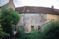
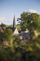
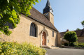
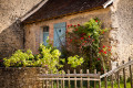
The present-day commune of Coudrecieux consists of the former parish of the same name, which was merged with that of Les Loges in 1808. Their place names reflect the wooded environment of these villages, which are still 50% forest today. Coudrecieux refers to the hazel wood known locally as ‘coudre’, and Les Loges to the light dwellings, made of branches and heather, temporarily occupied by charcoal burners and other forest workers. The Coudrecieux route will allow you to discover the rich architectural and landscape heritage of this commune. This is evidenced by the Manoir de la Cour, the Château des Loges, and the church of Les Loges (with its renowned stone bell tower dating from the year 1000)… These features are highlighted by information panels.

Details

97636118
Creation:
Last update:
Last review:
  • Walking
    Activity: Walking
  • ↔
    Distance: 7.26 mi
  • ◔
    Average duration: 3h 35 
  • ▲
    Difficulty: Moderate

  • ⚐
    Back to start: Yes
  • ↗
    Ascent: + 295 ft
  • ↘
    Descent: - 282 ft

  • ▲
    Highest point: 577 ft
  • ▼
    Lowest point: 371 ft
  • ⚐ Country: France
  • ⚐ City: Coudrecieux (72440)
  • ⚑
    Start/End: N 47.993189° / E 0.628408°
  • ❏
    IGN map(s): Ref. 1819SB
  • Hour-by-hour weather

Photos

Description of the walk

(S/E) From the car park, head left of the start sign along Rue des Ruelles, then turn right at the first junction towards La Boudinerie.

(1) After 400 metres, take a path on the left, then follow the first path on the left.

(2) You’ll reach the D74; cross it (take care) by first turning right then left towards Les Méaberts. Continue along the road to the left and cross the hamlet to follow the grassy path that turns right. As you leave the woods, follow the hedgerow to a small road and follow it to the left.

(3) Then turn right before entering the Bois de la Boissière via the central path.

(4) Before reaching the edge of the woods, take a sharp left. At the end, first turn right then left and continue along the Chemin du Champ de la Moisson. You can take a detour towards Les Loges by taking the path on the left. Otherwise, continue straight on to the dairy farm.

(5) Then head down towards the Ruisseau des Loges. Caution: wet ground for 100 metres if the stream is in flood. Cross the two footbridges and continue to Chanteloup, then turn left.

(6) Follow the road then turn right onto the grassy path at the edge of the woods.

(7) Cross the D72 (take care) and continue straight ahead. Turn left onto the Chemin du Meslier. At the crossroads, head up to the right to visit the Château des Loges (private).

(8) Then turn back. On the way down, continue straight ahead to the road and turn right into Les Loges. Go round the church on the right.

(9) Head up to the right onto the Chemin des Fosses to leave the village. You’ll reach a small road; take it, heading up to the left. After the farm, turn right at the junction.

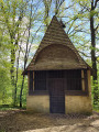
(10) Follow the road to the right for 1.3 km (take care). At the wayside shrine, turn left twice to go down the sunken path and then onto the road opposite. At the bottom, enter Coudrecieux and head right to Saint-Sigismond Church.

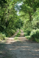
(11) Turn left below the church, then head down Rue de la Cour opposite to pass in front of the Manoir de la Cour. On leaving the village, turn left onto Rue de la Mairie. Cross at the pedestrian crossing to take the side lane following the route of the old railway line (Mamers-Saint-Calais) to the Ancienne Gare car park (S/E).

Waypoints

  1. S/E : mi 0 - alt. 456 ft - Place de l'Ancienne Gare, Coudrecieux
  2. 1 : mi 0.34 - alt. 430 ft - Trail
  3. 2 : mi 0.82 - alt. 397 ft - D74
  4. 3 : mi 1.55 - alt. 433 ft - Crossroads towards the woods
  5. 4 : mi 1.85 - alt. 404 ft - Pin
  6. 5 : mi 2.49 - alt. 377 ft - Dairy farm
  7. 6 : mi 2.82 - alt. 384 ft - Chanteloup
  8. 7 : mi 3.45 - alt. 420 ft - D72
  9. 8 : mi 4.22 - alt. 522 ft - Château des Loges
  10. 9 : mi 4.85 - alt. 404 ft - Chemin des Fosses
  11. 10 : mi 5.42 - alt. 459 ft - Crossroads
  12. 11 : mi 6.8 - alt. 482 ft - St Sigismund’s Church
  13. S/E : mi 7.26 - alt. 456 ft - Place de l'Ancienne Gare, Coudrecieux

Notes

  • Yellow markings featuring angels.
  • 34% tarmac.
  • Connects with the Bouloire route.

Map and full route description available in the Perche Sarthois Hiking Guide (50 routes). On sale at Perche Sarthois tourist offices for €10.

Worth a visit

  • Castle (private) and Loges church,11th–15th and16th centuries (listed building).
  • Four chestnut trees near ‘La Grande Fosse’.
  • Saint-Sigismond Church (12th–19th centuries).
  • Foyer Sainte-Élisabeth (late19th century).
  • Manoir de la Cour (16th century) (listed historic monument, private).

Other walks in the area

For more walks, use our search engine .

The GPS track and description are the property of this route's author. Please do not copy them without permission.