


Refine your search for walks in Villepail
Villepail walks


 The Notre-Dame de Bon-Secours Chapel Trail from Villepail
 Tourist office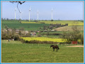
 8.89 mi
 +584 ft
 -584 ft
 4h 35
4h 35
 Moderate
 Departure from Villepail (Mayenne)
The Chapelle de Bon Secours trail consists of no less than 89 per cent dirt tracks. It follows the ancient Roman road that linked Gué Saint-Léonard to Mayenne. A short detour is recommended to the Tourbière des Égoutelles, a regional nature reserve. This two-hectare site, situated in a former Armorican sandstone quarry, is home to over a hundred rare plant species, including carnivorous plants such as sundews, round-leaved sundews and the Portuguese butterwort.
Bellevue Trail starting from Crennes-sur-Fraubée
 5.92 mi
+597 ft
-587 ft
3h 15
5.92 mi
+597 ft
-587 ft
3h 15
 Easy
Departure from Crennes-sur-Fraubée (Mayenne)
Easy
Departure from Crennes-sur-Fraubée (Mayenne)
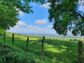
The village of Crennes-sur-Fraubée, situated on the southern slope of the Corniche de Pail, offers magnificent views of the surrounding countryside. This route, 88% of which is on dirt tracks, is one of the most beautiful walks in the Mont des Avaloirs area.
The “Circular Tour of Herbages” from Saint-Aignan-de-Couptrain
7.39 mi
+243 ft
-243 ft
3h 35
Moderate
Departure from Saint-Aignan-de-Couptrain (Mayenne)
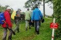
The village of Saint-Aignan-de-Couptrain is the starting point for two circular walks that will take you through unspoilt hedgerow countryside. Both routes follow dirt tracks for 90 per cent of the way. Here is one of these circular walks.
Circular Route of the Streams from Saint-Aignan-de-Couptrain
 6.85 mi
+285 ft
-292 ft
3h 25
Moderate
Departure from Saint-Aignan-de-Couptrain (Mayenne)
6.85 mi
+285 ft
-292 ft
3h 25
Moderate
Departure from Saint-Aignan-de-Couptrain (Mayenne)
The village of Saint-Aignan-de-Couptrain is the starting point for two circular walks that will take you through unspoilt hedgerow countryside. Both routes follow dirt tracks for 90 per cent of the way. Here is one of these circular walks. The second: The ‘Boucle des herbages’ circular walk from Saint-Aignan-de-Couptrain
Averton circular route via Merdereau
5.79 mi
+587 ft
-600 ft
3h 10
Easy
Departure from Averton (Mayenne)
A very pretty trail in the Merdereau valley, through the forest and over the hills of Averton, with some panoramic views and good dirt tracks covering 73% of the route.
Discovery trail around the Mont des Avaloirs Reserve in Pré-en-Pail
 5.18 mi
+604 ft
-614 ft
2h 55
Moderate
Departure from Pré-en-Pail (Mayenne)
5.18 mi
+604 ft
-614 ft
2h 55
Moderate
Departure from Pré-en-Pail (Mayenne)
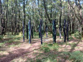
Immerse yourself in nature at the heart of the Mont des Avaloirs Regional Nature Reserve!
At 416 metres high, Mont des Avaloirs, the highest point in western France, takes you to the summit of the Armorican Massif. You are in the heart of the Normandy-Maine Regional Nature Park and Geopark. On the poor soil of Armorican sandstone, the dominant habitats are heathland and deciduous woodland. In this gentle, low-lying landscape, you’ll also find meadows, peat bogs and scree slopes. Current inventories list over 2,000 species, several of which are heritage species such as the European Nightjar and the Montagu’s Harrier.
Numerous routes set off from this particularly well-preserved natural environment, dotted with magnificent sites.
This trail offers a total immersion in nature, with themed stops to trace the thread of history, discover the wildlife and flora, and understand how the landscapes have evolved. Along the way, new views unfold!
Circular route starting from the Mont des Avaloirs viewpoint
 4.54 mi
+479 ft
-479 ft
2h 30
Easy
Departure from Pré-en-Pail (Mayenne)
4.54 mi
+479 ft
-479 ft
2h 30
Easy
Departure from Pré-en-Pail (Mayenne)
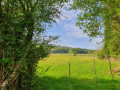
A hike starting from the iconic Mont des Avaloirs viewpoint, offering a beautiful route through the Multonne forest. Before or after the hike, be sure to climb the 108 steps of the building for an exceptional 360° view and, as you ascend, discover the brightly coloured street art by Seb Toussaint, a Franco-British graffiti artist.
Route of the Mont des Avaloirs Community of Communes.
Mont du Saule Trail
 9.08 mi
+850 ft
-850 ft
4h 55
Moderate
Departure from Le Ribay (Mayenne)
9.08 mi
+850 ft
-850 ft
4h 55
Moderate
Departure from Le Ribay (Mayenne)
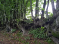
A very lovely walk in the Buttes d’Hardanges, a Sensitive Natural Area, between the villages of Ribay and Hardanges.
This former military zone is now a true haven of peace and offers a vast array of natural meadows, wet heathland, dry heathland, peat bogs and valley floors.
The Avaloirs viewpoint from the Champfrémont chapel
 Visorando Member
 8.37 mi
+843 ft
-833 ft
4h 35
Moderate
Departure from Champfrémont (Mayenne)
8.37 mi
+843 ft
-833 ft
4h 35
Moderate
Departure from Champfrémont (Mayenne)
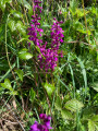
The goal of this hike, which can be done as a circular or round trip, is none other than the highest point in western France, at... 416 metres above sea level. From the viewpoint that has been built there, you can enjoy a 360° panorama and, on a very clear day, you can see the silhouette of Mont Saint-Michel, about a hundred kilometres away.
The Montaigu Ferryman
 4.97 mi
+285 ft
-295 ft
2h 30
Moderate
Departure from Saint-Léonard-des-Bois (Sarthe)
4.97 mi
+285 ft
-295 ft
2h 30
Moderate
Departure from Saint-Léonard-des-Bois (Sarthe)
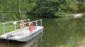
In the heart of the Alpes Mancelles, discover this hike in an exceptional natural setting: the Canyon des Toyères. Between Sarthe and Mayenne, discover landscapes where nature reigns supreme.
The meandering Sarthe
 9.94 mi
+1,148 ft
-1,158 ft
5h 35
9.94 mi
+1,148 ft
-1,158 ft
5h 35
 Difficult
Departure from Saint-Léonard-des-Bois (Sarthe)
Difficult
Departure from Saint-Léonard-des-Bois (Sarthe)
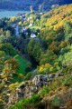
The meandering Sarthe route takes you through the Alpes Mancelles from Saint-Léonard-des-Bois via Saint-Céneri-le-Gérei, listed as one of the most beautiful villages in France.
Circular route from Saint-Léonard-des-Bois to Saint-Céneri-le-Gérei
 9.86 mi
+1,257 ft
-1,253 ft
5h 40
Moderate
Departure from Saint-Léonard-des-Bois (Sarthe)
9.86 mi
+1,257 ft
-1,253 ft
5h 40
Moderate
Departure from Saint-Léonard-des-Bois (Sarthe)
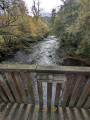
This hilly route between Saint-Léonard-des-Bois and Saint-Céneri-le-Gérei will introduce you to these two typical towns in the Alpes Mancelles, as well as unique landscapes and places.
Le Haut Fourché
 1.97 mi
+364 ft
-364 ft
1h 15
Easy
Departure from Saint-Léonard-des-Bois (Sarthe)
1.97 mi
+364 ft
-364 ft
1h 15
Easy
Departure from Saint-Léonard-des-Bois (Sarthe)
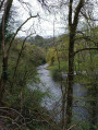
This short route, in the heart of the Alpes Mancelles, takes you along a challenging but unspoilt path to one of the finest viewpoints over the Sarthe Valley and the village of Saint-Léonard-des-Bois, nestled at the foot of the Plateau de Narbonne.
Misère Valley and Narbonne Plateau Route
 3.56 mi
+423 ft
-404 ft
2h 00
Easy
Departure from Saint-Léonard-des-Bois (Sarthe)
3.56 mi
+423 ft
-404 ft
2h 00
Easy
Departure from Saint-Léonard-des-Bois (Sarthe)
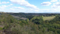
From the banks of the Sarthe to the animal park on the Narbonne Plateau, this route offers all the charm of a mountain hike. Its steep paths, scree slopes, the small stream winding its way through the valley, the panoramic views... The Misère Valley, Haut-Fourché, Manoir de l'Linthe and the village of Saint-Léonard-des-Bois confirm this impression.
A visit to the church and two typical houses rounds off this route, 98% of which is on dirt tracks.
The Croix à Coquilles and the viaduct over the Vaudelle
 4.71 mi
+374 ft
-374 ft
2h 30
Easy
Departure from Saint-Georges-le-Gaultier (Sarthe)
4.71 mi
+374 ft
-374 ft
2h 30
Easy
Departure from Saint-Georges-le-Gaultier (Sarthe)
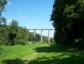
This route will allow you to discover the commune of Saint-Georges-le-Gaultier, located in the canton of Fresnay-sur-Sarthe in the heart of the Alpes Mancelles. You will discover nature and heritage: church, viaduct, archaic crosses, etc.
Tour of the Castles of Lassay-les-Châteaux
 3.61 mi
+135 ft
-135 ft
1h 45
Easy
Departure from Lassay-les-Châteaux (Mayenne)
3.61 mi
+135 ft
-135 ft
1h 45
Easy
Departure from Lassay-les-Châteaux (Mayenne)
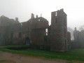
In the northern Mayenne countryside, Lassay-les-Châteaux is a small town that is well worth a visit. As you walk along the surrounding paths, a few signposts invite you to follow in the footsteps of Lancelot through meadows, forests and the remains of three castles. An easy walk on well-maintained paths and a few country roads.
The Aron route starting from Bais
 11.04 mi
+764 ft
-778 ft
5h 45
Moderate
Departure from Bais (Mayenne) (Mayenne)
11.04 mi
+764 ft
-778 ft
5h 45
Moderate
Departure from Bais (Mayenne) (Mayenne)
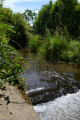
Come and explore the sunken paths of Bais, which will take you up to the ridges of Mont Rochard.Nearby, don’t miss a visit to Montesson Castle.This route is signposted No. 37 on yellow directional signs.
The Lancelot du Lac Trail in the Lassay region
 3.32 mi
+148 ft
-167 ft
1h 40
Easy
Departure from Lassay-les-Châteaux (Mayenne)
3.32 mi
+148 ft
-167 ft
1h 40
Easy
Departure from Lassay-les-Châteaux (Mayenne)
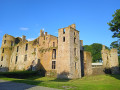
A superb circular walk starting from the ‘Petite Cité de Caractère’ of Lassay-les-Châteaux, voted France’s third favourite village in 2023. 94 per cent dirt tracks and some wonderful heritage sites to discover along the way: Lassay Castle, Bois Thibault Castle and the ruins of Bois Frou.An interpretative trail based on the legend of Lancelot du Lac enhances this route with several stops featuring information panels on themes from Arthurian legend. The Château de Bois Thibault, open during the tourist season (weekends and public holidays only), features a magnificent round table and a comic strip depicting the legend of the famous knight Lancelot.
Stream Trail in Lassay-les-Châteaux
 5.28 mi
+318 ft
-318 ft
2h 40
Moderate
Departure from Lassay-les-Châteaux (Mayenne)
5.28 mi
+318 ft
-318 ft
2h 40
Moderate
Departure from Lassay-les-Châteaux (Mayenne)
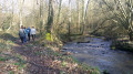
This is undoubtedly one of the most beautiful walks in the Lassay-les-Châteaux area. Lots of sunken paths, some woodland and a stream.
La Vaudelle route in Izé
 5.82 mi
+358 ft
-348 ft
3h 00
Easy
Departure from Izé (Mayenne)
5.82 mi
+358 ft
-348 ft
3h 00
Easy
Departure from Izé (Mayenne)
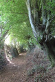
This route will take you through the hills of the Coëvrons and allow you to discover the beauty of the sunken paths in our region.
Route du Bois d’Izé
 5.80 mi
+269 ft
-249 ft
2h 55
Moderate
Departure from Izé (Mayenne)
5.80 mi
+269 ft
-249 ft
2h 55
Moderate
Departure from Izé (Mayenne)
Come and explore the sunken paths of Izé and the surrounding area on this 8.6 km circular walk. This walk is signposted with yellow directional signs marked “No. 36 – Route du Bois d’Izé”.
You can combine this route with route no. 35: “Circuit de la Vaudelle”.
Hambers circular
 9.19 mi
+820 ft
-814 ft
4h 55
Moderate
Departure from Hambers (Mayenne)
9.19 mi
+820 ft
-814 ft
4h 55
Moderate
Departure from Hambers (Mayenne)
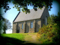
This 15 km route will take you through the magnificent sunken lanes of Hambers.
It is ideal for all nature lovers: on foot, by bike, or even on horseback!
This route is marked "No. 24" on the yellow directional signs.
On the Hambers ridges
 11.77 mi
+610 ft
-584 ft
5h 55
Moderate
Departure from Hambers (Mayenne)
11.77 mi
+610 ft
-584 ft
5h 55
Moderate
Departure from Hambers (Mayenne)
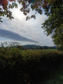
This route will take you along pretty sunken paths and up into the hills. It is signposted with yellow directional signs: No. 38 – on the Crêtes d’Hambers. You can combine this route with No. 24 – the Hambers circular route.
Around the village of Sougé-le-Ganelon
6.59 mi
+305 ft
-308 ft
3h 20
Moderate
Departure from Sougé-le-Ganelon (Sarthe)
A circular route through the village of Sougé-le-Ganelon, where the Hutchinson factory is located.
Circular walk from the Chapelle du Chêne to Saint-Martin-de-Connée
 10.01 mi
+846 ft
-846 ft
5h 20
Moderate
Departure from Saint-Martin-de-Connée (Mayenne)
10.01 mi
+846 ft
-846 ft
5h 20
Moderate
Departure from Saint-Martin-de-Connée (Mayenne)
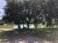
Gain some height on this beautiful heritage walk.
Hills and the Orthe Valley starting from Saint-Pierre-sur-Orthe
 12.37 mi
+1,188 ft
-1,194 ft
6h 45
Difficult
Departure from Saint-Pierre-sur-Orthe (Mayenne)
12.37 mi
+1,188 ft
-1,194 ft
6h 45
Difficult
Departure from Saint-Pierre-sur-Orthe (Mayenne)
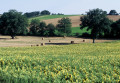
A lovely walk with a succession of paths, sometimes through the forest and sometimes along sunken lanes. You will also follow a section of theGR®365.
This walk is signposted with yellow directional signs marked “No. 41 – Collines et vallée d’Orthe”
Around Fresnay-sur-Sarthe
 11.86 mi
+709 ft
-709 ft
6h 05
Moderate
Departure from Douillet (Sarthe)
11.86 mi
+709 ft
-709 ft
6h 05
Moderate
Departure from Douillet (Sarthe)
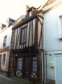
The Sarthe Valley and a visit to Fresnay-sur-Sarthe.
Between town and country in Bagnoles-de-l'Orne
 3.91 mi
+131 ft
-144 ft
1h 55
Easy
Departure from Bagnoles-de-l'Orne (Orne)
3.91 mi
+131 ft
-144 ft
1h 55
Easy
Departure from Bagnoles-de-l'Orne (Orne)
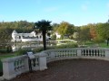
A beautiful walk that runs alongside the Village du Cheval and then enters the forest via a path offering beautiful views of the surrounding countryside. It then crosses the Saint-Ortaire priory and returns to the centre of Bagnoles-de-l'Orne, passing by the lake and the casino on the way back to the car park.
Path through the forest and around the Grand Pond in Sillé-le-Guillaume.
 4.88 mi
+33 ft
-33 ft
2h 15
Easy
Departure from Sillé-le-Guillaume (Sarthe)
4.88 mi
+33 ft
-33 ft
2h 15
Easy
Departure from Sillé-le-Guillaume (Sarthe)
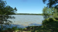
Short family hike, forest with its discovery trail, tour of the Grand Pond, the Étang Neuf, the Étang des Molières and perhaps enjoy the activities offered by the information point.
Woods and chapels in Jublains
 5.41 mi
+157 ft
-164 ft
2h 40
Easy
Departure from Jublains (Mayenne)
5.41 mi
+157 ft
-164 ft
2h 40
Easy
Departure from Jublains (Mayenne)
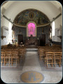
A walk starting from Jublains to explore the sunken paths to the north-east of the town. Please note that in winter the paths are particularly wet. The very pretty Doucé Chapel is well worth a visit in the charming hamlet of the same name.
Please note: the path is particularly wet in winter.
Heritage and History in Jublains
3.12 mi
+98 ft
-105 ft
1h 30
Easy
Departure from Jublains (Mayenne)
Starting from the centre of Jublains, this walk will allow you to discover the Gallo-Roman remains of the town as well as the Chapel of Doucé.
Route of castles and ponds in Jublains
 6.65 mi
+135 ft
-144 ft
3h 10
Moderate
Departure from Jublains (Mayenne)
6.65 mi
+135 ft
-144 ft
3h 10
Moderate
Departure from Jublains (Mayenne)
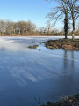
A walk allowing you to discover all the Gallo-Roman remains in the town of Jublains, as well as a beautiful natural heritage site with the Étang de Neuvillette, its flora and fauna.
From Saint-Christophe-du-Jambet to Lake Sillé-le-Guillaume
 24.55 mi
+1,581 ft
-1,575 ft
2 days
Moderate
Departure from Sillé-le-Guillaume (Sarthe)
24.55 mi
+1,581 ft
-1,575 ft
2 days
Moderate
Departure from Sillé-le-Guillaume (Sarthe)
A 40km circular route over 2 days, to discover (or rediscover) the countryside of northern Sarthe and the Sillé-le-Guillaume national forest.
From Lake Sillé-le-Guillaume to Saint-Christophe-du-Jambet
11.16 mi
+459 ft
-712 ft
5h 30
Moderate
Departure from Sillé-le-Guillaume (Sarthe)
A walk to discover (or rediscover) the countryside of northern Sarthe and the Sillé-le-Guillaume national forest.
On the side of Mont Rochard
 7.30 mi
+837 ft
-807 ft
4h 05
Moderate
Departure from Sainte-Gemmes-le-Robert (Mayenne)
7.30 mi
+837 ft
-807 ft
4h 05
Moderate
Departure from Sainte-Gemmes-le-Robert (Mayenne)
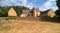
This route, which has little elevation gain, is an opportunity to discover typical villages and hamlets with rich granite architecture. This route is marked "No. 22" on the yellow directional signs.
Route de Pierre Fontaine
 5.00 mi
+682 ft
-669 ft
2h 55
Easy
Departure from Sainte-Gemmes-le-Robert (Mayenne)
5.00 mi
+682 ft
-669 ft
2h 55
Easy
Departure from Sainte-Gemmes-le-Robert (Mayenne)
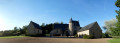
From Sainte-Gemmes-le-Robert, you can take a leisurely stroll along the slopes of Mont Rochard and enjoy the views of the lush green countryside. Along the way, you’ll discover the former manor house of Pierre Fontaine and some charming villages.
This route is signposted “No. 23” on the yellow directional signs.
The three ponds in the Sillé Forest
5.93 mi
+295 ft
-289 ft
3h 00
Easy
Departure from Sillé-le-Guillaume (Sarthe)
Sillé-le-Guillaume, a Petite Cité de Caractère® located 35 km north-west of Le Mans, is a former stronghold of the Haut-Maine region on the border between Normandy and Brittany. It developed around its castle and collegiate church. It became famous in the20th century for its ‘Coco Plage’ leisure and swimming centre. This walk will allow you to explore the Sillé State Forest and its lakes. Extend your outing with a visit to the town and its castle.
Étiveau Route
 10.74 mi
+449 ft
-449 ft
5h 20
Moderate
Departure from Mézangers (Mayenne)
10.74 mi
+449 ft
-449 ft
5h 20
Moderate
Departure from Mézangers (Mayenne)
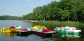
How about setting off on a walk from a peaceful pond, heading towards ancient hamlets? Here, nature shows you its best side, and you’ll discover magnificent views.
This 17 km route is suitable for walkers, horse riders and mountain bikers and is signposted “No. 21” on the yellow directional signs.