Le Haut Fourché

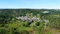
This short route, in the heart of the Alpes Mancelles, takes you along a challenging but unspoilt path to one of the finest viewpoints over the Sarthe Valley and the village of Saint-Léonard-des-Bois, nestled at the foot of the Plateau de Narbonne.

Details

3312686
Creation:
Last update:
Last review:
  • Walking
    Activity: Walking
  • ↔
    Distance: 1.97 mi
  • ◔
    Average duration: 1h 15 
  • ▲
    Difficulty: Easy

  • ⚐
    Back to start: Yes
  • ↗
    Ascent: + 364 ft
  • ↘
    Descent: - 364 ft

  • ▲
    Highest point: 679 ft
  • ▼
    Lowest point: 312 ft

Photos

Description of the walk

(S/E) On leaving the car park, cross the road and take the path leading uphill to the left of the chapel.

(1) Ignore the path on the left – which will be the return route – and carry on straight ahead. As you climb this steep, rugged slope, an information board on the left explains the geological history of the site.

Just before the buildings at La Joussière, on the left, the mighty branches of an old chestnut tree catch the eye. Continue along the path to the ridge, then follow the top of the cliff to the left until you reach the first bench.

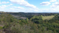
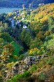
(2) Continue along the ridge, where several clearings in the foliage offer panoramic views of the Sarthe Valley, the village of Saint-Léonard-des-Bois and, above it, the Butte de Narbonne.

(3) At the second bench, leave the wide Haut Fourché path, which continues to the right, and begin the descent along a (barely visible) path leading straight from the bench until you reach a road, which you follow to the left for about 280 m.

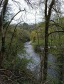
(4) At the crossroads, take the Chemin des Îles straight ahead. Walk down to the picturesque setting of Le Chapelet, then return to the crossroads. Turn right and follow the road down towards the river.

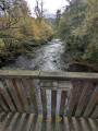
On the left, just before the bridge over the Sarthe, a flight of steps leading down takes you to the path running along the base of the cliff on the river’s left bank. At the end, the path leaves the riverbank, climbs back up and rejoins the path you followed at the start, just below the information sign.

(1) Turn right onto the path leading down to the chapel where you started. Cross the road to reach the car park entrance opposite (S/E).

Waypoints

  1. S/E : mi 0 - alt. 315 ft - Car park by the - Sarthe (rivière)
  2. 1 : mi 0.1 - alt. 354 ft - Junction of the circular loop
  3. 2 : mi 0.65 - alt. 676 ft - Viewpoint
  4. 3 : mi 0.77 - alt. 663 ft - Start of the descent path
  5. 4 : mi 1.2 - alt. 358 ft - Chemin des Îles
  6. S/E : mi 1.97 - alt. 315 ft - Car park on the banks of the Sarthe

Notes

Hiking boots recommended.

Worth a visit

Information board on the geological history of the Alpes Mancelles.
Châtaigner after the ‘1 ’.
Panoramic views of the village and the Butte de Narbonne (ancient oppidum).
Le Chapelet.
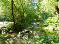
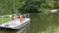
You can cross the stream without getting your feet wet (at low water) by hopping from stone to stone.

Reviews and comments

4.7 / 5
Based on 2 reviews

Reliability of the description
4.5 / 5
Ease of following the route
4.5 / 5
Route interest
5 / 5
bionat
bionat

Overall rating : 5 / 5

Date of your route : Apr 04, 2026
Reliability of the description : ★★★★★ Very good
Ease of following the route : ★★★★★ Very good
Route interest : ★★★★★ Very good
Very busy route : No

Although short (3 km), this route is very interesting and varied;
A first, “mountainous” section with a 110-metre climb,
followed by a peaceful stretch along the banks of the Sarthe.

Machine-translated

boucolijafbon
boucolijafbon

Thank you for your feedback.
Kind regards.

Machine-translated

User 19545243

Overall rating : 4.3 / 5

Date of your route : Jun 09, 2025
Reliability of the description : ★★★★☆ Good
Ease of following the route : ★★★★☆ Good
Route interest : ★★★★★ Very good
Very busy route : Yes

At first, it climbs and climbs...
At the highest point, there are lovely views of the village of St Léonard des Bois.
The path becomes more rugged along the river.
My walking sticks served me well.

Machine-translated

MarionB44980
MarionB44980

Thank you for your feedback

Machine-translated

boucolijafbon
boucolijafbon

This route is classified as easy as it does not present any danger or insurmountable difficulty for the average walker.
I do not recommend it for young children unless they are properly supervised by one adult per child.

Machine-translated

MarionB44980
MarionB44980

Hello,
This walk is rated ‘easy’, but the gradient is described as ‘strenuous’ and it involves walking along a cliff edge… My question is: with two young children, is this walk suitable, please?
Thank you in advance for your reply

Machine-translated

Other walks in the area

For more walks, use our search engine .

The GPS track and description are the property of this route's author. Please do not copy them without permission.