Around Fresnay-sur-Sarthe

The Sarthe Valley and a visit to Fresnay-sur-Sarthe.

Details

46793
Creation:
Last update:
Last review:
  • Walking
    Activity: Walking
  • ↔
    Distance: 11.86 mi
  • ◔
    Average duration: 6h 05 
  • ▲
    Difficulty: Moderate

  • ⚐
    Back to start: Yes
  • ↗
    Ascent: + 709 ft
  • ↘
    Descent: - 709 ft

  • ▲
    Highest point: 472 ft
  • ▼
    Lowest point: 236 ft
  • ⚐ Country: France
  • ⚐ City: Douillet (72590|72130)
  • ⚑
    Start/End: N 48.272582° / W 0.044922°
  • ❏
    IGN map(s): Ref. 1617SB, 1717SB
  • Hour-by-hour weather

Photos

Description of the walk

Car park at the church in Douillet-le-Joli.

(S/E) Walk through the village of Douillet. Cross the River Orthe.

(1) Opposite, take the D120, which joins theGR®36A, and follow it towards Fresnay-sur-Sarthe to reach the D310.

(2) Follow it to the left and, after Le Fourneau, turn onto a circular path that returns to the D310, which you then follow to the right again.

(3) At a place called Fort Écu, leave the departmental road and continue along theGR® to Avenue Victor Hugo in Fresnay-sur-Sarthe. Follow it to the right.

(4) It is best to cross the Sarthe via the footbridge on the right-hand side of the bridge (the bridge is closed to pedestrians).
Walk up Rue des Tanneries, then Rue de la Basse-Court and Rue de la Panneterie.

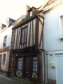
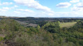
(5) Place de Bassu provides access to the ramparts park (beautiful view over the Sarthe valley) and the fortress (ruined castle). Head towards the church via Rue du Lion (a pretty little lane), then Grande Rue and finally Rue de l’Église.

(6) Head to the north of the town via Rue Gambetta, Rue de la Beslière and Rue de Bailleul. Walk along the banks of the Sarthe (Rue du Clos de Paris, Rue de Bourgneuf).

(7) Follow theGR®36Ato the Départementale 15

(8) . Please note that theGR® is often marked only with mountain bike signposts.

(9) Follow the D15 (leaving theGR®36A) until you reach the junction where you turn left towards La Pataudière.

(10) After passing through La Pataudière, take the first road on the left towards La Robinière.

(11) After passing through La Robinière, take the D173 on the left towards Douillet-Le-Joli.

(12) Cross the River Sarthe near Moré.

(1) In Douillet-Le-Joli, turn right and head up towards the church, the end point of the walk (S/E) .

Waypoints

  1. S/E : mi 0 - alt. 377 ft - Car park at Douillet-le-Joli church. Towards the - Orthe (rivière) - Affluent de la Sarthe
  2. 1 : mi 0.26 - alt. 292 ft - Junction of the circular loop
  3. 2 : mi 2.78 - alt. 305 ft - D310
  4. 3 : mi 3.43 - alt. 331 ft - Fort Écu
  5. 4 : mi 4.26 - alt. 243 ft - Footbridge over the - Sarthe (rivière)
  6. 5 : mi 4.46 - alt. 312 ft - Place de Bassu
  7. 6 : mi 4.59 - alt. 312 ft - Notre-Dame Church - Eglise Notre Dame
  8. 7 : mi 4.85 - alt. 259 ft - Bank of the Sarthe
  9. 8 : mi 5.34 - alt. 249 ft - Mountain bike trail
  10. 9 : mi 6.95 - alt. 282 ft - Turn left onto the D15
  11. 10 : mi 7.71 - alt. 302 ft - La Pateaudière
  12. 11 : mi 9.32 - alt. 394 ft - D173 after La Robinière
  13. 12 : mi 10.25 - alt. 276 ft - Crossing the River Sarthe
  14. S/E : mi 11.85 - alt. 377 ft - Car park at Douillet-le-Joli church

Notes

Take care when crossing roads!

Always be cautious and plan ahead when you're outdoors. Visorando and the author of this route cannot be held responsible for any accidents occurring on this route.

The GR® and PR® markings are the intellectual property of the Fédération Française de Randonnée Pédestre.

Reviews and comments

4.7 / 5
Based on 2 reviews

Reliability of the description
5 / 5
Ease of following the route
5 / 5
Route interest
4 / 5
Breton Exilé
Breton Exilé

Overall rating : 4.3 / 5

Date of your route : Aug 22, 2021
Reliability of the description : ★★★★★ Very good
Ease of following the route : ★★★★★ Very good
Route interest : ★★★☆☆ Average
Very busy route : No

We enjoyed our visit to Fresnay-sur-Sarthe, which offers a lovely view. However, we were disappointed by the fact that the route was mostly tarmac, with a few sections on fairly busy roads.

Machine-translated

mariehugerfouqueray
mariehugerfouqueray

Overall rating : 5 / 5

Date of your route : Oct 23, 2019
Reliability of the description : ★★★★★ Very good
Ease of following the route : ★★★★★ Very good
Route interest : ★★★★★ Very good

A lovely walk around Fresnay-sur-Sarthe.
We did this walk in autumn, at a time of year when the crops and harvests in the fields had finished. As a result, the landscape was rather drab, even though the autumn colours weren’t yet particularly vibrant at that point. We’d recommend doing this walk in spring or even early summer, when nature is reawakening and flourishing.
It’s a fairly long route with no difficulties, offering a good mix of stony or grassy paths and gravel or tarmac tracks. The sections on road are short and few in number.
On the way back, don’t forget to take the vineyard hillside path as you approach Fresnay. You’ll discover a magnificent panoramic view of the town and the meandering Sarthe River, and you’ll learn a bit about local history.
Finally, take a leisurely stroll and explore the medieval part of the town.

Machine-translated

Other walks in the area

For more walks, use our search engine .

The GPS track and description are the property of this route's author. Please do not copy them without permission.