Country:
 City:
City:


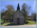
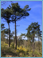
The walk starts at Villepail church (car park and toilets nearby).
(S/E) Head towards Crennes-sur-Fraubée, going round a lake on the right, until you reach a crossroads.
(1) Follow the D240, then, at the Fork in the road, take a small path on the left through the woodland. After a steep climb, the route joins a ridge path (an ancient Roman road).
(2) Take a hairpin bend to the left towards the Signal de Pail, a registered summit marked by an IGN granite boundary stone (356 m). Reach a crossroads.
(3) Continue straight on towards the north-east to the Croix de Chézy.
(4) The path then descends to the foot of the Corniche and joins the D218. First turn left then right here and take the path towards the Notre-Dame de Bon-Secours Chapel. A short detour to the left will allow you to see this chapel.
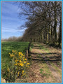
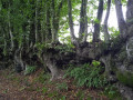
(5) The route continues along a shady, damp path beside the Corniche de Pail for about 1 km.
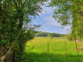
(6) Turn left onto more open farm tracks. Continue along the track to the next crossroads near the hamlet of Froc.
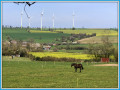
(7) Take the track on the left until you reach the Route des Éoliennes.
(8) Here, turn right, then immediately left onto the first dirt track. Pass in front of Les Loges.
(9) Cross the D536 with care, then turn left to walk south along the Monnerie. Continue straight on along this dirt track to Le Mesnil.
(10) At Le Mesnil, turn left, then left again 100 metres further on towards Les Landes.
(11) After passing it, leave the road and take the first track on the right. Follow it to a junction and turn left.
(12) When you reach a road, turn right, then left.
(13) A few metres further on, turn left. The route ends with a pretty sunken lane and a final hill which suddenly opens out onto the village and the church at Villepail (S/E).


 Tourist office
 Easy
Easy 
 Visorando Member