Woods and chapels in Jublains

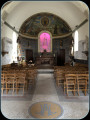
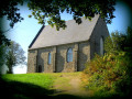
A walk starting from Jublains to explore the sunken paths to the north-east of the town. Please note that in winter the paths are particularly wet. The very pretty Doucé Chapel is well worth a visit in the charming hamlet of the same name.
Please note: the path is particularly wet in winter.

Details

46408477
Creation:
Last update:
Last review:
  • Walking
    Activity: Walking
  • ↔
    Distance: 5.41 mi
  • ◔
    Average duration: 2h 40 
  • ▲
    Difficulty: Easy

  • ⚐
    Back to start: Yes
  • ↗
    Ascent: + 157 ft
  • ↘
    Descent: - 164 ft

  • ▲
    Highest point: 554 ft
  • ▼
    Lowest point: 410 ft
  • ⚐ Country: France
  • ⚐ City: Jublains (53160)
  • ⚑
    Start/End: N 48.256226° / W 0.494752°
  • ❏
    IGN map(s): Ref. 1517SB, 1518SB
  • Hour-by-hour weather

Photos

Description of the walk

Parking is available opposite the church next to the town hall. Start: Place de la Mairie, Jublains.

(S/E) Turn into Impasse Romaine to the right of the starting sign. At the end of the cul-de-sac, turn right towards the residential area, then turn left towards the sports facilities. After the last house on the right, turn and follow the path, then turn left at the junction. Continue straight on until you reach the ponds.

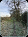
(1) Take the path between the two ponds, then head diagonally left towards the road. When you reach the district road, turn right, then turn right again onto the second path. Follow this sunken lane for a long distance until you reach the D160.

(2) Carry straight on at the Bois de la Guesnerie junction to reach the hamlet known as La Renardière further on. Turn right to join the D129. Continue carefully to the left, then take the first road on the right towards the hamlet of La Fauchetière. Before you reach the houses, turn right along a field. A little further on, turn right again and continue to the hamlet known as La Charpenterie des Landes.

(3) Turn left, then, when you reach the departmental road, turn right. Carry on for about a hundred metres, then take the path on the left. Further on, this path splits in two: keep slightly to the right. After the hamlet of La Vieille Mare, turn left and carry on to the D129.

(4) If you wish, cross the road carefully and take a few minutes to explore the chapel at Doucé before rejoining the route. Otherwise, continue to the left along a cycle path as far as Jublains. The cycle path will take you back to the starting point, 1.3 km further on (S/E).

Waypoints

  1. S/E : mi 0 - alt. 505 ft - Jublains Town Hall
  2. 1 : mi 0.59 - alt. 456 ft - Bodies of water
  3. 2 : mi 1.84 - alt. 518 ft - D160, “La Guesnerie” crossroads
  4. 3 : mi 3.3 - alt. 466 ft - Charpenterie des Landes
  5. 4 : mi 4.65 - alt. 482 ft - Doucé, D129
  6. S/E : mi 5.41 - alt. 505 ft - Jublains Town Hall

Notes

Dirt tracks: 60 per cent.
Circular route: yes.
Signposting: Yellow PR°°®°°.

Worth a visit

Always be cautious and plan ahead when you're outdoors. Visorando and the author of this route cannot be held responsible for any accidents occurring on this route.

The GR® and PR® markings are the intellectual property of the Fédération Française de Randonnée Pédestre.

Reviews and comments

4.1 / 5
Based on 3 reviews

Reliability of the description
4 / 5
Ease of following the route
4.3 / 5
Route interest
4 / 5
DenisGJ
DenisGJ

Overall rating : 3.3 / 5

Date of your route : Oct 01, 2025
Reliability of the description : ★★★☆☆ Average
Ease of following the route : ★★★★☆ Good
Route interest : ★★★☆☆ Average
Very busy route : No

Unnecessarily complicated and uninteresting start with a somewhat vague description. Before reaching La Fauchetière, there is another "path on the right along a field" which should be mentioned in the description. Even after several days of dry weather, the path between La Charpenterie des Landes and La Vieille Mare (part of the GR trail!) is muddy because it has been completely ruined by tractors and is therefore not very pleasant. Otherwise, it is a very peaceful and relaxing route.

Machine-translated

BMary
BMary

Overall rating : 4 / 5

Date of your route : Jan 04, 2025
Reliability of the description : ★★★★☆ Good
Ease of following the route : ★★★★☆ Good
Route interest : ★★★★☆ Good
Very busy route : Yes

A variety of paths – through the countryside, the forest and along country lanes – make for an enjoyable walk and offer a range of scenery. Beautiful views of Mont Rochard and the surrounding area. Due to the wet weather at this time of year, only the final dirt track (the last third of the walk) is difficult to navigate as it is completely flooded and rutted. Even with wellies on, you find yourself searching for a way through and getting stuck – it’s a bit like a bog. Without wellies, it’s virtually impossible!
The DOUCE Chapel is an absolute must-see – superbly restored, with a very beautiful interior.

Machine-translated

Alfred53
Alfred53

Overall rating : 5 / 5

Date of your route : Apr 22, 2024
Reliability of the description : ★★★★★ Very good
Ease of following the route : ★★★★★ Very good
Route interest : ★★★★★ Very good
Very busy route : No

One slight drawback at this point: after 6 km, just as you come off the Chemin de La Charpenterie des Landes, you cross the road to the right and, 100 metres further on, take a path on the left; however, this path is impassable as there are deep ruts filled with water and, in places, the whole path is covered in water. We tried to push on anyway, which earned us a proper soaking – we were wet right up to our ankles – but it gave us a good laugh. Otherwise, it’s an easy walk.

Machine-translated

Other walks in the area

For more walks, use our search engine .

The GPS track and description are the property of this route's author. Please do not copy them without permission.