Discovery trail around the Mont des Avaloirs Reserve in Pré-en-Pail

Immerse yourself in nature at the heart of the Mont des Avaloirs Regional Nature Reserve!
At 416 metres high, Mont des Avaloirs, the highest point in western France, takes you to the summit of the Armorican Massif. You are in the heart of the Normandy-Maine Regional Nature Park and Geopark. On the poor soil of Armorican sandstone, the dominant habitats are heathland and deciduous woodland. In this gentle, low-lying landscape, you’ll also find meadows, peat bogs and scree slopes. Current inventories list over 2,000 species, several of which are heritage species such as the European Nightjar and the Montagu’s Harrier.
Numerous routes set off from this particularly well-preserved natural environment, dotted with magnificent sites.
This trail offers a total immersion in nature, with themed stops to trace the thread of history, discover the wildlife and flora, and understand how the landscapes have evolved. Along the way, new views unfold!

Details

66330143
Creation:
Last update:
Last review:
  • Walking
    Activity: Walking
  • ↔
    Distance: 5.18 mi
  • ◔
    Average duration: 2h 55 
  • ▲
    Difficulty: Moderate

  • ⚐
    Back to start: Yes
  • ↗
    Ascent: + 604 ft
  • ↘
    Descent: - 614 ft

  • ▲
    Highest point: 1,368 ft
  • ▼
    Lowest point: 968 ft

Photos

Description of the walk

Start from the Mont des Avaloirs viewpoint car park.

(S/E) Park in the car park at the belvedere and head towards this tall, very contemporary-looking building. Climb the 108 steps that take you to the top. From the dome, a 360° panorama unfolds, an ideal viewpoint with a landscape guide. Make your way back down, taking in the vibrant murals adorning the building’s interior walls – the work of Caen-based street artist Seb Toussaint. With your back to the belvedere, head towards the junction you arrived at.

(1) Turn right onto the local road and follow it to the crossroads.

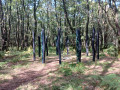
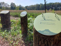
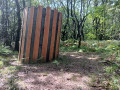
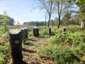
(2) Turn right onto the forest track. Walk gently downhill and , as you go, admire the artworks depicting the forest, coal mining and wildlife by artists Benoit Delomez and Léo Besnier. You’ll reach a small tarmac road and the Carrefour de Souprat.

(3) Take the path on the right and, immediately afterwards, you will reach another crossroads.

(4) Turn right towards the Pierre au Loup site and go round the rock formation on the right, then return to the path and follow it to the next crossroads.

(5) At the Carrefour de la Pierre au Loup, turn right towards the Carrefour du Busard Saint-Martin.

(6) Turn left and head down a lovely sunken path leading to the edge of the woods. Along the way, you’ll see the Souprat scree slope with an observation post, then the remains of the old natural fences created using the traditional skill of hedge-laying. Continue to the La Timberdière crossroads.

(7) Follow the path on the left along the edge of the forest to a narrow pass.

(8) Continue to a former crushing and transfer station for materials from the Bel-Air Quarries to Les Wagons. This transport to the old SNCF railway line, converted into a greenway since 2020, was carried out using conveyor belts and wagons.

(9) Turn right for a return trip to a viewpoint. Then return to the crossroads and turn right. Continue along the edge of the woods to the Bas-Sousprat crossroads.

(10) Once you reach the Bas-Sousprat crossroads, you can continue straight on for a return trip to the large Bel-Air Quarry, where you can explore the extensive quarry face.

(11) Then return to the previous junction.

(10) Turn right and continue straight on until you reach the crossroads after the mast.

(3) Head straight ahead and return to the car park at the starting point (S/E).

Waypoints

  1. S/E : mi 0 - alt. 1,368 ft - Start: car park at the viewpoint of the - Le Mont des Avaloirs
  2. 1 : mi 0.1 - alt. 1,345 ft - Common junction for outbound and return routes
  3. 2 : mi 0.22 - alt. 1,352 ft - Common junction for outbound and return routes
  4. 3 : mi 0.93 - alt. 1,283 ft - Crossroads of the circular loop. Souprat
  5. 4 : mi 0.96 - alt. 1,276 ft - La Pierre au Loup crossroads
  6. 5 : mi 1.14 - alt. 1,257 ft - La Pierre au Loup crossroads, altitude 378 m
  7. 6 : mi 1.46 - alt. 1,109 ft - Busard St-Martin crossroads – altitude 348 m
  8. 7 : mi 1.88 - alt. 988 ft - La Timberdière crossroads – alt. 296 m
  9. 8 : mi 2.28 - alt. 1,060 ft - Goulet - the Little Rocky Valley
  10. 9 : mi 2.35 - alt. 1,050 ft - Crushing plant. Return to the viewpoint
  11. 10 : mi 2.69 - alt. 978 ft - T-junction (turn-around point) at the quarries. Bas-Souprat – altitude 297 m
  12. 11 : mi 3.05 - alt. 1,076 ft - Bel-Air Quarries
  13. S/E : mi 5.18 - alt. 1,368 ft - Car park at the viewpoint - Le Mont des Avaloirs

Notes

Route map available to download free of charge.

At the start: car park, bike racks, picnic tables, public toilets and drinking water point.

Follow the directional signage, arrows and markers on a green background indicating "Tour de la Réserve Mont des Avaloirs".

Please note: for conservation reasons, certain paths are closed to motorised vehicles all year round or at certain times: from1 October to 31 March and on Sundays, all year round from 1pm to midnight.

Worth a visit

- Mont des Avaloirs (S/E).

Reviews and comments

4.7 / 5
Based on 6 reviews

Reliability of the description
4.8 / 5
Ease of following the route
4.7 / 5
Route interest
4.7 / 5
OT Mont des Avaloirs

Hello, thank you very much for your feedback.

Machine-translated

pillowlava
pillowlava

Overall rating : 5 / 5

Date of your route : May 04, 2026
Reliability of the description : ★★★★★ Very good
Ease of following the route : ★★★★★ Very good
Route interest : ★★★★★ Very good
Very busy route : No

A brilliant walk, with plenty of information boards, points of interest and artworks. It’s great fun for young and old alike!
However, allow plenty of time if you want to make the most of it. Plenty of benches and picnic spots. The route is well signposted and easy to follow.
Thank you very much!

Machine-translated

OT Mont des Avaloirs

Hello, thank you for your feedback.

Machine-translated

Almc
Almc

Overall rating : 3.7 / 5

Date of your route : Apr 14, 2026
Reliability of the description : ★★★★☆ Good
Ease of following the route : ★★★★☆ Good
Route interest : ★★★☆☆ Average
Very busy route : Yes

The route is a bit too overgrown; there aren't many views considering the altitude;

Machine-translated

Mister61
Mister61

Overall rating : 5 / 5

Date of your route : Sep 24, 2025
Reliability of the description : ★★★★★ Very good
Ease of following the route : ★★★★★ Very good
Route interest : ★★★★★ Very good
Very busy route : Yes

A very beautiful hike to do all the way to the end. Lots to see.

Machine-translated

User 19551372

Overall rating : 5 / 5

Date of your route : Aug 07, 2025
Reliability of the description : ★★★★★ Very good
Ease of following the route : ★★★★★ Very good
Route interest : ★★★★★ Very good
Very busy route : Yes

A beautiful, easy route, well laid out by the Normandy Maine Regional Nature Park with information about birds and sites (crushing, quarrying, etc.) and enhanced by artwork related to nature.

Machine-translated

OT Mont des Avaloirs

Hello Morgane,
Thank you very much for your very positive feedback! We are delighted that you enjoyed this lovely walk so much. In the heart of the forest, the artwork and information boards about the flora, fauna and landscape are indeed designed to enhance the experience, particularly for children — we are pleased that this contributed to the success of your outing.
Regarding the lack of signposting at Bas Souprat, you are absolutely right: this issue was recently brought to our attention and work is planned to resolve it. Thank you again for your feedback and we look forward to seeing you again on other trails in the Mont des Avaloirs.
Kind regards, Dolorès

Machine-translated

MorganeS
MorganeS

Overall rating : 4.7 / 5

Date of your route : May 01, 2025
Reliability of the description : ★★★★★ Very good
Ease of following the route : ★★★★☆ Good
Route interest : ★★★★★ Very good
Very busy route : No

A superb, shaded walk along the edge of the Pail Forest. The scenery is as varied as it is beautiful. The artworks on display in the forest, along with the information boards about the flora, fauna and landscape, are a real bonus, especially when you’re with children. Don’t hesitate to take the short detour that leads up to the quarry.
However, there is a sign missing at a place called Le Bas Souprat. By re-reading the route details on the information sheet, you can still find your way around.

Machine-translated

veronique61
veronique61

Overall rating : 5 / 5

Date of your route : Jan 20, 2025
Reliability of the description : ★★★★★ Very good
Ease of following the route : ★★★★★ Very good
Route interest : ★★★★★ Very good
Very busy route : Yes

A pleasant and easy walk, very well signposted, with a few little surprises along the way

Machine-translated

Other walks in the area

For more walks, use our search engine .

The GPS track and description are the property of this route's author. Please do not copy them without permission.