The “Circular Tour of Herbages” from Saint-Aignan-de-Couptrain

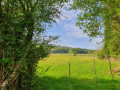
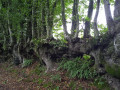
The village of Saint-Aignan-de-Couptrain is the starting point for two circular walks that will take you through unspoilt hedgerow countryside. Both routes follow dirt tracks for 90 per cent of the way. Here is one of these circular walks.

Details

20352507
Creation:
Last update:
Last review:
  • Walking
    Activity: Walking
  • ↔
    Distance: 7.39 mi
  • ◔
    Average duration: 3h 35 
  • ▲
    Difficulty: Moderate

  • ⚐
    Back to start: Yes
  • ↗
    Ascent: + 243 ft
  • ↘
    Descent: - 243 ft

  • ▲
    Highest point: 617 ft
  • ▼
    Lowest point: 456 ft

Description of the walk

Follow the yellow PR® markings.

Park in the main square in Saint-Aignan-de-Couptrain.

(S/E) Take the D3 towards Javron-les-Chapelles, then, at the wayside cross, follow the road to the right for about a hundred metres.

(1) At La Ratterie, turn right and continue along the road opposite until you reach the hamlet known as Le Désert.

(2) Take the track on the right and turn left onto the D3, continuing for about 150 metres.

(3) Turn right after La Bitouzière, then, further on, turn left towards Lamboux. Turn right, cross the greenway, then turn left twice to go round Belle-Fontaine on the right. You’ll come out onto the D3 again.

(4) This time, follow the D3 to the left, then turn onto the greenway, straight to the right. At the junction, turn left and go round Coulfrut on the left.

(5) Cross the village track opposite and continue along the path leading to Montiège.

(6) At the wayside shrine, take the path on the left, then pass Les Bruyères.

(7) Cross the road, then take the path on the left to La Monnerie.

(8) After La Monnerie, turn left, then head towards La Haute Chabossière.

(9) Follow the track which turns right towards La Basse Chabossière and joins a local road (C101).

(10) Turn left onto this road and continue towards La Ratterie.

(1) Follow the route back the way you came to reach the main square in Saint-Aignan-de-Couptrain (S/E).


Waypoints

  1. S/E : mi 0 - alt. 577 ft - Main square in Saint-Aignan-de-Couptrain
  2. 1 : mi 0.23 - alt. 554 ft - La Ratterie
  3. 2 : mi 0.87 - alt. 577 ft - The Desert
  4. 3 : mi 1.54 - alt. 610 ft - Junction after La Bitouzière
  5. 4 : mi 3.01 - alt. 597 ft - D3
  6. 5 : mi 3.83 - alt. 558 ft - Coulfrult
  7. 6 : mi 4.45 - alt. 535 ft - Montiège
  8. 7 : mi 4.99 - alt. 515 ft - The road beyond Les Bruyères. Towards the - Aisne (l')
  9. 8 : mi 5.73 - alt. 463 ft - Junction after La Monnerie
  10. 9 : mi 6.31 - alt. 558 ft - Haute Chabossière
  11. 10 : mi 6.76 - alt. 509 ft - Local track
  12. S/E : mi 7.39 - alt. 577 ft - Main square in Saint-Aignan-de-Couptrain

Notes

Route hiking in the Mont des Avaloirs Community of Communes (Mayenne). Full details are available at http://randomontdesavaloirs.free.fr/.

Please note: for conservation reasons, some trails are closed to motorised vehicles either all year round or at certain times: from 1 October to 31 March and on Sundays, all year round from 1 pm to midnight.

Always be cautious and plan ahead when you're outdoors. Visorando and the author of this route cannot be held responsible for any accidents occurring on this route.

The GR® and PR® markings are the intellectual property of the Fédération Française de Randonnée Pédestre.

Reviews and comments

4 / 5
Based on 3 reviews

Reliability of the description
4.7 / 5
Ease of following the route
4.3 / 5
Route interest
3 / 5
benoitrando
benoitrando

Overall rating : 4.7 / 5

Date of your route : Jun 09, 2025
Reliability of the description : ★★★★★ Very good
Ease of following the route : ★★★★★ Very good
Route interest : ★★★★☆ Good
Very busy route : Yes

Thank you for this wonderful review of the Mont-des-Avaloirs tourist office.
Indeed, in some places there is some tall grass, which is normal for a country trail, and there are always ruts, whether in the countryside or in the forest. Otherwise, you would have to choose trails that are entirely paved with tarmac or asphalt.

Machine-translated

Fertois61
Fertois61

Thank you for clarifying that. Last week we were in the Dordogne and, despite the rugged terrain and the fact that it’s very difficult to get to, everything was perfectly maintained. They, too, had experienced incessant downpours throughout the first part of the month.
Imagine the contrast when we arrived here.
But I understand your problems
Best regards
Thierry PENNET

Machine-translated

OT Mont des Avaloirs

Hello,
I’m sorry to hear about your unpleasant experience on this route, which is usually very popular.
Maintenance is carried out by the local authority and, unfortunately, due to this particularly wet spring, we had to either cancel or postpone using the machinery, as the paths would have suffered too much damage and the equipment would have got bogged down. Very recently, the few (albeit rare!) spells of warm weather have been enough for nature to reclaim its place. The maintenance team are back out in the field; the situation should return to normal and the schedule be restored shortly. Thank you for your understanding.
Kind regards,
Dolorès – Mont des Avaloirs Tourist Office

Machine-translated

Fertois61
Fertois61

Overall rating : 2.7 / 5

Date of your route : Jun 02, 2024
Reliability of the description : ★★★★☆ Good
Ease of following the route : ★★★☆☆ Average
Route interest : ★☆☆☆☆ Very disappointing
Very busy route : No

What a disgrace! How can they offer a trail like this without maintaining it!
Overgrown with tall grass and stinging nettles a metre and a half high
Even our dogs didn’t want to stay on this trail.
Only the first 2–3 km were pleasant to walk along, with our feet in the water. But that quickly turned to mud with ruts left by vehicles.
The rest was nothing but impassable paths, a quagmire with absolutely no maintenance – what a sight for the Mayenne!

Machine-translated

JM-Epinard
JM-Epinard

Overall rating : 4.7 / 5

Date of your route : May 15, 2022
Reliability of the description : ★★★★★ Very good
Ease of following the route : ★★★★★ Very good
Route interest : ★★★★☆ Good
Very busy route : No

A walk along very natural paths.
Avoid the winter months, as the paths are muddy.

Machine-translated

Other walks in the area

For more walks, use our search engine .

The GPS track and description are the property of this route's author. Please do not copy them without permission.