The Lancelot du Lac Trail in the Lassay region

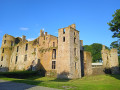
A superb circular walk starting from the ‘Petite Cité de Caractère’ of Lassay-les-Châteaux, voted France’s third favourite village in 2023. 94 per cent dirt tracks and some wonderful heritage sites to discover along the way: Lassay Castle, Bois Thibault Castle and the ruins of Bois Frou.
An interpretative trail based on the legend of Lancelot du Lac enhances this route with several stops featuring information panels on themes from Arthurian legend. The Château de Bois Thibault, open during the tourist season (weekends and public holidays only), features a magnificent round table and a comic strip depicting the legend of the famous knight Lancelot.

Details

45812581
Creation:
Last update:
Last review:
  • Walking
    Activity: Walking
  • ↔
    Distance: 3.32 mi
  • ◔
    Average duration: 1h 40 
  • ▲
    Difficulty: Easy

  • ⚐
    Back to start: Yes
  • ↗
    Ascent: + 148 ft
  • ↘
    Descent: - 167 ft

  • ▲
    Highest point: 676 ft
  • ▼
    Lowest point: 499 ft

Photos

Description of the walk

Start: Place du Château de Lassay (car park).

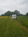
(S/E) At the foot of the hiking sign, take the small path leading downhill, then continue to your right until you reach Route de Domfront (D117). Turn left until you reach the corner of the Château restaurant and cross at the pedestrian crossing.

(1) Turn right into Rue des Jardins. After 100 m, turn left into Rue du Faubourg. Carry on straight ahead, taking care on the steep descent; you’ll then come across a magnificent wash house on your right (Lassay has more than ten wash houses). You’ll emerge onto Rue du Bois Janvier; turn right, then carry on straight ahead along a tree-lined path that passes through a housing estate before reaching Rue Jean-Baptiste Messager.

(2) Cross the street and continue straight ahead. Cross a dirt track towards a path bordered on the left by a hedgerow, which you follow until you reach the departmental road (D216).

(3) Cross carefully, turn left, then right a good hundred metres further on to head towards the ruined Château du Bois Thibault.

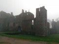
(4) Walk round the castle on the right, head up to the embankment to read the information boards. You will then come to the inner courtyard. Walk round the building to admire the façade. In summer, you can enter the grounds of the Château du Bois Thibault (weekends only, in the afternoons). Continue on your way towards the ruins of Bois Frou.

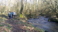
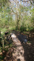
(5) Cross the county road (D117) with care, then take the path directly opposite which leads down to the stream and follow it. Cross the wooden footbridge and head down through the woodland towards the river. Here you’ll discover Alain Legros’s sculptures on the theme of Lancelot du Lac. Continue along the path until you reach a crossroads.

(6) Turn right, cross the bridge and turn right again to follow the river as closely as possible. The path winds along the Lassay, then climbs towards the ruins of Bois Frou.

(7) Once you reach the top of the embankment, take the path on the left, carry on straight ahead, then turn left to cross the bridge again.

(6) Keep to the right to follow the village path which will take you towards Lassay. When you reach the foot of the main road, walk along the verge on the right towards Lassay Castle.

(1) Carry on straight ahead, then turn right to return to the car park (S/E).

Waypoints

  1. S/E : mi 0 - alt. 640 ft - Château de Lassay-les-Châteaux
  2. 1 : mi 0.05 - alt. 627 ft - Restaurant, junction of the circular loop
  3. 2 : mi 0.37 - alt. 669 ft - Rue Jean-Baptiste Messager
  4. 3 : mi 0.72 - alt. 630 ft - D216
  5. 4 : mi 1.02 - alt. 594 ft - Bois Thibault Castle
  6. 5 : mi 1.35 - alt. 548 ft - Crossing the D117
  7. 6 : mi 1.77 - alt. 509 ft - Junction with the Bois Frou circular loop
  8. 7 : mi 2.16 - alt. 518 ft - Château du Bois Frou
  9. S/E : mi 3.32 - alt. 636 ft - Château de Lassay-les-Châteaux

Notes

Dirt tracks: 94 per cent.
Circular route: Yes.
Signposting: Yellow PR®.

Worth a visit

Always be cautious and plan ahead when you're outdoors. Visorando and the author of this route cannot be held responsible for any accidents occurring on this route.

The GR® and PR® markings are the intellectual property of the Fédération Française de Randonnée Pédestre.

Reviews and comments

4.9 / 5
Based on 3 reviews

Reliability of the description
4.7 / 5
Ease of following the route
5 / 5
Route interest
5 / 5
User 29858108

Overall rating : 4.7 / 5

Date of your route : Jul 10, 2026
Reliability of the description : ★★★★☆ Good
Ease of following the route : ★★★★★ Very good
Route interest : ★★★★★ Very good
Very busy route : No

Make sure you don’t set off in the blazing sun.
And make sure the paths are kept cleaner
Otherwise, it’s perfect

Machine-translated

benoitrando
benoitrando

Overall rating : 5 / 5

Date of your route : Jun 07, 2025
Reliability of the description : ★★★★★ Very good
Ease of following the route : ★★★★★ Very good
Route interest : ★★★★★ Very good
Very busy route : Yes

Thanks to the Mayenne CO tourist office for the great tip.

Machine-translated

randonneecasoc
randonneecasoc

Overall rating : 5 / 5

Date of your route : Apr 19, 2024
Reliability of the description : ★★★★★ Very good
Ease of following the route : ★★★★★ Very good
Route interest : ★★★★★ Very good
Very busy route : Yes

The path after crossing the D117 road, which runs alongside the stream, is currently very muddy; waterproof footwear is recommended.

Machine-translated

Other walks in the area

For more walks, use our search engine .

The GPS track and description are the property of this route's author. Please do not copy them without permission.