Route of castles and ponds in Jublains

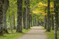
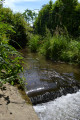
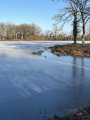
A walk allowing you to discover all the Gallo-Roman remains in the town of Jublains, as well as a beautiful natural heritage site with the Étang de Neuvillette, its flora and fauna.

Details

n°46405399
Creation:
Last update:
Last review:
  • Walking
    Activity: Walking
  • ↔
    Distance: 6.65 mi
  • ◔
    Average duration: 3h 10 
  • ▲
    Difficulty: Moderate

  • ⚐
    Back to start: Yes
  • ↗
    Ascent: + 135 ft
  • ↘
    Descent: - 144 ft

  • ▲
    Highest point: 535 ft
  • ▼
    Lowest point: 407 ft
  • ⚐ Country: France
  • ⚐ City: Jublains (53160)
  • ⚑
    Start/End: N 48.256148° / W 0.495006°
  • ❏
    IGN map(s): Ref. 1517SB, 1518SB
  • Hour-by-hour weather

Photos

Description of the walk

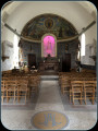
Start in front of the town hall square in Jublains. Parking is available nearby, opposite the church next to the town hall.

(S/E) Leave the church on your left, then head down the road opposite, Rue de Douce, then turn left onto Rue Henri Brabe, and turn off into the cul-de-sac, which is extended by the footpath leading to the Gallo-Roman theatre

(1) Take the path on the right, then, a little further on, turn right and cross the intergenerational garden. You’ll come out onto the D7.

(2) Cross the road carefully, turn left, cross the car park below and take the path running alongside the ruins of the citadel.

(3) Continue along the path which leads onto the Route de Montsûrs. Cross the road at the hamlet of Le Gasseau and take the path directly opposite you, until you reach a crossroads.

(4) You have the option of taking a shorter alternative route (see practical information). Otherwise, turn left towards the ponds. The path passes in front of La Trincannière. Cross the access road and then head further south towards La Trimonnière.

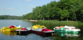
(5) Turn left, go round a charming pond with swans on your right, then carry on to Le Petit Bel Air. Turn right towards the Étang de Neuvillette, which you’ll see on your right.

(6) Carry on straight ahead. When you reach the road at La Haute Maison, turn right and stay on this quiet road until it ends, just past the crossroads with the cross.

(7) Then take the D241 (Route de Belgeard) on the right, until you reach the fourth junction with the track leading to La Motte.

(8) Turn left, then follow the track as it winds first to the left, then to the right. When you reach the road, turn right until you reach the D7. Take great care when crossing this road. Continue straight on until you reach the junction with the Petite Ragottière.

(9) Turn right onto the track towards this hamlet and you’ll come out onto the Jublains–Grazay road.

(10) Turn right to head back towards Jublains, then turn right again onto the second path to visit the Gallo-Roman temple.

(11) Take the central path. At the road, first turn left then right. Turn left then right again and continue along the street. Walk past the town hall and return to your starting point (S/E).

Waypoints

  1. S/E : mi 0 - alt. 505 ft - Parking opposite the church
  2. 1 : mi 0.12 - alt. 476 ft - Gallo-Roman theatre
  3. 2 : mi 0.3 - alt. 469 ft - D7
  4. 3 : mi 0.47 - alt. 472 ft - Ruins of the citadel
  5. 4 : mi 0.68 - alt. 492 ft - Junction
  6. 5 : mi 1.23 - alt. 499 ft - Junction
  7. 6 : mi 2.36 - alt. 407 ft - Neuvillette Pond
  8. 7 : mi 3.71 - alt. 499 ft - Junction with the D241
  9. 8 : mi 4.77 - alt. 518 ft - Junction towards La Motte
  10. 9 : mi 5.46 - alt. 531 ft - Junction towards La Petite Ragottière
  11. 10 : mi 5.96 - alt. 472 ft - Road junction
  12. 11 : mi 6.28 - alt. 495 ft - Gallo-Roman temple
  13. S/E : mi 6.65 - alt. 505 ft - Parking opposite the church

Notes

You can take a shorter alternative route: in this case, continue straight on at (4) to reach the D241, then head for the centre of Jublains by going straight on to (8) and then turning right.

Dirt tracks: 59%
Circular: Yes
Signposting: Yellow PR°°®°°

Worth a visit

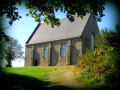
Discover the Gallo-Roman ruins of the city: temple (11), theatre (1), citadel (3) (entrance via the archaeological museum), thermal baths (beneath the church).

Always be cautious and plan ahead when you're outdoors. Visorando and the author of this route cannot be held responsible for any accidents occurring on this route.

The GR® and PR® markings are the intellectual property of the Fédération Française de Randonnée Pédestre.

Reviews and comments

5 / 5
Based on 1 review

Reliability of the description
5 / 5
Ease of following the route
5 / 5
Route interest
5 / 5
User 26670653

Overall rating : 5 / 5

Date of your route : Jan 05, 2026
Reliability of the description : ★★★★★ Very good
Ease of following the route : ★★★★★ Very good
Route interest : ★★★★★ Very good
Very busy route : Yes

Route meets expectations, accessible and well marked.🥾 🥾🎒

Machine-translated

Other walks in the area

For more walks, use our search engine .

The GPS track and description are the property of this route's author. Please do not copy them without permission.