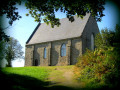
Route du Bois d’Izé

Come and explore the sunken paths of Izé and the surrounding area on this 8.6 km circular walk. This walk is signposted with yellow directional signs marked “No. 36 – Route du Bois d’Izé”.
You can combine this route with route no. 35: “Circuit de la Vaudelle”.

Details

2521041
Creation:
Last update:
Last review:
  • Walking
    Activity: Walking
  • ↔
    Distance: 5.80 mi
  • ◔
    Average duration: 2h 55 
  • ▲
    Difficulty: Moderate

  • ⚐
    Back to start: Yes
  • ↗
    Ascent: + 269 ft
  • ↘
    Descent: - 249 ft

  • ▲
    Highest point: 968 ft
  • ▼
    Lowest point: 745 ft
  • ⚐ Country: France
  • ⚐ City: Izé (53160)
  • ⚑
    Start/End: N 48.230444° / W 0.308375°
  • ❏
    IGN map(s): Ref. 1617SB, 1618SB
  • Hour-by-hour weather

Photos

Description of the walk

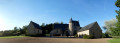
Start at the square by the church and town hall in Izé.

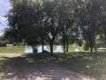
(S/E) Head towards the lake, go round it on the right and then turn right onto the main road, the D35.

(1) Turn left onto the D35 for about 250m, then cross at the pedestrian crossing to take the D240 on the right. Continue to the Croix Aubrun.

(2) Turn right, then carry on straight ahead, leaving ‘la Hunière’ on your right, heading towards ‘les Chasseries’ along a lovely dirt track for about 1 km.

(3) Turn right at the transformer and head towards ‘Jenny’.

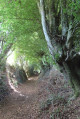
(4) After Jenny, turn left onto the sunken track for 750 metres, then pass ‘la Fosse’ and ‘la Bretonnière’ to reach the D240.

(5) Turn right onto the D240. At the junction after ‘l’Écluse’, turn left and walk for about 300 metres towards ‘Sainte-Thérèse – Les Bouillons’.

(6) At the Route de Cordouan on your left, turn right onto the small path leading to ‘La Monnerie de Cordouan’ for 700 metres to reach ‘Sainte-Thérèse’.
Cross the road and follow the path opposite for 800m.

(7) At ‘l’Orière’, turn right onto the small road and follow it for 500 metres, passing ‘la Guichardière’ on your right, and follow the signposts.

(8) Turn left into the Bois d’Izé. Walk through the woods for 1 km until you reach the Bais–Sillé-le-Guillaume road (D35).
Warning! This is a busy and dangerous road. Please take care!

(9) Cross the D35 and follow the signposts for 1.7 km to rejoin the D35, near the village of Izé.

(1) In the village, turn right to reach the square where the church and town hall are located (S/E).

Waypoints

  1. S/E : mi 0 - alt. 860 ft - Church and town hall square
  2. 1 : mi 0.25 - alt. 863 ft - D35 road
  3. 2 : mi 0.42 - alt. 886 ft - The Aubrun Cross
  4. 3 : mi 1.01 - alt. 896 ft - Turn right at the transformer
  5. 4 : mi 1.49 - alt. 968 ft - On the left, a sunken path
  6. 5 : mi 2.36 - alt. 801 ft - Turn right onto the D240. Cross the - Orthe (rivière) - Affluent de la Sarthe
  7. 6 : mi 2.69 - alt. 774 ft - Small path on the right
  8. 7 : mi 3.69 - alt. 833 ft - L’Orière
  9. 8 : mi 3.96 - alt. 810 ft - Turn left towards the Izé woods
  10. 9 : mi 4.54 - alt. 948 ft - Crossing the D35
  11. S/E : mi 5.8 - alt. 860 ft - Church and town hall square

Notes

- Picnic tables in Izé, in the village near the lake.

Reviews and comments

4.6 / 5
Based on 3 reviews

Reliability of the description
4.7 / 5
Ease of following the route
4.7 / 5
Route interest
4.3 / 5
User 22622234

Overall rating : 5 / 5

Date of your route : Aug 24, 2025
Reliability of the description : ★★★★★ Very good
Ease of following the route : ★★★★★ Very good
Route interest : ★★★★★ Very good
Very busy route : No

many paths and few roads
can be combined with the 35 Circuit de la Vaudelle, making a total of 14.2 km

Machine-translated

jfcouture
jfcouture
• Edited:

Overall rating : 4 / 5

Date of your route : Sep 25, 2023
Reliability of the description : ★★★★☆ Good
Ease of following the route : ★★★★☆ Good
Route interest : ★★★★☆ Good
Very busy route : Yes

The signposting is excellent; other regions could take a leaf out of their book.

Machine-translated

martinelepel
martinelepel

Overall rating : 4.7 / 5

Date of your route : Apr 21, 2022
Reliability of the description : ★★★★★ Very good
Ease of following the route : ★★★★★ Very good
Route interest : ★★★★☆ Good
Very busy route : Yes

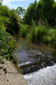
A brilliant walk that I did with the children and my dogs. The route is fairly easy and consists mostly of dirt tracks rather than roads. There’s a small waterfall and a stream, which allowed my dogs to cool their paws. Above all, it’s very well signposted. The children were able to lead the group.
The children were delighted.

Machine-translated

Other walks in the area

For more walks, use our search engine .

The GPS track and description are the property of this route's author. Please do not copy them without permission.