Country:
 City:
City:


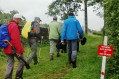
Park in the main square in Saint-Aignan-de-Couptrain.
Follow the yellow No. 5 markings on the PR® trail.
(S/E) From the main square in Saint-Aignan-de-Couptrain, head towards Javron-les-Chapelles. At the wayside cross, follow the small road to the right.
(1) At La Ratterie, turn left onto a narrow lane which continues as a dirt track, then a very rutted track leading up to the D242.
(2) Cross the departmental road and join a dirt track which leads onto the D3. Follow the road to the left, taking care, then immediately turn right onto a grassy path, which becomes rutted and stony, leading to La Hérissière.
(3) Pass under the old railway bridge and head up to the right along a local track. After about 500 m, turn right onto a grassy track, then follow a track lined with hedges which leads to La Tremblaie.
(4) Turn left, before the junction with the D3, onto a grassy track.
(5) Take a stony track on the right until you rejoin the D3. Cross the departmental road with care and continue straight ahead to a junction where two tracks meet.
(6) Leave the Dreurie on your left and follow the yellow and redGRP® markings. Carry straight on, down a path paved with natural schist slabs. Take care in wet weather as they can be slippery.
(7) When you reach the D242, turn right for 200 m, then leave the road by turning left towards the hamlet of La Malherbière. At the end of this track, take a footpath for 150 m to the next crossroads.
(8) Leave the track on the left and follow the yellow and redGRP® markings towards the Grotte des Chapelles. Head along the shaded path opposite and follow the yellow No. 5 PR® markings.
(9) When you reach La Monnerie, turn right. Make your way to the village of Saint-Aignan via La Haute Chabossière on the left, then La Basse Chabossière (with its beautiful slate walls).
(10) After Basse Chabossière, turn left and continue towards La Ratterie.
(1) Follow the route back in the opposite direction to reach the main square in Saint-Aignan-de-Couptrain (S/E).



 Tourist office

 Easy
Easy 
 Visorando Member