Route de Pierre Fontaine

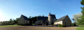
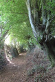
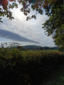
From Sainte-Gemmes-le-Robert, you can take a leisurely stroll along the slopes of Mont Rochard and enjoy the views of the lush green countryside. Along the way, you’ll discover the former manor house of Pierre Fontaine and some charming villages.
This route is signposted “No. 23” on the yellow directional signs.

Details

1610857
Creation:
Last update:
Last review:
  • Walking
    Activity: Walking
  • ↔
    Distance: 5.00 mi
  • ◔
    Average duration: 2h 55 
  • ▲
    Difficulty: Easy

  • ⚐
    Back to start: Yes
  • ↗
    Ascent: + 682 ft
  • ↘
    Descent: - 669 ft

  • ▲
    Highest point: 981 ft
  • ▼
    Lowest point: 433 ft

Photos

Description of the walk

Park at the town hall.

(S/E) From the town hall, head right towards the church and turn right onto the D517 towards Izé.

(1) At the junction with the D552, opposite the corner house, you’ll see a disc cross dedicated to pilgrims to Mont Saint-Michel (17th century). Turn left onto the path running parallel to the road alongside the housing estate, then take the next path on the left which leads up to the first foothill of Le Rochard.

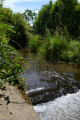
(2) At La Planche (an old mill), head up the valley to the left towards Pierre Fontaine, a 15th-century manor house.

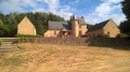
(3) After the reservoir, turn right to pass in front of the Pierre Fontaine manor house, which is situated on the left-hand side of the path.

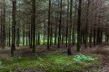
(4) In a mid-mountain landscape, head uphill along the edge of the Bois du Gros Roc towards the springs (abundant in spring), keeping in the same direction.

(5) Take a hairpin bend on the right to cross over to the other side of the hill, heading towards La Gaulerie.
There are numerous viewpoints beneath the towering Rochard. At La Gaulerie, continue left along the road to reach the pretty linear village of Montdésert.

(6) Pass the turn-off for La Chouannerie on your right, then turn right at the junction just after it.

(7) At the Arnaudières crossroads, leave the road and take the path slightly to the left that runs along the hillside, skirting a small copse (ignore the two other paths on the left).

(8) When you reach the road, turn left, then immediately right onto Chemin de la Chaîne. At the start of the track, turn immediately left onto the dirt track which leads straight down to La Planche. Halfway down, you can enjoy a lovely view of the Manoir de Pierre Fontaine.

(2) At La Planche, rejoin the original path until you reach the D517. Follow the road to the right to return to the village of Sainte-Gemmes-le-Robert and the town hall (S/E).

Waypoints

  1. S/E : mi 0 - alt. 433 ft - Town Hall Square
  2. 1 : mi 0.25 - alt. 479 ft - D552 junction
  3. 2 : mi 0.92 - alt. 541 ft - La Planche – junction of the circular loop
  4. 3 : mi 1.34 - alt. 620 ft - Turn right towards the manor house
  5. 4 : mi 1.67 - alt. 673 ft - Edge of the Bois du Gros Roc
  6. 5 : mi 2.2 - alt. 850 ft - Hairpin bend towards La Gaulerie
  7. 6 : mi 2.74 - alt. 971 ft - Montdésert
  8. 7 : mi 2.96 - alt. 919 ft - Carrefour des Arnaudières (cross)
  9. 8 : mi 3.39 - alt. 758 ft - La Chaîne
  10. S/E : mi 5 - alt. 433 ft - Town Hall Square

Notes

Worth a visit

Pierre-Fontaine Manor: the present-day main building was rebuilt in 1540 on the original foundations by Jacques de Bouillé, the younger son of a family well established locally in Chellé at the foot of Montaigu and at Le Rocher in Mézangers. This reconstruction was necessitated by the damage caused by the Hundred Years’ War. In 1672, the fief and seigneury of Pierre-Fontaine comprised the seigneurial house, consisting of three main wings, a tower in the courtyard, an enclosed courtyard containing a chapel, a barn, a dovecote and an adjoining garden. The building, with its covered steps, has been restored by the current owners and has regained its former splendour. It is a private property and is not open to the public.

Mont Rochard: the highest point (357m) of the Coëvrons massif, a hilly region situated near the town of Évron.

Reviews and comments

4.8 / 5
Based on 2 reviews

Reliability of the description
5 / 5
Ease of following the route
5 / 5
Route interest
4.5 / 5
Les Woodies
Les Woodies

Overall rating : 4.7 / 5

Date of your route : Jun 06, 2022
Reliability of the description : ★★★★★ Very good
Ease of following the route : ★★★★★ Very good
Route interest : ★★★★☆ Good
Very busy route : Yes

A well-signposted, very pleasant route. Highly recommended

Machine-translated

hillwalking
hillwalking
• Edited:

Overall rating : 5 / 5

Date of your route : Jun 13, 2021
Reliability of the description : ★★★★★ Very good
Ease of following the route : ★★★★★ Very good
Route interest : ★★★★★ Very good
Very busy route : No

A very pleasant walk, with a section under the canopy of trees, ideal in hot weather. Some lovely views, a bit of an uphill climb, and a lovely variety of scenery along the route.
A lovely, peaceful time.

Machine-translated

Other walks in the area

For more walks, use our search engine .

The GPS track and description are the property of this route's author. Please do not copy them without permission.