


Refine your search for walks in Vaux-et-Chantegrue
Vaux-et-Chantegrue walks


 Water Trail
 Visorando Member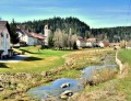
 0.57 mi
 +30 ft
 -30 ft
 0h 15
0h 15
 Easy
Easy
 Departure from Vaux-et-Chantegrue (Doubs)
In Vaux-et-Chantegrue, explore the mysteries of water!
Starting from the school, find the four markers along the route to discover the different facets of water in the village.
Sentier du Berger des Vaches
 3.50 mi
+236 ft
-259 ft
1h 50
Easy
Departure from Vaux-et-Chantegrue (Doubs)
3.50 mi
+236 ft
-259 ft
1h 50
Easy
Departure from Vaux-et-Chantegrue (Doubs)
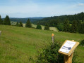
Follow in the footsteps of the Shepherd of Chantegrue and step into the heart of a pastoral landscape typical of the Haut-Doubs, where livestock farming plays a vital role in preserving wildlife. Thirteen information boards reveal the secrets of this unique landscape, steeped in memories of a bygone way of life and traditional pastoral practices.
Walk around Lake Remoray
 10.57 mi
+974 ft
-961 ft
5h 40
10.57 mi
+974 ft
-961 ft
5h 40
 Moderate
Departure from Labergement-Sainte-Marie (Doubs)
Moderate
Departure from Labergement-Sainte-Marie (Doubs)
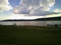
A pleasant walk through forest and pastureland, overlooking the lake. Halfway along the route, there is a superb view of the two lakes from the viewpoint. Return via the same route.
Circuit around Saint-Point-Lac
 Association / Club / Walk leader
 11.53 mi
+607 ft
-604 ft
5h 50
Easy
Departure from Labergement-Sainte-Marie (Doubs)
11.53 mi
+607 ft
-604 ft
5h 50
Easy
Departure from Labergement-Sainte-Marie (Doubs)
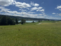
The route around the lake is a long hike but on good roads. Saint-Point-Lac is the third-largest natural lake in France. The path will take you along and close to the lake but also rises up a little and leads away from it at times for better views.
This trail is littered with signs to better understand your environment.
The Blue Spring
 Tourist office
 4.03 mi
+646 ft
-656 ft
2h 25
Easy
Departure from Malbuisson (Doubs)
4.03 mi
+646 ft
-656 ft
2h 25
Easy
Departure from Malbuisson (Doubs)
A short walk takes you to the Blue Spring. There are lovely views of Lake Saint-Point.
Located between the villages of Malbuisson and Montperreux, this spring is a pure transparent blue colour.
The view of the Alps from Malbuisson via the GR®509
 7.03 mi
+981 ft
-968 ft
4h 05
Moderate
Departure from Malbuisson (Doubs)
7.03 mi
+981 ft
-968 ft
4h 05
Moderate
Departure from Malbuisson (Doubs)
A medium-altitude hike that alternates between wooded areas and open, sunny sections.
Nice view of the Alps if the weather is good.
From Malbuisson to the Source Bleue via Port Titi
11.32 mi
+850 ft
-879 ft
5h 55
Moderate
Departure from Malbuisson (Doubs)
A varied hike with splendid views of Lake Saint-Point and the mid-mountain range, passing through a picturesque little village. The end of the route is enhanced by the discovery of a magnificent blue/turquoise-green water source.
Lake Bouverans Lakeside Discovery Trail
 1.36 mi
+30 ft
-30 ft
0h 40
Easy
Departure from Bouverans (Doubs)
1.36 mi
+30 ft
-30 ft
0h 40
Easy
Departure from Bouverans (Doubs)
Discover the exceptional richness and variety of the natural habitats along the shores of Lake Bouverans and the Marais du Varot, classified as a Sensitive Natural Area (ENS).
A 2km round-trip educational trail, featuring audio interpretation panels on the environment, nature, history and heritage of these areas.
The Deux Lacs viewpoint from Labergement-Sainte-Marie
 6.37 mi
+722 ft
-702 ft
3h 35
Moderate
Departure from Labergement-Sainte-Marie (Doubs)
6.37 mi
+722 ft
-702 ft
3h 35
Moderate
Departure from Labergement-Sainte-Marie (Doubs)
Lac de Remoray, formerly known as Lac Savoureux, is located just upstream from Lac de Saint-Point and used to be part of it. Over thousands of years, the Doubs River, with its alluvial deposits, has separated the original large lake into two. You will discover a patchwork of very different environments: lakes, marshes, peat bogs, rivers, meadows and forests. The viewpoint overlooking the two lakes offers a unique view of the diversity of these landscapes, giving this hike a special charm.
Fourperet Gorges and alpine landscapes around Labergement
 5.98 mi
+725 ft
-712 ft
3h 25
Easy
Departure from Labergement-Sainte-Marie (Doubs)
5.98 mi
+725 ft
-712 ft
3h 25
Easy
Departure from Labergement-Sainte-Marie (Doubs)
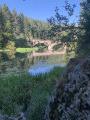
This half-day hike offers beautiful views of the Lac de Remoray Nature Reserve, the Fourperet Gorges on the banks of the Doubs and the alternating spruce forests and pasture meadows. You can also admire the mountains around Métabief.
From Labergement to the Gorges du Fourperet via Rochejean
 7.00 mi
+722 ft
-722 ft
3h 50
Moderate
Departure from Labergement-Sainte-Marie (Doubs)
7.00 mi
+722 ft
-722 ft
3h 50
Moderate
Departure from Labergement-Sainte-Marie (Doubs)
This easy walk follows paths and roads from Labergement-Sainte-Marie to the Gorges du Fourperet via Rochejean. The River Doubs, which gave its name to the department, forms the backbone of the route, winding its way through forests and lush green meadows.
The view of the Alps and Fort Saint-Antoine
 3.19 mi
+279 ft
-272 ft
1h 40
Easy
Departure from Malbuisson (Doubs)
3.19 mi
+279 ft
-272 ft
1h 40
Easy
Departure from Malbuisson (Doubs)
A pleasant hike mainly through the mountain pastures of the Haut-Doubs with a superb view of Mont Blanc if the weather is good. The last quarter of the route passes through forest.
Circular route around Malbuisson via Fort Saint-Antoine and Montperreux
9.07 mi
+928 ft
-912 ft
5h 00
Moderate
Departure from Malbuisson (Doubs)
A lovely circular walk above Malbuisson that will take you to Fort Saint-Antoine (or Fort Lucotte), one of the sites where Comté cheese is matured. From there, through meadows and mountain pastures, and through the woods, you’ll reach the borders of Touillon and Loutelet with a superb view of the peaks of the Swiss Jura, the Mont d’Or and the resort of Métabief, and, weather permitting, Mont Blanc. After reaching Montperreux, you’ll walk along pleasant paths with views of Lake Saint-Point and the village of Chaudron.
Please note: some sections can be tricky to navigate; as a precaution, we recommend using the app or a hiking GPS.
Bonnevaux Village Trail
 4.46 mi
+663 ft
-656 ft
2h 40
Moderate
Departure from Bonnevaux (Doubs)
4.46 mi
+663 ft
-656 ft
2h 40
Moderate
Departure from Bonnevaux (Doubs)
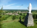
Alternating between pastures and high-altitude forests, this trail allows you to enjoy the varied landscapes of the Haut-Doubs. It leads you to the Vieille Citerne de Bonnevaux, passing through the communal lands of the Côte de Bonnevaux, where you can admire a magnificent panorama of the Frasne plateau and the mosaic of forests, peat bogs and pastures.
From the Belvédère des Deux Lacs to the meadows of Remoray
 6.29 mi
+689 ft
-666 ft
3h 30
Moderate
Departure from Brey-et-Maison-du-Bois (Doubs)
6.29 mi
+689 ft
-666 ft
3h 30
Moderate
Departure from Brey-et-Maison-du-Bois (Doubs)
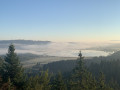
This walk starts at the superb viewpoint overlooking the two lakes of Saint-Point and Remoray. It then alternates between alpine meadows and spruce forests between Le Brey, Bougeons and Remoray. It thus offers an excellent overview of the Jura landscapes.
Drugeon and Dragon
 2.23 mi
+16 ft
-16 ft
1h 00
Easy
Departure from La Rivière-Drugeon (Doubs)
2.23 mi
+16 ft
-16 ft
1h 00
Easy
Departure from La Rivière-Drugeon (Doubs)
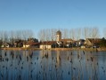
A well-marked, family-friendly and fun trail to explore the village of La-Rivière-Drugeon, where you can investigate the mystery of the missing fibula (a 7th-century brooch).
Croix de la Bèche Trail
 10.91 mi
+1,175 ft
-1,165 ft
6h 00
Moderate
Departure from La Rivière-Drugeon (Doubs)
10.91 mi
+1,175 ft
-1,165 ft
6h 00
Moderate
Departure from La Rivière-Drugeon (Doubs)
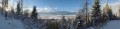
The Croix de la Bèche trail passes through the villages of La-Rivière-Drugeon and Bouverans, allowing you to explore the Drugeon Valley and the Montagne du Laveron, passing by the shores of Lac de l'Entonnoir.
Belvédère des Deux Lacs from Le Brey
 3.25 mi
+413 ft
-410 ft
1h 45
Easy
Departure from Brey-et-Maison-du-Bois (Doubs)
3.25 mi
+413 ft
-410 ft
1h 45
Easy
Departure from Brey-et-Maison-du-Bois (Doubs)
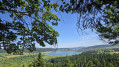
This varied route has a special charm, taking in very different environments: lakes, marshes, peat bogs, rivers, meadows and forests. The highlight is the Belvédère des Deux Lacs, which offers a unique view of the Lac de Remoray National Nature Reserve and its natural environments.
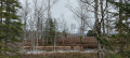
Tourbières circuit via the Moulin car park
 5.61 mi
+26 ft
-26 ft
2h 35
Easy
Departure from Frasne (Doubs)
5.61 mi
+26 ft
-26 ft
2h 35
Easy
Departure from Frasne (Doubs)
Five good reasons to go:
It is the largest high-altitude wetland in France.The Nordic landscape is highly original.You will find a unique biodiversity and surprising natural environments.The trail is designed and equipped for educational discovery.The site has been awarded the Tourism and Disability label.
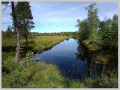
Route des Tourbières via the Tourbières car park
 4.07 mi
+36 ft
-36 ft
1h 55
Easy
Departure from Frasne (Doubs)
4.07 mi
+36 ft
-36 ft
1h 55
Easy
Departure from Frasne (Doubs)
Five good reasons to go:It is the largest high-altitude wetland in France.The Nordic landscape is highly original.You will find a unique biodiversity and surprising natural environments.The route is designed and equipped for educational discovery.The site has been awarded the Tourism and Disability label.
There are two possible routes:
Short Route: 1.44 km, accessible to people with reduced mobility (Tourism and Disability label) and pushchairs
- Long Route: 5.67 km
The Morbier Trail and the resort of Métabief
 Tourism professional3.63 mi
+312 ft
-315 ft
1h 55
Easy
Departure from Métabief (Doubs)
Tourism professional3.63 mi
+312 ft
-315 ft
1h 55
Easy
Departure from Métabief (Doubs)
A themed walk centred on one of the region’s cheeses, Morbier. The first part of this idyllic walk follows the river, passes through the villages and past the Mont d’Or cheese dairy, before offering a lovely viewpoint halfway along the route, set amongst woodland and pastures.
La Source du Doubs as seen from Gellin and La Croix de La Bonde
 12.84 mi
+1,581 ft
-1,581 ft
7h 15
12.84 mi
+1,581 ft
-1,581 ft
7h 15
 Difficult
Departure from Gellin (Doubs)
Difficult
Departure from Gellin (Doubs)
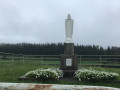
Set off to explore La Source du Doubs and its viewing point in Mouthe, passing by the Virgin of Villedieu-les-Mouthe and the Virgin of Villedieu-les-Rochejean.
You’ll cross a ski run before reaching La Source du Doubs.
Then head for the Croix de La Bonde via the peat bog trail and, finally, the Sainte-Barbe Chapel
(dedicated to the patron saint of artillerymen and firefighters) at Maison du Bois.
Adjoining the chapel is a monumental cross dating from the 15th century, adorned with two sculptures of saints.
You’ll be following sections of theGR®5Jura trail.
You’ll enjoy magnificent panoramic views throughout this walk.
Saint-Colombe and its chapel, La Planée and its memorial stone
 13.93 mi
+1,329 ft
-1,352 ft
7h 35
Moderate
Departure from Granges-Narboz (Doubs)
13.93 mi
+1,329 ft
-1,352 ft
7h 35
Moderate
Departure from Granges-Narboz (Doubs)
A pleasant walk through the forests of Les Granges-Dessus, Saint-Colombe and La Planée.
Discover the Chapel of Notre-Dame de Bon Secours in Saint-Colombe and the memorial to Marie-Hélène Wuilleumier: a member of the Resistance executed by the Nazis on 13 July 1944.
An easy walk along lovely paths, though, unfortunately, with a few forest tracks.I recommendusing the Visorando app or a GPS for peace of mind.
Les Granges Dessus
 6.54 mi
+492 ft
-479 ft
3h 25
Moderate
Departure from Granges-Narboz (Doubs)
6.54 mi
+492 ft
-479 ft
3h 25
Moderate
Departure from Granges-Narboz (Doubs)
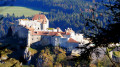
From the hamlet of La Grange Dessus, you will walk through the Bois de Ban to discover the Château de Joux, located in the heart of a magnificent natural site, overlooking its cluse since the year 1000. Along the way, there is a viewpoint over Mont d'Or and Lac Saint-Point.
On and below Mont d'Or
 10.53 mi
+3,087 ft
-3,091 ft
7h 30
Moderate
Departure from Métabief (Doubs)
10.53 mi
+3,087 ft
-3,091 ft
7h 30
Moderate
Departure from Métabief (Doubs)
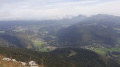
This hike will take you up Mont d'Or, where you can enjoy the view, then look down on it from below. You will pass through different environments and see a rich and diverse range of flora depending on the season.
 Circular path in the Billin Forest
 2.46 mi
+180 ft
-171 ft
2 hrs
Easy
Departure from Frasne (Doubs)
2.46 mi
+180 ft
-171 ft
2 hrs
Easy
Departure from Frasne (Doubs)
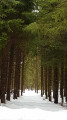
A snowshoe hike between the woodland edge and the Billin Forest.
Follow the yellow markings to find your way.
The Mont-d’Or ridges and alpine farms
 10.40 mi
+1,539 ft
-1,516 ft
6h 05
Moderate
Departure from Longevilles-Mont-d'Or (Doubs)
10.40 mi
+1,539 ft
-1,516 ft
6h 05
Moderate
Departure from Longevilles-Mont-d'Or (Doubs)
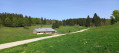
A circular route with no major difficulties, which runs along the cliffs of Mont-d’Or and its viewpoints over Lake Geneva, the Alps and Mont Blanc, before reaching the typical alpine farms of the Haut-Doubs.
Chalets on Mont d'Or
 8.19 mi
+1,365 ft
-1,335 ft
4h 55
Easy
Departure from Rochejean (Doubs)
8.19 mi
+1,365 ft
-1,335 ft
4h 55
Easy
Departure from Rochejean (Doubs)
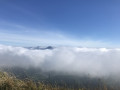
This hike will take you from one alpine chalet to another on Mont d'Or.
 Fort de Joux No. 80
13.90 mi
+1,575 ft
-1,585 ft
2.5 hrs
Difficult
Departure from La Cluse-et-Mijoux (Doubs)
This is a well-marked mountain bike trail. Number 80.A very varied and technical circuit, very interesting from a mountain biking point of view.
The Grand Tour of Château de Joux
 12.69 mi
+2,297 ft
-2,300 ft
7h 50
Difficult
Departure from Granges-Narboz (Doubs)
12.69 mi
+2,297 ft
-2,300 ft
7h 50
Difficult
Departure from Granges-Narboz (Doubs)
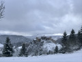
This route connects the four most beautiful viewpoints around Château de Joux. Views of the castle from every angle, as well as superb panoramas of the Doubs valley and the Fer à Cheval gorge. If you have time, you can add a visit to the castle (1 to 1½ hours). The Sandor site and the church at Oye-et-Pallet further enhance this walk.
Cessay Discovery Trail
 1.38 mi
+79 ft
-69 ft
0h 40
Easy
Departure from Frasne (Doubs)
1.38 mi
+79 ft
-69 ft
0h 40
Easy
Departure from Frasne (Doubs)
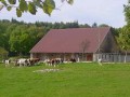
This trail, with its information boards, will introduce you to the historical and natural heritage of Cessay and lead you to the Source des Moines.
With its mascot, Huguenin, a little squirrel, young walkers can explore the Espace Cessay in a fun way.
For the more active, there’s a fitness trail featuring 11 wooden obstacles.
On the ridges of Mont d'Or
 4.12 mi
+755 ft
-738 ft
2h 35
Easy
Departure from Longevilles-Mont-d'Or (Doubs)
4.12 mi
+755 ft
-738 ft
2h 35
Easy
Departure from Longevilles-Mont-d'Or (Doubs)
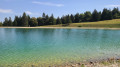
An easy walk to do on a clear day to be sure of seeing the Mont Blanc massif. The elevation gain is reasonable. There are some slightly steep but short climbs, panoramic views, and the pleasure of reaching the Morond and admiring the landscape from the Mont d’Or.Please note that you may have to cross meadows where cows graze freely.
Château de Joux
 3.91 mi
+843 ft
-873 ft
2h 30
Easy
Departure from La Cluse-et-Mijoux (Doubs)
3.91 mi
+843 ft
-873 ft
2h 30
Easy
Departure from La Cluse-et-Mijoux (Doubs)
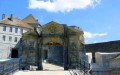
Located in the heart of a magnificent natural site, Château de Joux has overlooked its cluse since the year 1000. By installing a toll booth there, the lords of Joux were able to build this stone fortress. You will walk along both sides of the valley, climbing the Larmont anticline to Fort Mahler for superb views of this castle, which watches over the valley with all the imposing severity of a medieval watchtower.
The source of the Doubs
 3.25 mi
+223 ft
-207 ft
1h 40
Easy
Departure from Mouthe (Doubs)
3.25 mi
+223 ft
-207 ft
1h 40
Easy
Departure from Mouthe (Doubs)
Starting from Mouthe, a small village nestled in the heart of a wide valley bathed by the first meanders of the Doubs, this walk invites passers-by to discover the resurgence of this river, which is listed in the department's inventory of natural sites, and then the Moutat peat bog.
Route de découverte de Pontarlier
6.45 mi
+210 ft
-213 ft
3h 10
Moderate
Departure from Pontarlier (Doubs)
Pontarlier is a sub-prefecture of the Doubs department. The town is often regarded as its capital. Surrounded by low mountains, this town has undeniable charm and boasts a number of historic monuments such as the Porte Saint-Pierre. This walk, covering around ten kilometres, allows you to see many of these monuments as well as several parks. From the Church of Saint-Bénigne to the Parc des Ouillons, Pontarlier will reveal its many facets to you. The route presents no difficulties. It is, however, classified as ‘moderate’ as the route is over 10 kilometres long and may not be suitable for young children.
Discovering the Grand Taureau
 11.68 mi
+2,001 ft
-1,988 ft
7h 05
Moderate
Departure from Pontarlier (Doubs)
11.68 mi
+2,001 ft
-1,988 ft
7h 05
Moderate
Departure from Pontarlier (Doubs)
Through mountain pastures and forests, along paths and forest tracks, discover a summit above Pontarlier, with beautiful views of the Alps on a clear day.
The Château de Joux and Fort Mahler
 6.04 mi
+1,066 ft
-1,050 ft
3h 40
Moderate
Departure from Pontarlier (Doubs)
6.04 mi
+1,066 ft
-1,050 ft
3h 40
Moderate
Departure from Pontarlier (Doubs)
Pass through pastures dotted with gentians and friendly, cuddly horses, then through cool fir forests with slender trees to discover Fort Malher and Château de Joux overlooking the valley with all the imposing severity of a medieval watchtower.
The banks of the Doubs from Pontarlier to Doubs
3.63 mi
+338 ft
-335 ft
2h 00
Easy
Departure from Pontarlier (Doubs)
Follow the river from Pontarlier to the village of Doubs. Enjoy the coolness of the pine forest before crossing a pasture and looking out over the town nestled at the foot of Larmont.