Sentier du Berger des Vaches

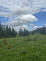
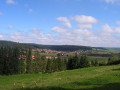
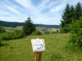
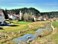
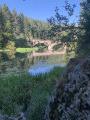
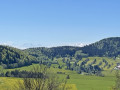
Follow in the footsteps of the Shepherd of Chantegrue and step into the heart of a pastoral landscape typical of the Haut-Doubs, where livestock farming plays a vital role in preserving wildlife. Thirteen information boards reveal the secrets of this unique landscape, steeped in memories of a bygone way of life and traditional pastoral practices.

Details

n°40648257
Creation:
Last update:
Last review:
  • Walking
    Activity: Walking
  • ↔
    Distance: 3.50 mi
  • ◔
    Average duration: 1h 50 
  • ▲
    Difficulty: Easy

  • ⚐
    Back to start: Yes
  • ↗
    Ascent: + 236 ft
  • ↘
    Descent: - 259 ft

  • ▲
    Highest point: 3,081 ft
  • ▼
    Lowest point: 2,844 ft

Photos

Description of the walk

The start of this walk is at the end of a small road between Vaux-et-Chantegrue and the hamlet of Chantegrue: there is a car park at the end of a stony track at 5 Chemin de la Lorre.
Park in the designated car and cycle car park.

This walk is fully signposted in blue and yellow.

(S/E) Take the gravel track on your right heading south-west

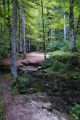
(1) Leave the stony track before it takes a sharp bend to the left. Take the small grassy path on the right and enter the woods. Cross the field fence via the designated gap on the right. Then follow the edge of the woods, keeping to the blue and yellow markings, until you reach a tarmac road.

(2) Cross the road and take the grassy path opposite. Walk along the pile of stone gathered from fields.

(3) Go round the hillock and rejoin the tarmac road.

(4) Turn right towards Chantegrue.

(5) Turn left and walk through the entire hamlet towards Vaux-et-Chantegrue along the road. Leave the hamlet and you’ll come to a crossroads.

(6) Take the tarmac road on your right until the next fork.

(7) Follow the stony track on the right and you’ll reach the car park (S/E).

Waypoints

  1. S/E : mi 0 - alt. 2,867 ft - Chemin de la Lorre car park
  2. 1 : mi 0.46 - alt. 3,035 ft - Les Landes, grassy path on the right
  3. 2 : mi 1.04 - alt. 3,009 ft - Tarmac road, grassy path opposite
  4. 3 : mi 1.57 - alt. 3,064 ft - Les Oselets
  5. 4 : mi 1.64 - alt. 3,058 ft - Path on the right
  6. 5 : mi 2.78 - alt. 2,923 ft - Chantegrue entrance
  7. 6 : mi 3.12 - alt. 2,861 ft - Crossroads on the right. Near the source of the - Drugeon (rivière)
  8. 7 : mi 3.42 - alt. 2,844 ft - Gravel path on the right
  9. S/E : mi 3.5 - alt. 2,867 ft - Chemin de la Lorre car park

Notes

Make sure you’re wearing good shoes.
Don’t be afraid of the cows and make sure you respect their peace and quiet.

Option at (4): continue your walk to the leisure, orienteering and cross-country skiing area on the left. There you’ll find three additional information boards to those you passed whilst walking along the Sentier du Berger. You can also try your hand at orienteering on the marked trails.

Worth a visit

In the village of Vaux, explore the mysteries of water by following the Water Trail. The trail starts in front of the town hall and school. Four information points will help you discover the different facets of water in the village.

At the Vaux-et-Chantegrue Nordic centre, an orienteering area with three courses of varying difficulty (suitable for children aged 2 and over) has been set up to introduce you to the sport and help you discover the local area in a unique way.

Reviews and comments

4.3 / 5
Based on 3 reviews

Reliability of the description
4.5 / 5
Ease of following the route
4.7 / 5
Route interest
3.7 / 5
User 27090188

Overall rating : 4.3 / 5

Date of your route : Oct 01, 2026
Reliability of the description : ★★★★★ Very good
Ease of following the route : ★★★★★ Very good
Route interest : ★★★☆☆ Average
Very busy route : No

Treat this walk as a leisurely stroll – but an enjoyable one – as you’ll also discover some of the vocabulary and customs of a bygone era, thanks to the various information boards created and put up by schoolchildren.

Machine-translated

Patoche39250
Patoche39250

Overall rating : 4.3 / 5

Date of your route : Sep 16, 2025
Reliability of the description : ★★★★☆ Good
Ease of following the route : ★★★★☆ Good
Route interest : ★★★★★ Very good
Very busy route : No

A pleasant walk of less than 6 km. Easy to access and suitable for all

Machine-translated

CFD
CFD

Thank you for your comment on the cowherd’s trail. The return route does indeed follow a tarmac road to make it more accessible to a wider range of visitors.

Machine-translated

Frala
Frala

Overall rating : 4 / 5

Date of your route : Aug 16, 2024
Reliability of the description : Not used / Not applicable
Ease of following the route : ★★★★★ Very good
Route interest : ★★★☆☆ Average
Very busy route : No

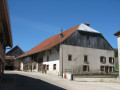
The first part of the route offers the chance to explore the alpine pastures of the Doubs and learn about life in this area in days gone by through a series of informative educational panels. The village of Chantegrue is typical of the old Franche-Comté farmhouses. However, the return journey along the tarmac road is a little long and offers little of interest in terms of scenery, as you have already seen it all.

Machine-translated

Other walks in the area

For more walks, use our search engine .

The GPS track and description are the property of this route's author. Please do not copy them without permission.