Water Trail

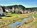
In Vaux-et-Chantegrue, explore the mysteries of water!
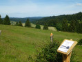
Starting from the school, find the four markers along the route to discover the different facets of water in the village.

Details

n°711693
Creation:
Last update:
Last review:
  • Walking
    Activity: Walking
  • ↔
    Distance: 0.57 mi
  • ◔
    Average duration: 0h 15 
  • ▲
    Difficulty: Easy

  • ⚐
    Back to start: Yes
  • ↗
    Ascent: + 30 ft
  • ↘
    Descent: - 30 ft

  • ▲
    Highest point: 2,861 ft
  • ▼
    Lowest point: 2,828 ft

Photos

Description of the walk

The start of this route is near the school in Vaux-et-Chantegrue.

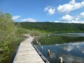
(S/E) Cross the school playground to find the first marker. Continue in the same direction to find the second. At the second marker, turn left and head towards the Drugeon. You’ll find the third marker on the bridge.

(1) You now know a bit more about the Drugeon. But that’s not all. Follow the river along the grassy strip on its left. After 250 metres, cross the small bridge and you’ll find the fourth marker. Then head towards the church to return to the starting point (S/E).

Waypoints

  1. S/E : mi 0 - alt. 2,858 ft - School-Town Hall
  2. 1 : mi 0.19 - alt. 2,831 ft - Bridge over the - Drugeon (rivière)
  3. S/E : mi 0.57 - alt. 2,858 ft - School–Town Hall

Worth a visit

Not tired after this walk? Head to the hamlet of Chantegrue and explore the ‘Berger des Vaches’ trail.

In the hamlet of Chantegrue, follow in the footsteps of the ‘Berger des Vaches’. Thirteen information panels will reveal the secrets of this unique landscape, steeped in memories of a bygone way of life and traditional pastoral practices.

Starting from the Vaux-et-Chantegrue Nordic centre, an orientation area with three trails of varying difficulty (suitable for children aged 2 and over) has been set up to introduce you to this activity and help you discover the local area in a unique way.

Reviews and comments

4.2 / 5
Based on 2 reviews

Reliability of the description
4.5 / 5
Ease of following the route
4 / 5
Route interest
4 / 5
Pramania
Pramania

Overall rating : 4 / 5

Date of your route : Oct 16, 2018
Reliability of the description : ★★★★☆ Good
Ease of following the route : ★★★★☆ Good
Route interest : ★★★★☆ Good

A pleasant walk

Machine-translated

PIEMARAN
PIEMARAN
• Edited:

Overall rating : 4.3 / 5

Date of your route : Apr 08, 2018
Reliability of the description : ★★★★★ Very good
Ease of following the route : ★★★★☆ Good
Route interest : ★★★★☆ Good

Your map of the route on your IGN map is excellent – thank you very much.

Machine-translated

Other walks in the area

For more walks, use our search engine .

The GPS track and description are the property of this route's author. Please do not copy them without permission.