The Morbier Trail and the resort of Métabief

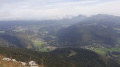
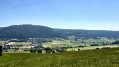
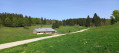
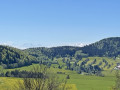
A themed walk centred on one of the region’s cheeses, Morbier. The first part of this idyllic walk follows the river, passes through the villages and past the Mont d’Or cheese dairy, before offering a lovely viewpoint halfway along the route, set amongst woodland and pastures.

Details

18629965
Creation:
Last update:
Last review:
  • Walking
    Activity: Walking
  • ↔
    Distance: 3.63 mi
  • ◔
    Average duration: 1h 55 
  • ▲
    Difficulty: Easy

  • ⚐
    Back to start: Yes
  • ↗
    Ascent: + 312 ft
  • ↘
    Descent: - 315 ft

  • ▲
    Highest point: 3,402 ft
  • ▼
    Lowest point: 3,087 ft

Description of the walk

The walk starts at the car park of the Museum of Milling and Local History, on Rue du Village in Métabief. There is an information sign for Morbier at the entrance to the car park, and arrows will guide you along this circular route.

(S/E) To begin, head to the far end of the car park and take a small dirt track which soon leads to a wooden bridge crossing the Leat Rouge stream. Follow this track along the stream until you come to some houses and a small road. Follow this road to the Mont d’Or cheese dairy. This family-run dairy produces Morbier, Mont d’Or and Comté. It has a visitor gallery and sells its products directly to the public.

(1) Carry on for a few dozen metres, then turn right to cross the stream once more. Turn left at the corner by the chemist’s. Continue along Rue de la Forge, which turns into a path, still following the stream. Take the path that runs closest to the stream behind the garage; it’s more pleasant than walking alongside the cars. After crossing another small bridge, carry on along the path and do not return to the road.

(2) The second Morbier information sign is at the end of the path, by a playground just before the campsite. Carry on alongside the Hôpitaux-Neufs village campsite until you reach the war memorial. Turn right in front of it onto Rue de la Sablière. About a hundred metres further on, turn left onto a small path markedGR® through a meadow and then under a small clump of trees.

(3) At the end of the small path, turn right onto the white track. Pass a picnic table and thethird Morbier information sign. Here, a gap in the hedge offers a view of the landscape. Continue along the track.

(4) The final Morbier information sign is located at this junction with the picnic table. Leave the path on your left and carry straight on to descend to the lower part of the Métabief resort.

(5) Follow the main street, pass the Tourist Office and continue straight down to the cemetery. Turn right, pass the holiday village and the Hôtel de l’Étoile des Neiges, then turn left to reach the cheese dairy.

(1) Take the same route back to the car park (S/E).

Waypoints

  1. S/E : mi 0 - alt. 3,091 ft - Milling Museum car park
  2. 1 : mi 0.42 - alt. 3,117 ft - Mont d’Or Cheese Dairy – Sancey Richard
  3. 2 : mi 1.09 - alt. 3,196 ft - 2nd signpost: Morbier and playground
  4. 3 : mi 1.68 - alt. 3,356 ft - Dirt track
  5. 4 : mi 2.11 - alt. 3,402 ft - 4th information sign for Morbier, picnic table
  6. 5 : mi 2.48 - alt. 3,314 ft - Métabief Tourist Office
  7. S/E : mi 3.63 - alt. 3,087 ft - Milling Museum car park

Notes

The car park at the Milling Museum is a very convenient place to park and start the walk.

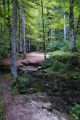
The route is mainly on roads, minor roads and dirt tracks that are easy to walk on, but the first section along the stream can be tricky, very wet or even flooded after heavy rain.

Worth a visit

  • The Mont d’Or family-run cheese dairy, with its shop and visitor gallery. You can watch Comté, Morbier or Mont d’Or being made in the morning (Mont d’Or in season).
  • Museum of milling and local history.
  • The ‘Coni’fer’, a small tourist train.
  • Educational treasure hunt in Morbier using the free Morbier Explor Game® app (More information at https://www.fromage-morbier.com/sentiers... ).

Things to do nearby:
Activities in the resort and the town of Métabief: summer tobogganing, mountain biking, paragliding, tree-top adventure course, ski resort and snowshoeing in winter.

Always be cautious and plan ahead when you're outdoors. Visorando and the author of this route cannot be held responsible for any accidents occurring on this route.

The GR® and PR® markings are the intellectual property of the Fédération Française de Randonnée Pédestre.

Reviews and comments

4.9 / 5
Based on 3 reviews

Reliability of the description
5 / 5
Ease of following the route
5 / 5
Route interest
4.7 / 5
User 21033838

Overall rating : 5 / 5

Date of your route : Jul 27, 2026
Reliability of the description : ★★★★★ Very good
Ease of following the route : ★★★★★ Very good
Route interest : ★★★★★ Very good
Very busy route : No

A lovely walk in the hills above Matabief

Machine-translated

fr6
fr6

Overall rating : 5 / 5

Date of your route : Jun 08, 2026
Reliability of the description : ★★★★★ Very good
Ease of following the route : ★★★★★ Very good
Route interest : ★★★★★ Very good
Very busy route : Yes

A short, relaxing and easy 5.5 km walk with a 100 m elevation gain – a very pleasant and varied route to explore Métabief. Beautiful scenery, a cheese dairy along the way, a short stop at the Hopitaux-Neufs station, a stretch through the woodland, and arrival in the village...
It’s impossible to get lost – the route is very well signposted.

Machine-translated

Anne ddj
Anne ddj

Too difficult and lost the GPS signal

Machine-translated

Syndicat du Morbier
Syndicat du Morbier

Hello,
thank you for your feedback; I’m delighted you enjoyed the trail!
You’ll find a similar trail starting from the cheese dairy in the village of Labergement-Sainte-Marie, 6 km from Métabief. Do pop into the cheese dairies to try a slice of Morbier!

Have a lovely day,
The Morbier Association

Machine-translated

Fafa81
Fafa81

Overall rating : 4.7 / 5

Date of your route : Jul 31, 2023
Reliability of the description : ★★★★★ Very good
Ease of following the route : ★★★★★ Very good
Route interest : ★★★★☆ Good
Very busy route : No

A very pleasant little walk. The route is very well signposted.

Machine-translated

Other walks in the area

For more walks, use our search engine .

The GPS track and description are the property of this route's author. Please do not copy them without permission.