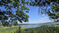
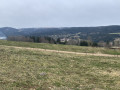
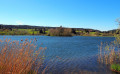
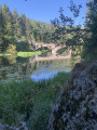
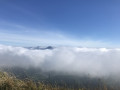
La Source du Doubs as seen from Gellin and La Croix de La Bonde

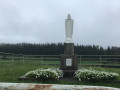
Set off to explore La Source du Doubs and its viewing point in Mouthe, passing by the Virgin of Villedieu-les-Mouthe and the Virgin of Villedieu-les-Rochejean.
You’ll cross a ski run before reaching La Source du Doubs.
Then head for the Croix de La Bonde via the peat bog trail and, finally, the Sainte-Barbe Chapel 
(dedicated to the patron saint of artillerymen and firefighters) at Maison du Bois.
Adjoining the chapel is a monumental cross dating from the 15th century, adorned with two sculptures of saints.
You’ll be following sections of theGR®5Jura trail.
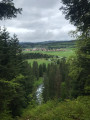
You’ll enjoy magnificent panoramic views throughout this walk.

Details

n°47199031
Creation:
Last update:
Last review:
  • Walking
    Activity: Walking
  • ↔
    Distance: 12.84 mi
  • ◔
    Average duration: 7h 15 
  • ▲
    Difficulty: Difficult

  • ⚐
    Back to start: Yes
  • ↗
    Ascent: + 1,581 ft
  • ↘
    Descent: - 1,581 ft

  • ▲
    Highest point: 3,845 ft
  • ▼
    Lowest point: 3,018 ft

Photos

Description of the walk

Free car park opposite the dairy in Gellin.

(S/E) Turn right onto the main street. Turn left and cross the D254 carefully to head towards Villedieu-les-Mouthe. Pass an old wash house and the town hall.

(1) Turn right onto Rue de la Vie Neuve and walk uphill to the statue of the Virgin Mary.

(2) Look out for an ascending path leading to the statue of the Virgin. You’ll need to pass under a wire a little further up! Then cross the field and continue along the forest track until the next junction.

(3) Despite the Yellow Cross and Blue Cross, carry on to the left along the road to reach Villedieu-les-Rochejean.

(4) At a place called La Remise, turn right towards Le Chaumois. Walk past an old wash house. Then look out for a road leading uphill on your left; walk past a house to reach the statue of the Virgin Mary. You’ll have to pass under a wire again! Then head down the small path that leads to the road.

(5) Turn right (look out for a small statue of the Virgin Mary opposite, towards the house), admire an old wash house on your right and head towards Le Chaumois on your left, along the forest track, until you reach the next signpost.

(6) At a place called Le Grand Tournant, take the path on your left that leads into the forest. Ignore all other paths and continue uphill to Le Chaumois farm. Carry on straight ahead, towards “La Vannode”. When you reach a forest track, head up to the left until you reach the farm.

(7) Head towards “Source du Doubs” on your right, across the field and then into the woods. Keep an eye out for the signposts until you reach the Bousson barn.

(8) Cross the road and head straight on through the field, then into the woods. Pass by the Sapeau Léger farm. Look out for the signs further down and take the path on your left, towards “Bois du Creux”.

(9) A little further on, at a place called ‘Sous le Sapeau Léger’, head towards ‘le Bief Girard’ on the left. This is part of theGR®509Grande Traversée du Jura. White and red markings.

(10) Take the forest road leading downhill on the right until you reach the next signpost.

(11) Leave the forest road and turn left onto the forest path, following signs for “Source du Doubs”.

(12) Be careful: leave theGR®509at signpost 14 to take the path leading uphill through the forest (much nicer!)

(13) Head uphill to the left and look out for a narrow path on the right, which is more pleasant than theGR®509forest track.

(14) Take in the view and head down to the forest track. Ignore the road on your right and head towards the Source du Doubs, a little further on, on your right. Cross a ski run!

(15) At a place called Forêt de La Source du Doubs, take a short round trip to see the spring on the left-hand side. Then return and take the steps up to the viewpoint. Magnificent. Continue along the descending path to see the spring on the right-hand side.

(16) Take the path to the spring on your left, heading towards the peat bogs, then carry on until you reach the main road.

(17) Turn right and cross the D433 with care, heading towards La Croix de La Bonde. Walk along a small road, then a path, then across a field. Magnificent views right up to the next junction.

(18) At a place called La Bonde, turn left towards “Sarrageois”, continue to the bridge and cross it. Turn left until you reach the main road. Important: you are now below the main road.

(19) Cross the D437 with care and carry on straight ahead, heading up into the village. Near the town hall, carry on straight ahead towards “Maison du Bois”.

(20) Turn left onto Chemin des Esseux and continue along the road to leave the village.

(21) Take the path on your right, leading to Maison du Bois.

(22) Turn right at the fork and walk past the Sainte-Barbe Chapel. Admire the 15th-century cross. Continue down this small road.

(23) At this junction of three roads, take the one furthest to the right and continue downhill to the car park opposite the dairy (S/E).

Waypoints

  1. S/E : mi 0 - alt. 3,028 ft - Car park opposite the dairy
  2. 1 : mi 0.85 - alt. 3,097 ft - Rue de la Vie Neuve
  3. 2 : mi 1.07 - alt. 3,136 ft - Uphill path
  4. 3 : mi 1.66 - alt. 3,189 ft - Yellow Cross/Blue Cross
  5. 4 : mi 2.09 - alt. 3,140 ft - La Remise - Doubs (rivière)
  6. 5 : mi 2.34 - alt. 3,045 ft - Le Chaumois
  7. 6 : mi 3.06 - alt. 3,340 ft - Le Grand Tournant.
  8. 7 : mi 4.04 - alt. 3,845 ft - La Vannode
  9. 8 : mi 4.79 - alt. 3,678 ft - Grange Bousson
  10. 9 : mi 5.49 - alt. 3,573 ft - Sous le Chapeau Léger
  11. 10 : mi 5.72 - alt. 3,583 ft - Forest track
  12. 11 : mi 6.27 - alt. 3,337 ft - Forest track
  13. 12 : mi 6.51 - alt. 3,337 ft - Signpost 14
  14. 13 : mi 6.84 - alt. 3,248 ft - Uphill path
  15. 14 : mi 7.1 - alt. 3,205 ft - View - Doubs (rivière)
  16. 15 : mi 7.46 - alt. 3,186 ft - La Source du Doubs Forest. - Belvédère Source du Doubs
  17. 16 : mi 7.73 - alt. 3,074 ft - The peat bogs, after the - Source du Doubs (Mouthe)
  18. 17 : mi 8.35 - alt. 3,094 ft - Crossing the D433
  19. 18 : mi 9.65 - alt. 3,192 ft - La Bonde - Doubs (rivière)
  20. 19 : mi 10.39 - alt. 3,048 ft - Crossing the D437
  21. 20 : mi 10.79 - alt. 3,084 ft - Head towards Maison du Bois
  22. 21 : mi 11.38 - alt. 3,320 ft - Path
  23. 22 : mi 12.1 - alt. 3,205 ft - Maison du Bois
  24. 23 : mi 12.26 - alt. 3,169 ft - Sainte-Barbe Chapel
  25. S/E : mi 12.84 - alt. 3,028 ft - Car park opposite the dairy

Notes

At point (4), if you do not wish to go as far as Villedieu-les-Rochejean, take the road uphill to rejoin the route.
The statue of the Virgin Mary at Villedieu-les-Rochejean is, unfortunately, poorly maintained.
There are several picnic tables at La Source du Doubs.
At point (19), you can shorten the walk and head straight towards Gellin via the D437. (Circular route of 18.5 km).

This route passes through a protected area, which may be subject to special regulations:

Worth a visit

The walk took 5 hours.

Always be cautious and plan ahead when you're outdoors. Visorando and the author of this route cannot be held responsible for any accidents occurring on this route.

The GR® and PR® markings are the intellectual property of the Fédération Française de Randonnée Pédestre.

Reviews and comments

4.2 / 5
Based on 2 reviews

Reliability of the description
4 / 5
Ease of following the route
5 / 5
Route interest
3.5 / 5
ANNICKZ
ANNICKZ

Overall rating : 4 / 5

Date of your route : May 10, 2025
Reliability of the description : ★★★★☆ Good
Ease of following the route : ★★★★★ Very good
Route interest : ★★★☆☆ Average
Very busy route : No

Beautiful scenery; the view as you reach the source of the Doubs is magnificent, but we found there was too much driving involved…; We avoided a short stretch towards the end of the route: before crossing the road to head towards Sarrageois, we carried on along the path that runs alongside the road below, so we didn’t have to go right through Sarrageois.
The sections through the forest are very pleasant.

Machine-translated

La Godasse Folle
La Godasse Folle

Overall rating : 4.3 / 5

Date of your route : Apr 28, 2025
Reliability of the description : ★★★★☆ Good
Ease of following the route : ★★★★★ Very good
Route interest : ★★★★☆ Good
Very busy route : No

A fairly easy walk, but lots of tarmac. We’d already reached point 6 by the time we got there, and then there was more tarmac on the way back after Mouthe. What a shame. Luckily, the scenery was absolutely stunning! The source of the Doubs is well worth a visit and the diverse vegetation is impressive.

Machine-translated

Other walks in the area

For more walks, use our search engine .

The GPS track and description are the property of this route's author. Please do not copy them without permission.