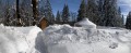
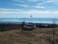
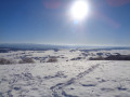
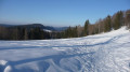
(S/E) From the car park, head onto the snowfield to the south, then head south-west, passing close to the antennas, until you reach a wide path. Start looking out for the GTJ markings. These may take various forms: a yellow line, a yellow post, a sign with the snowshoe symbol, etc.
(1) Turn slightly to the right, heading due south along the marked path which climbs gradually.
(2) Carry on following the markings and take the path opposite that leads uphill.
(3) At this point, the signposting in January 2018 was incorrect. Do not follow any tracks that might head steeply to your left; carry on straight ahead, passing the barrier (see map) to reach the correct junction. Turn left onto the path that climbs.
(4) Once you can see the chairlifts and ski lifts, carry on straight ahead, passing under the Paradis chairlift. 200 metres further on, you’ll see the mountain hut on your left. You can take a shortcut; the entrance is to the west (E).
Waypoints
S : mi 0 - alt. 3,330 ft - Car park on Avenue du Bois du Roi
1 : mi 0.57 - alt. 3,484 ft - Picnic area
2 : mi 0.85 - alt. 3,579 ft - Les Seignots
3 : mi 1.02 - alt. 3,714 ft - At the junction, turn left
4 : mi 1.91 - alt. 4,088 ft - Access via the chairlift
E : mi 2.24 - alt. 4,304 ft - Chalet du Grand Montrond
Notes
As for us, we deliberately kept this stage short, as we’d been driving for 7 hours that morning.
When you arrive in Métabief, pop into the Tourist Office to buy your pass.
It’s right in the town centre, near the ski lifts, and parking is a nightmare at weekends.
Get a Jura Mountains weekly pass: walking (access to marked and secure snowshoe and walking trails) for €22 in 2019
The staff at reception are very helpful. Ask them for the GTJ leaflets; they can provide you with further information.
To park a car for a week, we were advised to use Avenue du Bois du Roi.
For the mountain refuge, see the Chalet du Gros Morne (FFCAM) website; booking is essential. It’s unstaffed, so you’ll need to bring your own dinner, breakfast and a packed lunch for the following day.
Be aware that at weekends it can get very busy, or even more so.
Worth a visit
If you have time, you can climb to the summit of Morond to enjoy the scenery, as the next day you’ll be heading south towards Mont d’Or.
Reviews and comments
5 / 5
Based on 1 review
Reliability of the description 5 / 5
Ease of following the route 5 / 5
Route interest 5 / 5
User 13606401
Overall rating :
5 / 5
Date of your route : Jul 15, 2026 Reliability of the description : ★★★★★ Very good Ease of following the route : ★★★★★ Very good Route interest : ★★★★★ Very good Very busy route : Yes
Right, we’ve got all the information we need for this hike. Thanks
To open this route on your smartphone, you must have the Visorando app installed. If not, got to the Apple Store (iPhone) or Google Play Store (Android) to download the app.



 Country:

 City:
City:



 Visorando Member
 Association / Club / Walk leader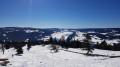
 Easy
Easy