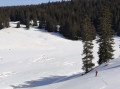
The Lynx Trail starting from Métabief

A cross-country ski trail in the Haut Doubs, on the slopes of Mont d’Or.

Details

n°29
Creation:
Last update:
Last review:
  • Skiing
    Activity: Skiing
  • ↔
    Distance: 11.01 mi
  • ◔
    Duration according to the author: 2 hrs 
  • ▲
    Difficulty: Moderate

  • ⚐
    Back to start: Yes
  • ↗
    Ascent: + 1,201 ft
  • ↘
    Descent: - 1,194 ft

  • ▲
    Highest point: 4,541 ft
  • ▼
    Lowest point: 3,747 ft

Description of the walk

This hike can start from two locations: either from Les Granges Raguin or from the Super Longevilles car park, as shown on the map.
(6) Note: Starting from Les Granges Raguin, simply follow the signposting for the Lynx trail.

(S/E) Starting from Super Longevilles, head towards Bellevue and then reach the junction of the trail at La Bartelette.

(1) Join the Lynx trail here. Turn left towards the Auberge de la Grangette; before reaching the inn, turn right, cross theGR®5, continue south-east past the Ferme de la Vermode, and you’ll reach the French-Swiss border.

(2) Make a 180° turn to follow a route almost parallel to the previous one, leading to a water tank.

(3) Turn left, follow the track and reach the hamlet of La Roulette.

(4) Stay on the track and, heading almost constantly west, pass the chalets of Chalet Brûlé, Chalet Neuf and Haut Soulier. Shortly after the last chalet, you’ll reach a crossroads.

(5) Change direction completely, heading north towards Les Granges Raguin.

(6) Turn right, walk past the chalets at La Besaine, and further on you’ll reach La Boissaude.

(7) Continue along the track until you reach the original crossroads.

(1) Turn left and follow the route you took on the way there to return to the Super Longevilles car park (S/E).


Waypoints

  1. S/E : mi 0 - alt. 3,907 ft - Super Longevilles car park
  2. 1 : mi 0.91 - alt. 3,996 ft - Lynx run
  3. 2 : mi 3.42 - alt. 4,498 ft - French-Swiss border
  4. 3 : mi 4.4 - alt. 4,334 ft - Citerne
  5. 4 : mi 5.34 - alt. 4,144 ft - La Roulette
  6. 5 : mi 7.15 - alt. 3,940 ft - Road junction
  7. 6 : mi 7.9 - alt. 3,757 ft - Granges Raguin
  8. 7 : mi 9.23 - alt. 4,012 ft - La Boissaude
  9. S/E : mi 11.01 - alt. 3,911 ft - Super Longevilles car park

Notes

For information on snow conditions and ski area opening times: https://www.espacenordiquejurassien.com/...
There are two restaurants along this route: La Boissaude and Les Grangettes.
At the Super Longevilles car park, there is a restaurant and bar called Le Flocon.

This route passes through a protected area, which may be subject to special regulations:

Always be cautious and plan ahead when you're outdoors. Visorando and the author of this route cannot be held responsible for any accidents occurring on this route.

The GR® and PR® markings are the intellectual property of the Fédération Française de Randonnée Pédestre.

Reviews and comments

5 / 5
Based on 1 review

Reliability of the description
Not used
Ease of following the route
Non utilisé
Route interest
5 / 5
xav25
xav25

Hello,
Let’s keep OSM alive,
My son makes edits and additions every day.
For example, one interesting piece of data is drinking water points.
If we add details of those near us, everyone benefits...

Machine-translated

xav25
xav25

Sorry,
I found that all the download windows were hidden behind another window, so the problem was on my end.
Thank you for your prompt response.
Have a good week

Machine-translated

henri57
henri57 ★

Hello

Hello, is the PDF not coming through? ?

Are you having trouble downloading the PDF file?

Which web browser are you using – Chrome, Firefox, etc.?

See you soon

Machine-translated

xav25
xav25

Overall rating : 5 / 5

Date of your route : Jun 19, 2020
Reliability of the description : Not used / Not applicable
Ease of following the route : Not used / Not applicable
Route interest : ★★★★★ Very good
Very busy route : No

Hello, is the PDF not coming through??

Machine-translated

BOBI25
BOBI25
• Edited:

Big mistake: La Boissaude and La Grangette are not farm inns, but restaurants. To be a farm inn, you must first and foremost be a farmer.

Machine-translated

For more walks, use our search engine .

The GPS track and description are the property of this route's author. Please do not copy them without permission.