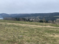
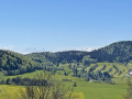
The Morbier Trail and panoramic view of Lake Remoray

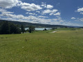
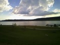
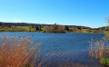
A lovely themed walk centred around one of the region’s cheeses, Morbier. This circular route starts at the Fruitière des Lacs and winds through the typical agricultural landscapes of the Haut-Doubs. Don’t miss the stunning 360° view over Lake Remoray and the peaks of the Doubs.

Details

n°18625303
Creation:
Last update:
Last review:
  • Walking
    Activity: Walking
  • ↔
    Distance: 2.58 mi
  • ◔
    Average duration: 1h 30 
  • ▲
    Difficulty: Easy

  • ⚐
    Back to start: Yes
  • ↗
    Ascent: + 358 ft
  • ↘
    Descent: - 358 ft

  • ▲
    Highest point: 3,123 ft
  • ▼
    Lowest point: 2,815 ft

Photos

Description of the walk

From Mouthe, take the D437 towards Malbuisson. Drive on to Labergement-Ste-Marie. The route starts in front of the Fruitière des Lacs. This cooperative cheese dairy produces Morbier and Comté. It has a visitor gallery and sells its products directly to the public. The first Morbier information sign is in front of the cheese dairy; arrows will guide you along the circular route.

(S/E) Take the small road that climbs alongside the cheese dairy. Follow the road uphill until you reach thesecond ‘Morbier’ information sign on the farm building.

(1) Walk past the farmhouse until you reach a wayside cross: turn right towards the church.

(2) Continue along the upper part of the Grande Rue, passing the church, then take the steps alongside the town hall (it’s nicer to walk past the church than along the road below).
At the school, before the bridge, cross the road and start along the Chemin de la Cité, then take the first road on your left.
Carry on straight ahead, leaving the steep climb slightly to your left (which leads to the same place but is steeper). After passing the new wooden farmhouse – ignoring its access road – turn left at a right angle until you reach the next junction.

(3) Carry on straight ahead along the path, passing thethird Morbier information sign. At this point, take in the 360° panoramic view of Lake Remoray and the Longevilles Mont d’Or ski resort. Continue to the water reservoir.

(4) The final ‘Morbier’ information sign is located here. Take the path leading down to the left, keep left at the Y-junction and walk past a third farm before reaching the ‘Stop’ sign. Turn left and continue to the fountain.

(5) Turn right at the fountain and you’ll soon rejoin the first part of the circular path. Back in front of the wayside cross, take the path you came along on the way out to the right and follow it back to the cheese dairy (S/E).

Waypoints

  1. S/E : mi 0 - alt. 2,815 ft - Fruitière des Lacs – 1st Morbier information sign
  2. 1 : mi 0.34 - alt. 2,913 ft - Farm – 2nd Morbier information sign
  3. 2 : mi 0.55 - alt. 2,858 ft - Église Saint-Théodule (Labergement Sainte-Marie)
  4. 3 : mi 1.32 - alt. 3,091 ft - 3rd Morbier information sign – Viewpoint over the - Lac de Remoray
  5. 4 : mi 1.67 - alt. 3,107 ft - 4th Morbier information sign
  6. 5 : mi 2.14 - alt. 2,884 ft - Fountain
  7. S/E : mi 2.58 - alt. 2,815 ft - Fruitière des Lacs

Notes

The cheese dairy’s car park is very spacious, making it very convenient to park and start the walk.
The route follows roads, minor roads and dirt tracks, and is easily accessible even in wet weather.
There are four Morbier information boards along this route, which can also be explored using the Morbier Explor Game® app (a free educational treasure hunt; for more information, visit https://www.fromage-morbier.com/sentiers...)

Worth a visit

Places to visit on the walk:
- Fruitière des Lacs, with its shop and visitor gallery. You can watch Comté or Morbier being made in the morning.
- Viewpoint overlooking Lake Remoray and the peaks of the Doubs.
- Educational treasure hunt about Morbier using the free Morbier Explor Game® app . More information at https://www.fromage-morbier.com/sentiers...).

Things to do nearby:
- The Obertineau bell foundry.
- The Rucher des 2 Lacs apiary.
- The Nature Reserve Centre.
- Lake Saint-Point.

Reviews and comments

5 / 5
Based on 1 review

Reliability of the description
5 / 5
Ease of following the route
5 / 5
Route interest
5 / 5
User 4292374

Overall rating : 5 / 5

Date of your route : Jul 23, 2025
Reliability of the description : ★★★★★ Very good
Ease of following the route : ★★★★★ Very good
Route interest : ★★★★★ Very good
Very busy route : No

A lovely walk. We chose to do it on an overcast day and it was really pleasant, as we mainly walked through the village and up the hills, with meadows to the right and left. Beautiful views over Lake Remoray.

Machine-translated

Other walks in the area

For more walks, use our search engine .

The GPS track and description are the property of this route's author. Please do not copy them without permission.