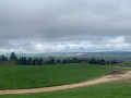
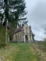
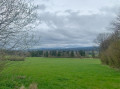
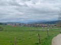
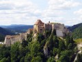
Saint-Colombe and its chapel, La Planée and its memorial stone

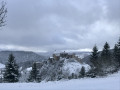
A pleasant walk through the forests of Les Granges-Dessus, Saint-Colombe and La Planée. Discover the Chapel of Notre-Dame de Bon Secours in Saint-Colombe and the memorial to Marie-Hélène Wuilleumier: a Resistance fighter executed by the Nazis on 13 July 1944.
An easy walk along lovely paths, though, unfortunately, there are a few forest tracks.
I recommendusing the Visorando app or a GPS for added peace of mind.

Details

73458122
Creation:
Last update:
Last review:
  • Walking
    Activity: Walking
  • ↔
    Distance: 13.97 mi
  • ◔
    Average duration: 7h 35 
  • ▲
    Difficulty: Moderate

  • ⚐
    Back to start: Yes
  • ↗
    Ascent: + 1,339 ft
  • ↘
    Descent: - 1,362 ft

  • ▲
    Highest point: 3,455 ft
  • ▼
    Lowest point: 2,740 ft
  • ⚐ Country: France
  • ⚐
  • ⚐ City: Granges-Narboz (25300)
  • ⚑
    Start/End: N 46.872935° / E 6.323413°
  • Accessible from the train station Gare de Les Granges-Narboz.
  • ❏
    IGN map(s): Ref. 3425OT
  • Hour-by-hour weather

Photos

Description of the walk

Free car park at the Granges-Dessus Nordic Centre.

(S/E) Take care and walk down the road for about 200 metres until you reach the right-hand bend. Continue along the forest track on the left via the Combe aux Loups.

(1) Take the path on your right (you’re on the Saint-Colombe mountain bike trail) to join the forest track at Côte des Granges l’Église.

(2) Carry on straight ahead, then at a junction, turn left. Continue to the entrance to the village of Saint-Colombe. Stay on the main path at all times.

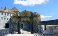
(3) Go round the cross via the path to avoid the main road on your left. Then continue along Rue du Tilleul until you reach the cemetery. Take Route de la Chapelle on your left and climb up to the Chapel of Notre-Dame de Bon Secours. There’s a lovely view over the valley. Continue climbing the road until the next junction.

(4) Take the path on your right, heading towards Le Souillet, then Le Tessaire. Ignore all other paths until you reach the road.

(5) Take care and continue along the road for 200 m. Then take the forest track on your right. 100 m further on, take a path on your left.

(6) Carry on straight ahead at the junction, then at the fork much further on, take the path on the right towards the Sapin Président de Bannans. Walk past it and continue for about 150 metres.

(7) Turn right. Continue along the track until you reach the sign for “Stèle Marie-Hélène”.

(8) Turn left and walk for 100 metres. When you reach the memorial, carry on downhill until you come to a hunting lodge. Continue until you reach the forest track.

(9) Take it on your right, pass the cross, then turn left at the first path. At a place called La Corne à Poulain, the path turns into a forest track, leading to a junction at Combe Donjean.

(10) Take the path leading uphill on your left towards the hut, then carry on straight ahead, passing another hut. Continue until you reach the road.

(11) Head down the road on your right to reach the village of La Planée. Take the Route de Vaux, pass the town hall and continue to the church.

(12) Take the road going uphill on your left and continue uphill to the wayside cross. Then carry on to the next junction on your right.

(13) Cross the road carefully, take the forest track on your right and turn right at the first path, heading towards Oye and Pallet. Stay on this path and ignore all other tracks.

(14) When you reach a forest track, take it on your left, then look out for a path on your right shortly afterwards. Take this path and you’ll come out onto another forest track at a place called Les Prés Varaux. Continue along this track.

(15) Carry on to the left. Stay on the main track until the next junction at the hamlet of Combe à la Cloche.

(16) Turn right, then stay on the path on the left.

(17) Keep to the left and stay on this track until the next junction. Before reaching the road, head up to the right to reach the car park (S/E).

Waypoints

  1. S/E : mi 0 - alt. 3,258 ft - Car park at the Granges-Dessus Nordic Centre
  2. 1 : mi 0.71 - alt. 3,127 ft - Junction. Path
  3. 2 : mi 1.18 - alt. 2,917 ft - Junction. Forest track
  4. 3 : mi 3.09 - alt. 2,746 ft - Cross - Drugeon (rivière)
  5. 4 : mi 4.18 - alt. 3,123 ft - Junction. Path
  6. 5 : mi 5.09 - alt. 3,054 ft - Road
  7. 6 : mi 5.71 - alt. 3,146 ft - Junction
  8. 7 : mi 6.28 - alt. 3,396 ft - Junction. Forest track to the right
  9. 8 : mi 6.91 - alt. 3,451 ft - Junction. Towards the Marie-Hélène memorial
  10. 9 : mi 7.25 - alt. 3,360 ft - Cross
  11. 10 : mi 8.38 - alt. 3,225 ft - Junction. Combe Donjean
  12. 11 : mi 8.95 - alt. 3,248 ft - Road
  13. 12 : mi 9.93 - alt. 3,097 ft - Road junction
  14. 13 : mi 10.26 - alt. 3,205 ft - Junction. Forest road
  15. 14 : mi 11.56 - alt. 3,136 ft - Les Prés Varaux
  16. 15 : mi 12.1 - alt. 3,196 ft - Junction
  17. 16 : mi 12.58 - alt. 3,196 ft - Junction
  18. 17 : mi 13.13 - alt. 3,264 ft - Fork in the path.
  19. S/E : mi 13.97 - alt. 3,264 ft - Car park at the Granges-Dessus Nordic Centre

Notes

Rest area at La Chapelle Notre-Dame de Bon Secours.

Hunting lodge.

One slight drawback of this walk: lots of forest tracks.

This route passes through a protected area, which may be subject to special regulations:

Worth a visit

You can make a round trip to the Oratory of the Sacred Heart, which is on your right when you’re on the road right at the start of the walk.

Memorial to Marie-Hélène Wuilleumier, a Resistance fighter executed by the Nazis on 13 July 1944. Born on 17 August 1907 in Paris, she held a Bachelor’s degree in Arts, a D.E.S. in Philosophy, and was a graduate of the École du Louvre; she was an agrégée teacher at the Collège Sévigné in Paris. Having joined the Resistance at a very early stage as part of the ‘Périclès’ network, in 1944 she joined the staff of Lieutenant-Colonel Lagarde, commander of the Doubs-Jura Border Group, where she took charge of intelligence operations.

Reviews and comments

2.7 / 5
Based on 1 review

Reliability of the description
4 / 5
Ease of following the route
2 / 5
Route interest
2 / 5
Mamychoupette
Mamychoupette

Hello, thank you for your message.
I might not be very good at using this app, as I can’t see what you mean by the GPS point you mention in your reply. I think there’s something I’m missing.
If you could help me, I’d be very grateful.
Sorry to bother you.
Many thanks, kind regards
Michèle

Machine-translated

nature25
nature25

Good evening, MamyChoupette,
I’m the author of this walk; I can see that a moderator has already replied to you.
Having done the walk a very long time ago, I’m afraid I can’t be of any further help!!
I’m really sorry about that. I spend a lot of time writing and publishing my route descriptions, so I’m extremely surprised.
The moderators check them, and then I check them again as well.
To be able to give you a precise answer, I’ll need to go back to the site.
I don’t know if you used the GPS waypoint – it’s always safer, and you’d have seen that there was another path leading to point 7.
Kind regards
Sylvie

Machine-translated

Mamychoupette
Mamychoupette

Hello, thank you for your reply.
We’re sorry we didn’t complete the whole walk, but perhaps we missed something along the route. It’s true that the path leading to point 6 was virtually impassable: we were walking in ruts, sometimes through puddles (it had rained the day before), and there were lots of brambles scratching our legs. We didn’t always know where to put our feet. Perhaps we shouldn’t have taken that path. Yet, according to Visorando, we were on the right track. We’ll try again anyway, perhaps starting from Ste Colombe, as we don’t like to be left wanting and would like to understand where we went wrong.
Thanks again for your hiking posts,
have a lovely day
Kind regards
Michèle

Machine-translated

lemarcheur65
lemarcheur65 ★

Hello Mamychoupette

That’s quite surprising!

However, please note what is written in the introduction =>

An easy walk along lovely paths, though, unfortunately, with a few forest tracks.
I’d recommendusing the Visorando app or a GPS for peace of mind

I have, however, made some changes to the description.

Machine-translated

Mamychoupette
Mamychoupette

Overall rating : 2.7 / 5

Date of your route : Aug 25, 2026
Reliability of the description : ★★★★☆ Good
Ease of following the route : ★★☆☆☆ Disappointing
Route interest : ★★☆☆☆ Disappointing
Very busy route : No

We were very disappointed with this route. We got stuck at point 6; at the junction, it was impossible to carry on straight ahead as stated in the description – there was no path. We were never able to reach the ‘Presidential Fir’ in Bannans and had to turn back. It’s a real shame, as the whole route must have been very interesting.

Machine-translated

Other walks in the area

For more walks, use our search engine .

The GPS track and description are the property of this route's author. Please do not copy them without permission.