Country:

 City:
City:


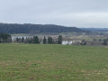
Park in the car park at the Maison de la Réserve, on the outskirts of Labergement-Sainte-Marie, heading towards Mouthe.
Yellow and blue markings
(S/E) Carefully cross the Mouthe road at the farm building opposite the Maison de la Réserve. Opposite this farm, turn right onto a path that is a bit muddy at first, then becomes grassy further on. This path heads south-west, running parallel to the Mouthe road; further on, it overlooks the River Doubs before joining the D439 towards Rochejean.
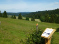
(1) Cross this road and set off opposite onto the Route de Chez le Maître. After 200 metres, ignore the path branching off to the right at the Belvédère des Deux Lacs (a lovely alternative route) and continue southwards towards Rochejean and Gare Longevilles.
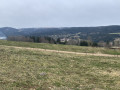
(2) At the large junction at Mont de la Croix (elevation 947), carry on straight ahead along the Chemin de Chez le Maître towards Rochejean. You will enter the Mont-Sainte-Marie state-owned forest. This path winds southwards before curving eastwards. Follow the signposts and ignore all the paths branching off to the right or left. At a hunting car park, the landscape opens up, offering beautiful views of the Mont d’Or. You’ll arrive at Les Granges Vannod, with its large Franche-Comté-style houses nestled in a tight left-hand bend.
(3) Follow the Route des Granges Vannod, which begins a wide hairpin bend to the east, then to the south. Continue along this road until you reach the T-junction with the D45, at the entrance to Rochejean.
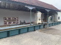
(4) Turn left onto Rue de la Fontaine; you’ll pass a large drinking trough. Continue eastwards along Rue Saint-Jean, towards “Le Mont d’Or”, at the right-hand corner of a large Franche-Comté-style building. You’ll pass the town hall and come within sight of the village church.
(5) Turn right at the church onto a small path bordered on the left by a parapet. After a short descent, the path leads to a bridge over the Doubs. An information panel to the right of the bridge recounts the history of iron and blast furnaces. Cross the Doubs and walk up Rue du Haut Fourneau to the junction with the D45. Cross this road carefully and follow it up to the left towards Longevilles-Mont d’Or.
(6) After about 1 km, as you enter Les Longevilles, turn left onto Rue de la Gare. When you see the slate-clad building of Longevilles-Rochejean station and are level with it, turn right, just after a house, towards the Gorges du Fourperet. You’ll walk alongside the Doubs on a narrow grassy path. You’ll reach Rue du Doubs; turn left and, a little further on, cross the bridge over the Leat Rouge.
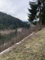
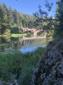
(7) Just after this bridge, at elevation 897, turn left onto a narrow path towards the Gorges du Fourperet. This path winds through the woodland alongside the River Doubs and requires a degree of caution due to the numerous roots protruding from the surface. Further on, the path veers away from the Doubs to join a wider track, which you follow to the left. This track runs slightly above the Doubs and rejoins its bank further on.
(8) As you approach a railway bridge visible on the opposite bank, this path climbs steeply and briefly to your right to join the road to Fourcatier and Maison Neuve. The climb is very steep and can be dangerous in wet weather.
Follow the Route de Fourcatier north-west; it runs alongside the gorges for a short while before winding its way through the forest. At the 932-metre mark, the view opens out; continue along the road.
(9) At the junction, leave the tarmac road to the left and follow a dirt track uphill for 30 metres, which leads to a crossroads (with a water tower on your right). Turn left onto a ridge path that crosses a large pasture. At elevation 943, and well before the farm below, turn right onto a track suitable for vehicles that crosses Fin-dessus. At the next T-junction, turn right onto the road which descends steeply. Ignore two streets on your left before reaching the Grande Rue de Labergement near the railway bridge. Turn left under this bridge. Cross the Route de Mouthe at the pedestrian crossing, in front of the café, and keep to the right to cross the River Doubs.
Unmarked section
(10) Immediately after the bridge, turn right at the corner of a large house onto the Chemin des Meules. You’ll enter a large meadow. After 300 metres, turn left at a 90-degree angle towards Labergement School. Just past a small basketball court, turn right onto a footpath running parallel to the Route du Lac. You’ll pass the Camping du Lac and turn left past the picnic tables onto a track leading towards the small lake at Remoray (Plan d’eau de la Seigne). Walk up the left-hand side of the lake. Take a look at the heronry on the island in the middle of the lake. Further on, you’ll reach the south-eastern corner of the lake (La Seigne).
(11) Turn left onto a path signposted ‘Maison de la Réserve’. Walk slightly uphill for 300 metres before turning left onto a footpath that takes you back to the reserve’s car park (S/E).

 Visorando Member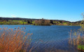

 Easy
Easy 
 Association / Club / Walk leader