


Refine your search for walks in Saxon
Saxon walks
 La Tzoumaz - Nendaz
 Visorando Member
 9.23 mi
 +2,001 ft
 -2,372 ft
 6h 00
6h 00
 Moderate
 Departure from Riddes (Valais)
The elevation profile says it all about this day. Most of the route runs along the Grand Bisse de Saxon. This section has been beautifully restored. In Taillay, you will discover a water wheel and a hammer powered by the stream. This ingenious invention was an alarm signal. The sound of the hammer could be heard 2 km away. The absence of sound alerted the bisse guard. You will recognise the Muverans massif on the other side of the Rhône valley.
Grand Chavalard Circuit starting from L’Erié
 7.34 mi
+2,940 ft
-2,943 ft
5h 55
Moderate
Departure from Fully (Valais)
7.34 mi
+2,940 ft
-2,943 ft
5h 55
Moderate
Departure from Fully (Valais)
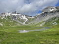
A very beautiful circular walk, offering magnificent views of the Grande Dent de Morcles, the lakes of Fully and the Mont Blanc massif, before finishing with a panoramic view over the Rhône Valley and the peaks of Valais.
The Grand Chavalard circular walk starting from Lérié and via the Fully Lakes
 10.57 mi
+5,817 ft
-5,827 ft
9h 55
10.57 mi
+5,817 ft
-5,827 ft
9h 55
 Very difficult
Departure from Fully (Valais)
Very difficult
Departure from Fully (Valais)
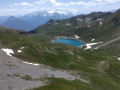
A circular route around the Grand Chavalard, passing by the Fully Lakes and the Col de Fenestral. The ascent of the Grand Chavalard itself is optional (a return leg), but it is, of course, from the summit that the view is best!
Col des Planches - La Tzoumaz
 8.55 mi
+3,048 ft
-2,720 ft
6h 35
8.55 mi
+3,048 ft
-2,720 ft
6h 35
 Difficult
Departure from Vollèges (Valais)
Difficult
Departure from Vollèges (Valais)
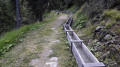
During this first stage, you will discover part of the Old Saxon Bisse (the longest of the bisse: 26 km from its water source in Siviez to La Boveresse). The bisse starts at the point (6). Built in the 1850s, the pipes no longer exist, so you will have to wait until you reach La Tzoumaz to finally see water flowing along the path. The bisse is currently being restored in sections.
From Col des Planches to Grimentz via the bisses trail
 62.19 mi
+17,077 ft
-16,499 ft
6 days
Difficult
Departure from Vollèges (Valais)
62.19 mi
+17,077 ft
-16,499 ft
6 days
Difficult
Departure from Vollèges (Valais)
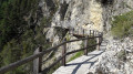
The word ‘bisse’ is used in Valais to refer to an irrigation channel carrying water from the mountains to farmland. They may be buried underground, carved into the rock or suspended from cliffs. Some bisses date back over 500 years and their channels have deteriorated or even ceased to exist following rockfalls. Water is therefore not available everywhere, despite efforts to restore this precious heritage.Over the course of six days, you will explore these trails steeped in history.
The Pierre Avoi from the Col des Planches
 12.93 mi
+4,957 ft
-4,948 ft
10h 15
Difficult
Departure from Vollèges (Valais)
12.93 mi
+4,957 ft
-4,948 ft
10h 15
Difficult
Departure from Vollèges (Valais)
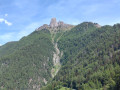
Pierre Avoi is the local dialect term for ‘rock worth seeing’: that certainly makes you want to go there! It is an isolated rocky peak on the Verbier ridge, making it an iconic summit. The route suggested here, starting from the Col des Planches, is a slightly less busy alternative to the one from Verbier or Savoleyres.
The Farinet Footbridge
6.84 mi
+1,486 ft
-1,545 ft
4h 25
Moderate
Departure from Chamoson (Valais)
An autumn walk through the lands of Farinet, the Robin Hood of Valais, a beautiful climb through the vineyards to a spectacular footbridge that crosses the Salentze valley at a height of over 130 metres. There are no particular difficulties, but the footbridge is strongly discouraged for people who are prone to vertigo. The thermal baths of Saillon, 500 m from the finish, offer a great way to relax at the end of the day.
Ovronnaz – Lac de Derborence Mountain Hut
11.10 mi
+4,803 ft
-4,505 ft
9h 15
Very difficult
Departure from Leytron (Valais)
The hike described below covers the first of two days of the Tour des Muverans. It connects the resort of Ovronnaz (chairlift car park) with the Lac de Derborence mountain hut, crossing the Col de la Forcle (2,543 m), the highest point of the route.
From Ruinettes to La Chaux
1.36 mi
+243 ft
-46 ft
0h 50
 Easy
Departure from Bagnes (Valais)
Easy
Departure from Bagnes (Valais)
An extremely easy walk on a very gentle slope. Take the ski lifts from Verbier to Ruinettes (or walk up), and you can continue to Mont-Fort by cable car. At La Chaux, the restaurant “Le Dahu”, with sun loungers and occasional entertainment (such as concerts), awaits you.
Six Blanc mountain, Mont Brûlé and Col de Mille
 11.59 mi
+3,504 ft
-3,530 ft
8h 25
Difficult
Departure from Bagnes (Valais)
11.59 mi
+3,504 ft
-3,530 ft
8h 25
Difficult
Departure from Bagnes (Valais)
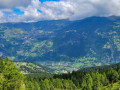
A challenging loop with alternating gentle climbs and easy descents, offering magnificent views of the Val de Bagne on one side and Orsières on the other. There are also numerous views of the French and Swiss Alps in good weather.
Nendaz - Veysonnaz
 8.84 mi
+1,781 ft
-1,870 ft
5h 35
Moderate
Departure from Nendaz (Valais)
8.84 mi
+1,781 ft
-1,870 ft
5h 35
Moderate
Departure from Nendaz (Valais)
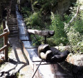
Two bisses are on the agenda for this third day. Very quickly in Nendaz, you will reach the "Bisse Vieux" against the current, then after Planchouet, you will stroll along the magnificent "Grand Bisse de Vex". Opposite, the Rhône valley is often visible, and you will clearly see the Derborance and Sanetsch valleys, Mont Gond, the Wildhorn and its glacier.
Cleuson Dam
7.96 mi
+3,084 ft
-3,071 ft
6h 20
Moderate
Departure from Nendaz (Valais)
A lovely hike starting from Siviez, beginning with the chairlift (15 FS for the ascent). Then take the path along the mountainside to reach the lake. Next, head downhill back to the starting point.
The Bisses of Nendaz
5.71 mi
+1,115 ft
-1,122 ft
3h 35
Easy
Departure from Nendaz (Valais)
The Nendaz plateau was once a productive orchard before being overdeveloped. This productivity was partly due to the water supply provided by the four irrigation channels diverted from the River Printse. The suggested route follows the course of two of these man-made channels and also links two village chapels. An easy, shaded and refreshing route for a hot day.
Vernayaz – Le Trétien via the Route des Diligences
 5.90 mi
+2,936 ft
-981 ft
5h 15
Moderate
Departure from Vernayaz (Valais)
5.90 mi
+2,936 ft
-981 ft
5h 15
Moderate
Departure from Vernayaz (Valais)
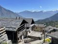
This beautiful route follows part of the “Route des Diligences”, which, in themid-19th century, alongside the arrival of the railway, led to the boom in tourism in the Trient Valley. The hike also offers the chance to admire the historic chalets in the villages of Les Granges, Les Marécottes and Le Trétien.Accessible by public transport.
Vernayaz Waterfalls Circular Path
 11.65 mi
+5,085 ft
-5,072 ft
9h 45
Very difficult
Departure from Vernayaz (Valais)
11.65 mi
+5,085 ft
-5,072 ft
9h 45
Very difficult
Departure from Vernayaz (Valais)
This route, starting from Vernayaz, takes in some of the most iconic sites from the early days of tourism in Valais: the Route des Diligences, the Dailley Gorges and the Pissevache Waterfall. To complete a circular route, take a lovely balcony path beneath the Dent du Salentin. This allows you to enjoy the spectacular route through the Dailley Gorges as part of a day’s walk, rather than just a return trip from the car park.
A circular walk through the Dailley Gorges starting from Les Granges
 2.60 mi
+1,263 ft
-1,260 ft
2h 20
Moderate
Departure from Salvan (Valais)
2.60 mi
+1,263 ft
-1,260 ft
2h 20
Moderate
Departure from Salvan (Valais)
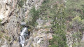
This is a short but picturesque walk. You’ll climb 656 steps alongside a waterfall, using several wooden staircases of excellent quality. You’ll then pass through a charming little valley before descending much more gently back to the starting point.
Circular Marecot from Salvan
 2.15 mi
+623 ft
-604 ft
1h 30
Easy
Departure from Salvan (Valais)
2.15 mi
+623 ft
-604 ft
1h 30
Easy
Departure from Salvan (Valais)
A circular route around Salvan, passing through Le Marecot.
Follow the route with the Visorando app
Salvan - Auberge de Salanfe
 5.21 mi
+3,504 ft
-646 ft
5h 25
Difficult
Departure from Salvan (Valais)
5.21 mi
+3,504 ft
-646 ft
5h 25
Difficult
Departure from Salvan (Valais)
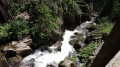
From the hamlet of Les Granges to Van d’en Bas, you’ll make your way up through the Dailley Gorges via daring structures, footbridges, tunnels and vertiginous staircases. The Salanfe river cascades down the steep gorges in a series of terraces. The view is breathtaking. You’ll enjoy numerous vantage points overlooking the Alpine peaks.You’ll cross the magnificent Vallon de Van. In the evening in Salanfe, you’ll already be able to admire the Dents du Midi standing out against the backdrop of the lake
Tour of the Dents du Midi and Petits Perrons
 47.88 mi
+21,716 ft
-21,296 ft
7 days
Difficult
Departure from Salvan (Valais)
47.88 mi
+21,716 ft
-21,296 ft
7 days
Difficult
Departure from Salvan (Valais)
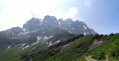
Starting in Salvan and finishing in Les Marécottes (VS, Switzerland), this hike is almost circular. The route combines several circuits. In the Val de Trient, you’ll discover the Dailley Gorges and the Vallon de Van.You will complete the entire Tour des Dents du Midi and enjoy this magnificent mountain range as well as the Sauflaz Gorges.You’ll make a short detour onto the Tour des Dents Blanches, which you can admire from the Barme plateau.
A circular walk from Van d’en Bas to Sex des Granges and Lake Salanfe
 9.98 mi
+5,784 ft
-5,758 ft
9h 35
Very difficult
Departure from Salvan (Valais)
9.98 mi
+5,784 ft
-5,758 ft
9h 35
Very difficult
Departure from Salvan (Valais)
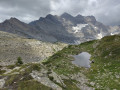
Le Sex des Granges (2,082 m) is the first peak on the ridges surrounding Lake Salanfe. This circular walk takes you along the ridges, offering superb views, as well as a stroll along the lakeshore.
Champex - Trient
 10.17 mi
+3,022 ft
-3,573 ft
7h 20
Moderate
Departure from Orsières (Valais)
10.17 mi
+3,022 ft
-3,573 ft
7h 20
Moderate
Departure from Orsières (Valais)
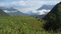
stage 7 of the Tour du Mont Blanc from Champex (Switzerland) to Trient via the Col de la Forclaz.
Le Belvedere
 4.53 mi
+2,110 ft
-2,093 ft
3h 55
Moderate
Departure from Orsières (Valais)
4.53 mi
+2,110 ft
-2,093 ft
3h 55
Moderate
Departure from Orsières (Valais)
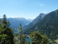
This is a variation on the Sentier Le Belvedere walk which is described in the Pays du St-Bernard tourist booklet.
Sentier du Bisse
 2.55 mi
+525 ft
-522 ft
1h 40
Easy
Departure from Orsières (Valais)
2.55 mi
+525 ft
-522 ft
1h 40
Easy
Departure from Orsières (Valais)
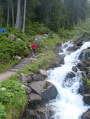
A short and easy walk from Champex Lac, taking the well signposted and good paths beside the Bisse. These are the water channels made to control and route the flow of water for irrigation purposes. The path returns to Champex via part of the Tour du Mont Blanc (TMB) path.
A circular route to the Panossière Hut starting from the Cabane Brunet car park
 9.99 mi
+3,497 ft
-3,484 ft
7h 40
Difficult
Departure from Bagnes (Valais)
9.99 mi
+3,497 ft
-3,484 ft
7h 40
Difficult
Departure from Bagnes (Valais)
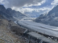
A magnificent route in the heart of the Val de Bagnes, with breathtaking views of the Combins massif and its glaciers. The route starts at the Brunet hut, continues to the Corbassière footbridge and then climbs to the Panossière hut. It largely follows the Bec de Sery circular trail, ascending the Col des Avouillons on the way out and continuing the circuit via La Maille on the way back.
Champex-Lac to Trient -Tour Mont Blanc
 Association / Club / Walk leader8.96 mi
+2,953 ft
-3,461 ft
6h 40
Difficult
Departure from Orsières (Valais)
Association / Club / Walk leader8.96 mi
+2,953 ft
-3,461 ft
6h 40
Difficult
Departure from Orsières (Valais)
This 8th stage of the Tour Mont Blanc (TMB) offers two options, the tough one via Fenetre D'Arpette and the somewhat easier option over Porte à l'Ô. Here's the second version, past Plan de L' au, over Alpage de Bovine and Porte à l'Ô, past the Col de la Forclaz to drop down to Trient. Let's do it!
The TMB is a classic long-distance footpath that goes around Mont Blanc, passing from France into Italy and through Switzerland before returning to France.
Champex-Lac - Liddes
 7.28 mi
+1,923 ft
-2,441 ft
5h 00
Moderate
Departure from Orsières (Valais)
7.28 mi
+1,923 ft
-2,441 ft
5h 00
Moderate
Departure from Orsières (Valais)
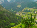
This third stage is fairly short and relaxing. It allows you to enjoy Champex and its lake a little longer. After the village of Orsières, you will follow a forest path on the left bank of the Dranse d'Entremont, then on its right bank before climbing up to the village of Liddes.
Champex to Cabane d'Orny and return via La Breya summit and ski lift.
 7.85 mi
+5,551 ft
-3,284 ft
8h 25
Difficult
Departure from Orsières (Valais)
7.85 mi
+5,551 ft
-3,284 ft
8h 25
Difficult
Departure from Orsières (Valais)
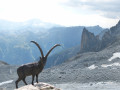
A circular walk from Champex Lac; ascending the tranquil and beautiful Combe d'Orny and joining the path to the Cabane d'Orny where there are refreshments available. The descent is via the path back to the La Breya ski lift taking in an optional ascent of La Breya. (It is also possible to descend by foot via the Val d' Arpette or from the ski lift, similarly the walk can be shortened and height gain reduced by taking the ski lift up.)
Champex to Cabane d'Orny via the Col de la Breya.
 7.01 mi
+5,509 ft
-3,251 ft
8h 00
Difficult
Departure from Orsières (Valais)
7.01 mi
+5,509 ft
-3,251 ft
8h 00
Difficult
Departure from Orsières (Valais)
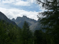
A circular walk from Champex Lac; ascending via the Bisses to the Arpette valley and then taking the path uphill through forest to the Col de la Breya. Then descending and joining the path to the Cabane d'Orny (refreshments available). The descent is via the path back to the La Breya chair lift taking in an optional ascent of La Breya.
6th stage of the Tour du Mont Blanc (TMB)
 7.75 mi
+4,652 ft
-4,564 ft
7h 35
Difficult
Departure from Orsières (Valais)
7.75 mi
+4,652 ft
-4,564 ft
7h 35
Difficult
Departure from Orsières (Valais)
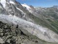
6th stage of the Mont Blanc tour: from the Relais d'Arpette to the Forclaz Pass via la Fenêtre d'Arpette.
Veysonnaz - Vernamiège
 13.83 mi
+3,550 ft
-3,753 ft
9h 25
Difficult
Departure from Veysonnaz (Valais)
13.83 mi
+3,550 ft
-3,753 ft
9h 25
Difficult
Departure from Veysonnaz (Valais)
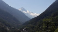
The fourth day is a long stage, using a variation on the "Chemin des Bisses" trail from La Luette.
This interesting alternative in hot weather allows you to reach Vernamiège via a new trail created in 2015, "La Luette-Ossona-Les Prixes", via the Grande Combe footbridge. The elevation gain is less than on the traditional route. You will follow the large Bisse de Vex to the Mayens de Sion. You will pass through two typical villages in the Val d'Hérens: Hérémence and Euseigne.
 Tracouet as seen from Veysonnaz
28.31 mi
+7,136 ft
-7,106 ft
4 hrs
Moderate
Departure from Veysonnaz (Valais)
A very beautiful route through the Veysonnaz and Nendaz region. The route consists entirely of forest tracks. The hike begins at the Veysonnaz resort, heading into the Ojentze valley and passing through La Giettaz. The next stop is Planchouet, with its two excellent restaurants. The walk then passes through La Planie and along the Tracouet road, which winds its way through the forest to the top of the Trancouet cable car (Nendaz resort). The return route takes you via Prarion and its larch trees, some of which are several hundred years old (600 years). The walk also passes through Haute-Nendaz, Pracondu, Sofleu, Sarclenze, the Scie bridge, La Giettaz and Veysonnaz.
Louvie Hut - Prafleuri Hut
 7.26 mi
+4,019 ft
-2,654 ft
6h 50
Difficult
Departure from Bagnes (Valais)
7.26 mi
+4,019 ft
-2,654 ft
6h 50
Difficult
Departure from Bagnes (Valais)
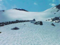
This sixth stage takes place in the high mountains and, depending on the season, may involve crossing snowfields.From Lake Louvie, climb up to Col Termin and rejoin the balcony path that comes from the Montfort Hut. Continue to Col de Louvie (possibility of snowfields). After descending Col de Louvie, the path passes at the foot of the Grand Désert Glacier. The trail then crosses scree; look out for the red and white markings and follow the signs for Prafleuri. Climb Col de Prafleuri. Descend to Torrent de Prafleuri (small bridge); on the left, a trail leads to the Prafleuri Hut.
Louvie Hut - Prafleuri Hut
 6.32 mi
+3,501 ft
-2,103 ft
8 hrs
Very difficult
Departure from Bagnes (Valais)
6.32 mi
+3,501 ft
-2,103 ft
8 hrs
Very difficult
Departure from Bagnes (Valais)
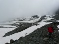
The second stage of the route involves crossing two passes, the Louvie and the Prafleuri, both of which were snow-covered.
Brunet Hut - Louvie Hut
 5.46 mi
+3,333 ft
-2,930 ft
5h 25
Difficult
Departure from Bagnes (Valais)
5.46 mi
+3,333 ft
-2,930 ft
5h 25
Difficult
Departure from Bagnes (Valais)
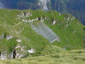
This fifth stage crosses the Val de Bagnes. To the right of the Cabane Brunet, follow the path that descends directly to Fionnay. Be careful, this very steep path with countless tree roots can be slippery and dangerous in wet weather. Cross the road that leads to Fionnay. The path to the Louvie Hut is signposted in the centre of the village, on the right bank of the torrent. The trail is well marked all the way to the hut. Ibex often come close to the hut. A little further on, it is possible to see chamois.
Brunet Hut - Panossière Hut
 4.16 mi
+2,815 ft
-1,070 ft
4h 20
Moderate
Departure from Bagnes (Valais)
4.16 mi
+2,815 ft
-1,070 ft
4h 20
Moderate
Departure from Bagnes (Valais)
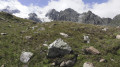
The route passes through the Col des Avouillons before descending to the rest of the Corbassière glacier, which is crossed via a spectacular 200 m long footbridge over a 70 m drop. The high mountains reveal themselves after the pass in a grandiose setting.
Cabane de Mille - Cabane Brunet
 4.53 mi
+686 ft
-1,909 ft
2h 40
Moderate
Departure from Liddes (Valais)
4.53 mi
+686 ft
-1,909 ft
2h 40
Moderate
Departure from Liddes (Valais)
This stage was shortened due to bad weather. The plan was to go via Mont Rogneux. This is a short stage that allows you to avoid Mont Rogneux when it is in thick fog. However, if the weather improves in the afternoon, it is possible to climb from the Cabane Brunet to the Goli des Otanes. You will then walk alongside pastures where Herens cows graze.
Cabane de Mille - FXB Panossière hut
 8.78 mi
+3,245 ft
-2,762 ft
6h 50
Difficult
Departure from Liddes (Valais)
8.78 mi
+3,245 ft
-2,762 ft
6h 50
Difficult
Departure from Liddes (Valais)
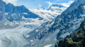
Between Mont Blanc and Monte Rosa, the Grand Combin stands out from everywhere. Forming the border between Switzerland and Italy, and the boundary between the Grand Saint-Bernard valley and the Val de Bagne, it rises to 4,314 m. The tour takes seven days; I added an extra day to visit the Fenêtres lakes, the icing on the cake. Each stage offers alpine accommodation.
Pointe d'Orny : out and return from the La Breya ski lift.
 8.35 mi
+4,577 ft
-4,564 ft
7h 50
Difficult
Departure from Orsières (Valais)
8.35 mi
+4,577 ft
-4,564 ft
7h 50
Difficult
Departure from Orsières (Valais)
An ascent of an easy alpine peak starting from the La Breya ski lift and via the Orny and Trient mountain huts. Superb views over the Trient Plateau.
Fionay - Cabane de Louvie
 2.01 mi
+2,592 ft
-177 ft
3h 10
Moderate
Departure from Bagnes (Valais)
2.01 mi
+2,592 ft
-177 ft
3h 10
Moderate
Departure from Bagnes (Valais)
First stage of the trek linking the village of Fionay to Saas Fee. A pleasant stage to reach the Cabane de Louvie, built on the edge of the lake of the same name.
Trek from Fionay to Saas-Fee
 63.00 mi
+27,582 ft
-26,322 ft
7 days
Very difficult
Departure from Bagnes (Valais)
63.00 mi
+27,582 ft
-26,322 ft
7 days
Very difficult
Departure from Bagnes (Valais)
In the Swiss valley, this particularly pleasant hike allows you to explore the many 4000 m peaks that surround the route.
N.B. this route is outlined on Openmap which doesn't have the details of our fine IGN maps. Before being able to get your hands on a Swiss map, which are more precise, the route and GPS layouts will be handy for this pleasant trek.
Lac de Derborence Mountain Hut – Ovronnaz
14.26 mi
+7,126 ft
-7,428 ft
12h 45
Very difficult
Departure from Conthey (Valais)
The path winds through mountain pastures at the foot of the Diablerets on the border between the cantons of Vaud and Valais, circling the Grand Muveran (3,051 m) and crossing the pass linking it to the Petit Muveran (2,811 m). The panoramic views it offers of the great Alpine peaks (Grand Combin, Dents du Midi, Mont Blanc, etc.) are magnificent.
Liddes - Cabane Brunet
 8.55 mi
+4,462 ft
-1,932 ft
7h 50
Very difficult
Departure from Liddes (Valais)
8.55 mi
+4,462 ft
-1,932 ft
7h 50
Very difficult
Departure from Liddes (Valais)
This fourth stage offers various views of the Combin massif. At the top of the village, head towards the Col and Cabane de Mille. After a pleasant walk through the forest, the path gradually opens up to reach Erra. The terrace of the Cabane de Mille offers a magnificent panorama of the Mont Blanc range, the Aiguilles de Chamonix and the Combin massif. At Servay (a small sheepfold after a small lake), head towards Cabane Brunet. The end of the route crosses a rather chaotic area before taking the small road that climbs up to Cabane Brunet. Superb view of the Combin mountains just behind the hut.
Liddes - Cabane de Mille
 3.40 mi
+3,927 ft
-33 ft
5h 00
Difficult
Departure from Liddes (Valais)
3.40 mi
+3,927 ft
-33 ft
5h 00
Difficult
Departure from Liddes (Valais)
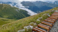
For this second stage, take the bus from the Grand Saint-Bernard Pass Hospice to the village of Liddes. Depart from Liddes and walk through large forest areas and flower-filled mountain pastures to reach the Cabane du Col de Mille.
Plan Monnay
 5.11 mi
+1,690 ft
-1,686 ft
3h 50
Moderate
Departure from Liddes (Valais)
5.11 mi
+1,690 ft
-1,686 ft
3h 50
Moderate
Departure from Liddes (Valais)
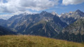
A lovely circular walk for a half day out which is good if the weather is forecast to deteriorate in the afternoon. It can also be extended if you want a longer walk. Amazing views from the top of Plan Monnay.
Bovonne Circular
6.00 mi
+2,274 ft
-2,267 ft
4h 45
Difficult
Departure from Bex (Vaud)
The start is steep and difficult for over 3 km. After that, it’s easy and the view from the top is stunning. Bovonne Farm is no longer of any interest in itself – the refreshment bar and warm welcome are a thing of the past. However, you can still buy cheese there (make sure you have Swiss francs in cash).
Raccard du Blé
 5.03 mi
+1,657 ft
-1,650 ft
3h 45
Easy
Departure from Orsières (Valais)
5.03 mi
+1,657 ft
-1,650 ft
3h 45
Easy
Departure from Orsières (Valais)
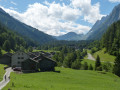
A circular walk in the lower part of the Swiss Val Ferret. One of the walks publicized by the tourist office and well signposted. There are information boards (in French) about the construction of traditional barns made from local stone and timber. Easy walking, navigation and some interesting information. The first section is on a quiet road.
Savièse Bisse or Bisse du Torrent Neuf
5.46 mi
+2,933 ft
-2,920 ft
5h 05
Moderate
Departure from Savièse (Valais)
A very well-signposted ‘tourist’ route with informative and historical signs explaining the historical role and construction methods of the bisses – these irrigation channels that carried water to the farmland. No difficulties for those with a head for heights, but even though the route is well-maintained and safe, the drop below is sometimes very noticeable and there are several footbridges that may be daunting.
Panossière Hut - Chanrion Hut
 9.72 mi
+3,921 ft
-4,501 ft
7h 55
Very difficult
Departure from Bagnes (Valais)
9.72 mi
+3,921 ft
-4,501 ft
7h 55
Very difficult
Departure from Bagnes (Valais)
This is a fairly long stage but set against a magnificent backdrop. The Mauvoisin dam is impressive, as are all the waterfalls along the right bank of the lake. The route passes through the easy and beautiful Tsofeiret Pass.