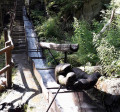
Savièse Bisse or Bisse du Torrent Neuf

A very well-signposted ‘tourist’ route with informative and historical signs explaining the historical role and construction methods of the bisses – these irrigation channels that carried water to the farmland. No difficulties for those with a head for heights, but even though the route is well-maintained and safe, the drop below is sometimes very noticeable and there are several footbridges that may be daunting.

Details

104678735
Creation:
Last update:
Last review:
  • Walking
    Activity: Walking
  • ↔
    Distance: 5.46 mi
  • ◔
    Average duration: 5h 05 
  • ▲
    Difficulty: Moderate

  • ⚐
    Back to start: Yes
  • ↗
    Ascent: + 2,933 ft
  • ↘
    Descent: - 2,920 ft

  • ▲
    Highest point: 4,173 ft
  • ▼
    Lowest point: 3,704 ft

Description of the walk

Park at the Bisse du Torrent Neuf car park (Car Park P1) and follow the signs to the irrigation channel. Please note that there is a second car park further down, which also provides all the information you need to reach the starting point.

From the car park (S), follow the signs to the start of the bisse at the Vouasseurs refreshment bar (1), then continue on a return walk to the Chalet de Brac (2) following the historic route of the Bisse du Torrent Neuf.

Waypoints

  1. S/E : mi 0 - alt. 3,704 ft - Start point / car park P1
  2. 1 : mi 0.66 - alt. 3,796 ft - Buvette des Vouasseurs
  3. 2 : mi 2.73 - alt. 3,944 ft - Chalet de Brac
  4. S/E : mi 5.46 - alt. 3,704 ft - Finish / car park P1

Notes

Other walks in the area

For more walks, use our search engine .

The GPS track and description are the property of this route's author. Please do not copy them without permission.