Country:

 City:
City:


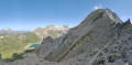
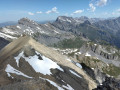
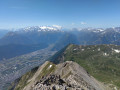
Start from the Lérié car park, accessible via a track from the village of Chiboz.
(S/E) From the car park, take the Red and White-marked path heading south towards Sorniot. The path runs along the mountainside, climbing gently for quite some time.
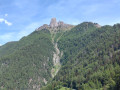
(1) At the first junction, turn right onto a blue and white-marked path towards the Grand Chavalard. The path climbs steeply up a valley. Pass several avalanche barriers and reach a ridge.
(2) Follow the ridge to the right (north) and climb a secondary summit, the Dent de Fully.
(3) Continue along the ridge to the north-east to reach the summit of the Grand Chavalard.
(4) Descend via the same route to the junction at the bottom of the valley.
(1) Turn right towards Sorniot.
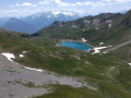
(5) At the next junction, veer right onto a path that crosses scree and goes round the Lower Lake of Fully, situated below on the left. You will reach a junction near some buildings.
(6) Then take a track that veers slightly to the right (north-west) towards the Upper Lake of Fully (do not take the path that starts from the same spot and climbs directly to the Col de Fenestral). Continue along this track until you are directly above the lake’s dam.
(7) Turn left and carry on along the track (ignore a path leading off to the right). Then take a hairpin bend to the right and climb up to the shore of the Upper Lake of Fully.
(8) Follow the track along the right-hand side of the lake.
(9) At the northern end of the lake, continue along a path that climbs towards the Cabane du Fenestral. Head north, then east.
(10) Join another path and follow it to the left as far as the Cabane de Fenestral.
(11) Then turn right to quickly reach the pass of the same name.
(12) Head back down the north-eastern slope and go straight on into the valley. Further on, cross a wetland area and arrive at a crossroads.
(13) Carry on straight ahead towards Petit Pré, passing directly beneath the Greppon Blanc.
(14) At a fork in the road, keep to the right, leaving a chairlift station on your left. Ignore a few paths branching off to the left and you’ll reach the Lui d’Août Lodge.
(15) Just past the lodge, carry on straight ahead, ignoring a path that climbs to the right. Stay on this path until it joins a wide track. Follow this track to the right to quickly reach the Lérié car park (S/E).
 Visorando Member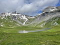
 Moderate
 Difficult