


Cleuson Dam


A lovely hike starting from Siviez, beginning with the chairlift (15 FS for the ascent). Then take the path along the mountainside to reach the lake. Next, head downhill back to the starting point.
Details
Creation:
Last update:
Last review:
–
–
-
 Activity: Walking
 -
 Distance: 7.96 mi
 -
 Average duration: 6h 20
 -
 Difficulty: Moderate
 -
-
 Back to start: Yes
 -
 Ascent: + 3,084 ft
 -
 Descent: - 3,071 ft
 -
-
 Highest point: 7,756 ft
 -
 Lowest point: 5,682 ft
-
 Country:
Switzerland
Country:
Switzerland
-
 Area: Alps
 -
 City:
Nendaz
City:
Nendaz -
 Start/End: N 46.135199° / E 7.316911°
 -


 Hour-by-hour weather


Waypoints
- S/E : mi 0 - alt. 5,689 ft - Chairlift
- 1 : mi 2.28 - alt. 7,392 ft - Fork in the road
- 2 : mi 3.06 - alt. 7,651 ft - Crossroads
- 3 : mi 4.32 - alt. 7,602 ft - La Gouille
- 4 : mi 5.66 - alt. 7,090 ft - Cleuson Dam - Lac de Cleuson
- 5 : mi 6.89 - alt. 6,348 ft - Pra Mounet
- S/E : mi 7.96 - alt. 5,692 ft - Chairlift
Other walks in the area
The Bisses of Nendaz
 Visorando Member5.71 mi
+1,115 ft
-1,122 ft
3h 35
Visorando Member5.71 mi
+1,115 ft
-1,122 ft
3h 35
 Easy
Easy
 Departure from Nendaz (Valais)
The Nendaz plateau was once a productive orchard before being overdeveloped. This productivity was partly due to the water supply provided by the four irrigation channels diverted from the River Printse. The suggested route follows the course of two of these man-made channels and also links two village chapels. An easy, shaded and refreshing route for a hot day.
Nendaz - Veysonnaz
 8.84 mi
+1,781 ft
-1,870 ft
5h 35
Moderate
Departure from Nendaz (Valais)
8.84 mi
+1,781 ft
-1,870 ft
5h 35
Moderate
Departure from Nendaz (Valais)
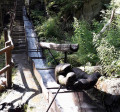
Two bisses are on the agenda for this third day. Very quickly in Nendaz, you will reach the "Bisse Vieux" against the current, then after Planchouet, you will stroll along the magnificent "Grand Bisse de Vex". Opposite, the Rhône valley is often visible, and you will clearly see the Derborance and Sanetsch valleys, Mont Gond, the Wildhorn and its glacier.
La Tzoumaz - Nendaz
 9.23 mi
+2,001 ft
-2,372 ft
6h 00
Moderate
Departure from Riddes (Valais)
9.23 mi
+2,001 ft
-2,372 ft
6h 00
Moderate
Departure from Riddes (Valais)
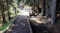
The elevation profile says it all about this day. Most of the route runs along the Grand Bisse de Saxon. This section has been beautifully restored. In Taillay, you will discover a water wheel and a hammer powered by the stream. This ingenious invention was an alarm signal. The sound of the hammer could be heard 2 km away. The absence of sound alerted the bisse guard. You will recognise the Muverans massif on the other side of the Rhône valley.
From Ruinettes to La Chaux
1.36 mi
+243 ft
-46 ft
0h 50
Easy
Departure from Bagnes (Valais)
An extremely easy walk on a very gentle slope. Take the ski lifts from Verbier to Ruinettes (or walk up), and you can continue to Mont-Fort by cable car. At La Chaux, the restaurant “Le Dahu”, with sun loungers and occasional entertainment (such as concerts), awaits you.
Veysonnaz - Vernamiège
 13.83 mi
+3,550 ft
-3,753 ft
9h 25
13.83 mi
+3,550 ft
-3,753 ft
9h 25
 Difficult
Departure from Veysonnaz (Valais)
Difficult
Departure from Veysonnaz (Valais)
The fourth day is a long stage, using a variation on the "Chemin des Bisses" trail from La Luette.
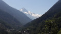
This interesting alternative in hot weather allows you to reach Vernamiège via a new trail created in 2015, "La Luette-Ossona-Les Prixes", via the Grande Combe footbridge. The elevation gain is less than on the traditional route. You will follow the large Bisse de Vex to the Mayens de Sion. You will pass through two typical villages in the Val d'Hérens: Hérémence and Euseigne.
Prafleuri hut - La Sage lodge
 12.28 mi
+4,327 ft
-7,536 ft
10 hrs
12.28 mi
+4,327 ft
-7,536 ft
10 hrs
 Very difficult
Departure from Hérémence (Valais)
Very difficult
Departure from Hérémence (Valais)
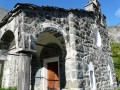
Today's stage is unusual: it starts with a descent before a long climb, a second descent and a chairlift transfer, followed by a flat walk and a bus ride to the lodge.
Cabane de Prafleuri - Cabane des Dix
 6.98 mi
+2,710 ft
-1,870 ft
5h 35
Difficult
Departure from Hérémence (Valais)
6.98 mi
+2,710 ft
-1,870 ft
5h 35
Difficult
Departure from Hérémence (Valais)
This seventh stage takes place in high mountains and, depending on the season, may involve crossing snowfields.From the Prafleuri hut, head towards the Col des Roux, then descend to Lac des Dix. Walk along the lake to the south-eastern end, where you will find signs for the Cabane des Dix. The path follows the glacier moraine and then goes around Tête Noire to reach the Cabane des Dix. Views of Mont Blanc de Cheilon, La Ruinette and Pigne d'Arolla.
The Farinet Footbridge
6.84 mi
+1,486 ft
-1,545 ft
4h 25
Moderate
Departure from Chamoson (Valais)
An autumn walk through the lands of Farinet, the Robin Hood of Valais, a beautiful climb through the vineyards to a spectacular footbridge that crosses the Salentze valley at a height of over 130 metres. There are no particular difficulties, but the footbridge is strongly discouraged for people who are prone to vertigo. The thermal baths of Saillon, 500 m from the finish, offer a great way to relax at the end of the day.
For more walks, use our search engine .
The GPS track and description are the property of this route's author. Please do not copy them without permission.

